


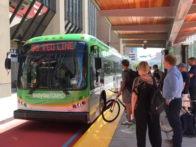
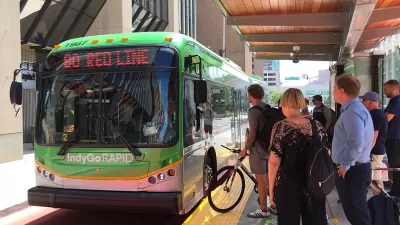
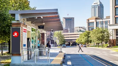
IndyGo is planning changes to the Blue Line. The city’s third bus rapid transit route is turning out to be much more expensive than originally expected.
“IndyGo is considering changes to the route for the Blue Line, the transit agency's third bus rapid transit line connecting Cumberland to the Indianapolis International Airport, in light of ballooning project cost estimates,” reports Kayla Dwyer for the Indianapolis Star.
Labor shortages and supply chain issues are blamed for increasing estimated costs on the project from $220 million in 2019 to $520 million in 2022. “Another major cost increase is attributable to city and Citizens Energy Group standards for drainage that have changed since work on the Blue Line began in 2018,” according to a source cited by Dwyer in the article. “Drainage costs alone comprise 42% of the total construction cost, whereas they comprised 18% of the Purple and Red Line costs.”
“To cut costs, IndyGo is proposing diverting the bus rapid transit route to I-70 between Holt Road and the airport, rather than using Washington Street,” reports Dwyer. “That would save in capital costs and travel time to the airport, but it would also mean no new stops west of Holt Road and no immediate infrastructure improvements to that stretch of Washington Street, unless the city or IndyGo pursues these in a separate project.”
More details on how much money each of the proposed changes would save are included in the source article below.
FULL STORY: Ballooning costs force IndyGo to rethink Blue Line design; here's what might change.

Funding for Planned Bus Rapid Transit Routes Survives Scare in the Indiana General Assembly
Despite the temporary victory for transit advocates in Indianapolis, the battle over transit funding continuous in the Indiana General Assembly.
Indianapolis Going Big on Transit Planning
The IndyGo transit system is wrapping up a period of free fares for its new Red Line bus rapid transit line before another big launch scheduled for spring 2020.
Indianapolis Receives FTA Grant for New BRT Line
The Blue Line will be the third bus rapid transit corridor in the city.

Planetizen Federal Action Tracker
A weekly monitor of how Trump’s orders and actions are impacting planners and planning in America.

Maui's Vacation Rental Debate Turns Ugly
Verbal attacks, misinformation campaigns and fistfights plague a high-stakes debate to convert thousands of vacation rentals into long-term housing.

Cuomo Is the Candidate of Both NIMBYs and Developers. What Gives?
In the New York City mayoral race, odd bedfellows align to preserve the housing status quo.

The Subversive Car-Free Guide to Trump's Great American Road Trip
Car-free ways to access Chicagoland’s best tourist attractions.

San Antonio and Austin are Fusing Into one Massive Megaregion
The region spanning the two central Texas cities is growing fast, posing challenges for local infrastructure and water supplies.

Charlottesville Temporarily Has No Zoning Code
A judge ordered the Virginia city to throw out its newly revised zoning code, leaving permitting for new development in legal limbo.
Urban Design for Planners 1: Software Tools
This six-course series explores essential urban design concepts using open source software and equips planners with the tools they need to participate fully in the urban design process.
Planning for Universal Design
Learn the tools for implementing Universal Design in planning regulations.
Heyer Gruel & Associates PA
JM Goldson LLC
Custer County Colorado
City of Camden Redevelopment Agency
City of Astoria
Transportation Research & Education Center (TREC) at Portland State University
Jefferson Parish Government
Camden Redevelopment Agency
City of Claremont