


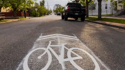
Originally designed as a low-cost way to encourage safer road sharing between bikes and cars, the sharrow has become a symbol of the lack of commitment to protected bike infrastructure in many cities.
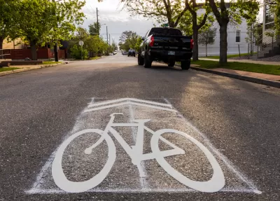
Many cyclists hate them. Most drivers don’t see or understand them. So why are sharrows—the painted symbols also known as lane-share markers—so popular with local governments and departments of transportation?
As Kyle Harris points out in a piece for Denverite, the answer is simple: cost. “Thrifty urban planners, disinterested in building significant bike infrastructure, have embraced them. Sharrows give city officials a cheap way to say they’re doing something for cyclists’ safety — even if it’s undermining it.” Indeed, “According to a 2016 University of Colorado, Denver study of bike infrastructure conducted over ten years and on 2,000 blocks in Chicago, sharrows might actually be more dangerous than no infrastructure at all.”
Harris outlines the history of the sharrow symbol, which was created by now-retired Denver bicycle traffic engineer James Mackay in the early 1990s, when the city resisted any efforts to make changes or invest in bike infrastructure. Mackay developed the symbol as an inexpensive way to encourage drivers and cyclists to share the road, but acknowledges that “Given funding and political will, Mackay knows Denver could have done more, such as cities like Copenhagen and Utrecht, to actively discourage driving and encourage biking.”
FULL STORY: Nobody really understands or likes this street symbol, so how’d it get made?

Calls to Stop Relying on Sharrows Grow Louder
The painted symbols can not only fail to protect bike riders, but can actually make riding conditions less safe.
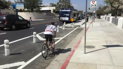
Less Paint, More Barriers, Make for Better Urban Cycling
New research from the University of Colorado Denver and the University of New Mexico sheds light on how to make cities safer for cyclists and other road users and refutes some assumptions about bike safety, such as "safety-in-numbers."
Cleveland to Boost Bike Safety With New Bike Lanes, School Programs
The program, using curriculum created by Cleveland Bikes, is part of a broader effort to improve safety along school routes.

Maui's Vacation Rental Debate Turns Ugly
Verbal attacks, misinformation campaigns and fistfights plague a high-stakes debate to convert thousands of vacation rentals into long-term housing.

Planetizen Federal Action Tracker
A weekly monitor of how Trump’s orders and actions are impacting planners and planning in America.

Chicago’s Ghost Rails
Just beneath the surface of the modern city lie the remnants of its expansive early 20th-century streetcar system.

Bend, Oregon Zoning Reforms Prioritize Small-Scale Housing
The city altered its zoning code to allow multi-family housing and eliminated parking mandates citywide.

Amtrak Cutting Jobs, Funding to High-Speed Rail
The agency plans to cut 10 percent of its workforce and has confirmed it will not fund new high-speed rail projects.

LA Denies Basic Services to Unhoused Residents
The city has repeatedly failed to respond to requests for trash pickup at encampment sites, and eliminated a program that provided mobile showers and toilets.
Urban Design for Planners 1: Software Tools
This six-course series explores essential urban design concepts using open source software and equips planners with the tools they need to participate fully in the urban design process.
Planning for Universal Design
Learn the tools for implementing Universal Design in planning regulations.
planning NEXT
Appalachian Highlands Housing Partners
Mpact (founded as Rail~Volution)
City of Camden Redevelopment Agency
City of Astoria
City of Portland
City of Laramie