


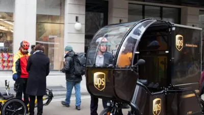
Facilitating the use of micromobility devices for the last mile of urban deliveries can reduce congestion, lower emissions, and take bigger vehicles off small neighborhood roads.
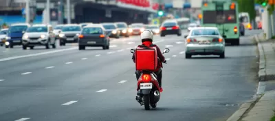
A whitepaper commissioned by Uber describes the potential for micromobility to improve last-mile delivery of goods, which, for the most part, are currently delivered by cars and trucks. As reported by Charles Pekow in Smart Cities Dive, “Use of micromobility vehicles for those last-mile deliveries can bring a variety of benefits in urban areas — benefits some cities are already realizing, the whitepaper states.”
While these devices aren’t practical everywhere, the paper notes five strategies cities can implement to improve infrastructure for micromobility deliveries:
- Make micromobility users feel safe by taking Vision Zero and Safe Systems approaches to road infrastructure, regulations and communications.
- Facilitate safe and easy pick-up and drop-off of deliveries such as through curbside management strategies and building codes.
- Provide policy leadership in support of micromobility such as net zero emissions goals and innovation incubators.
- Support remoding of last-mile deliveries through micro-logistics hubs and other efforts.
- Test and scale ideas that work.
The article notes that bike delivery is nothing new, dating back more than a hundred years. “The whitepaper documents how other cities have successfully implemented bike delivery services. For example, after Toronto improved its cycling network, Uber Eats saw its bike deliveries in that city increase 40% from 2019 and 2020, Uber said. A 2019 project in New York City more than doubled cargo bike deliveries in the covered area, with each cargo bike that replaced a van or box truck resulting in about 7 tons fewer of annual CO2 emissions.”
FULL STORY: 5 strategies to advance micromobility for urban last-mile delivery: report

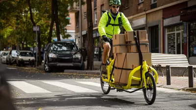
Building Infrastructure to Support Cargo Bikes
Industry leaders want cities to consider delivery bikes when crafting bike policy and building infrastructure.
DC, Columbus Bike Share Fleets Introduce Cargo Bikes
Shared mobility is ‘growing up,’ with rental options increasingly expanding to include e-bikes, scooters, and cargo bikes.
NYC Delivery ‘Microhubs’ Aim to Cut Down on Truck Pollution
The hubs are designed to provide parking for large delivery trucks, which can pass on their cargo to bikes or other zero-emission vehicles.

Maui's Vacation Rental Debate Turns Ugly
Verbal attacks, misinformation campaigns and fistfights plague a high-stakes debate to convert thousands of vacation rentals into long-term housing.

Planetizen Federal Action Tracker
A weekly monitor of how Trump’s orders and actions are impacting planners and planning in America.

San Francisco Suspends Traffic Calming Amidst Record Deaths
Citing “a challenging fiscal landscape,” the city will cease the program on the heels of 42 traffic deaths, including 24 pedestrians.

Defunct Pittsburgh Power Plant to Become Residential Tower
A decommissioned steam heat plant will be redeveloped into almost 100 affordable housing units.

Trump Prompts Restructuring of Transportation Research Board in “Unprecedented Overreach”
The TRB has eliminated more than half of its committees including those focused on climate, equity, and cities.

Amtrak Rolls Out New Orleans to Alabama “Mardi Gras” Train
The new service will operate morning and evening departures between Mobile and New Orleans.
Urban Design for Planners 1: Software Tools
This six-course series explores essential urban design concepts using open source software and equips planners with the tools they need to participate fully in the urban design process.
Planning for Universal Design
Learn the tools for implementing Universal Design in planning regulations.
Heyer Gruel & Associates PA
JM Goldson LLC
Custer County Colorado
City of Camden Redevelopment Agency
City of Astoria
Transportation Research & Education Center (TREC) at Portland State University
Jefferson Parish Government
Camden Redevelopment Agency
City of Claremont