


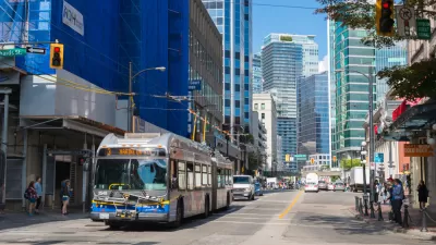
A new 30-year transportation plan, focusing heavily on transit projects and active transportation linkages, was approved recently for the Vancouver, British Columbia region.

TransLink, the regional planning authority responsible for the transportation network of the Vancouver region in British Columbia (and the American Public Transportation Association's "best public transit system in North America" in 2019), has a new long-term plan.
The Transport 2050 plan was approved in January after winning the support of the Mayors’ Council on Regional Transportation and the TransLink Board of Directors. The plan will guide transportation decisions in the famously multi-modal region for three decades.
According to a press release published by TransLink on January 27, Transport 2050 proposes 100 actions or strategies "to make transportation options more convenient, reliable, affordable, safe, comfortable, and environmentally sustainable."
Highlights of those 100 actions include
- Quadrupling the rapid transit network with over 300 kilometres of new rapid transit (potentially including bus rapid transit, light rail, subway, or SkyTrain.)
- Completing a connected 850-kilometre traffic-separated Major Bikeway Network to provide communities with greener and healthier transportation options.
- Promoting the use of electric and shared vehicles such as bikes, scooters, and cars.
An article by Claire Fenton and Mike Lloyd for City News shares news of the regional transportation plan, focusing on issues of transit affordability among the broad goals of the plan. Another article, by Cole Schisler for the Abbotsford News, also notes that plan proposes a "people first" approach to street design.
FULL STORY: Transport 2050 sets bright new vision for regional transportation

Vancouver Planners Hope to Leverage New Subway for Public Benefit
Vancouver is scheduled to begin construction on a new subway in 2020, and planners are laying out a vision for the neighborhoods surrounding the new line, including turning Broadway into a "Great Street."
That's How You Promote Better Bus Service
Along with new, improved bus service, Vancouver's TransLink launched some snazzy promotional materials.
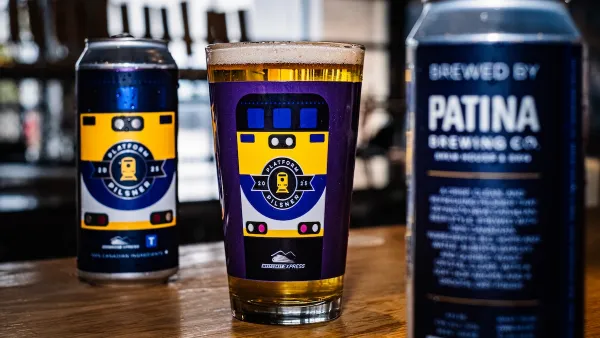
Platform Pilsner: Vancouver Transit Agency Releases... a Beer?
TransLink will receive a portion of every sale of the four-pack.

Maui's Vacation Rental Debate Turns Ugly
Verbal attacks, misinformation campaigns and fistfights plague a high-stakes debate to convert thousands of vacation rentals into long-term housing.

Planetizen Federal Action Tracker
A weekly monitor of how Trump’s orders and actions are impacting planners and planning in America.

Chicago’s Ghost Rails
Just beneath the surface of the modern city lie the remnants of its expansive early 20th-century streetcar system.

Bend, Oregon Zoning Reforms Prioritize Small-Scale Housing
The city altered its zoning code to allow multi-family housing and eliminated parking mandates citywide.

Amtrak Cutting Jobs, Funding to High-Speed Rail
The agency plans to cut 10 percent of its workforce and has confirmed it will not fund new high-speed rail projects.

LA Denies Basic Services to Unhoused Residents
The city has repeatedly failed to respond to requests for trash pickup at encampment sites, and eliminated a program that provided mobile showers and toilets.
Urban Design for Planners 1: Software Tools
This six-course series explores essential urban design concepts using open source software and equips planners with the tools they need to participate fully in the urban design process.
Planning for Universal Design
Learn the tools for implementing Universal Design in planning regulations.
planning NEXT
Appalachian Highlands Housing Partners
Mpact (founded as Rail~Volution)
City of Camden Redevelopment Agency
City of Astoria
City of Portland
City of Laramie