


Data is the key to crafting Vision Zero plans with community buy-in.
We’ve all read the alarming headlines: Driving kills more people in the U.S. than handguns. We’ve also likely witnessed cars weaving in and out of traffic, speeding by us like we’re standing still.
Even more distressing are the statistics. Preliminary data compiled by the National Safety Council show that 42,000 people died in motor vehicle crashes in the U.S. in 2020, an increase of 24% over the previous year. Pedestrian fatality rates, meanwhile, jumped 21% — the highest increase since 1975 – despite the fact that vehicle miles traveled dropped 13% due to the pandemic. According to the National Highway Traffic Safety Administration, a pedestrian is killed every two hours and injured every seven minutes somewhere in the U.S.
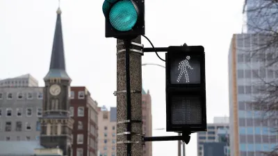
To counter this untenable state of affairs, an increasing number of communities nationwide are turning to a Vision Zero strategy, one that aims to eliminate all traffic fatalities and severe injuries while increasing safe, healthy, equitable mobility for all.
While many of the tactics that comprise Vision Zero are well known – from decreasing the legal speed limit to installing traffic calming measures (speed bumps, roundabouts, etc.) to improving roadway lighting and pedestrian crossings – the technological advances and data-driven analytics at the heart of those tactics’ effectiveness are often overlooked.
FULL STORY: Data-Driven Analytics Are at the Heart of Vision Zero Goals

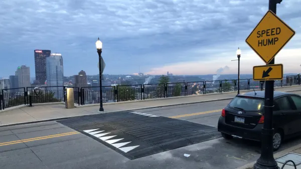
Pittsburgh Excels at Low-Cost, Quick-Build Traffic Calming
The city’s traffic calming initiative has led to a 6 percent average reduction in speeds on corridors with recent interventions.
Milwaukee Announces 60 Traffic Calming Projects for 2025
The city has successfully reduced traffic deaths and aims to eliminate them completely within the next decade.
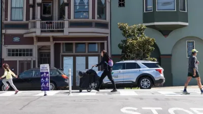
San Francisco Slow Streets Bucks Citywide Trend, Reducing Injuries by 61 Percent
Low-cost interventions aimed at slowing traffic are making a major impact on road safety.

Planetizen Federal Action Tracker
A weekly monitor of how Trump’s orders and actions are impacting planners and planning in America.

Restaurant Patios Were a Pandemic Win — Why Were They so Hard to Keep?
Social distancing requirements and changes in travel patterns prompted cities to pilot new uses for street and sidewalk space. Then it got complicated.

Map: Where Senate Republicans Want to Sell Your Public Lands
For public land advocates, the Senate Republicans’ proposal to sell millions of acres of public land in the West is “the biggest fight of their careers.”

Orange County, Florida Adopts Largest US “Sprawl Repair” Code
The ‘Orange Code’ seeks to rectify decades of sprawl-inducing, car-oriented development.

Maui's Vacation Rental Debate Turns Ugly
Verbal attacks, misinformation campaigns and fistfights plague a high-stakes debate to convert thousands of vacation rentals into long-term housing.

San Francisco Suspends Traffic Calming Amidst Record Deaths
Citing “a challenging fiscal landscape,” the city will cease the program on the heels of 42 traffic deaths, including 24 pedestrians.
Urban Design for Planners 1: Software Tools
This six-course series explores essential urban design concepts using open source software and equips planners with the tools they need to participate fully in the urban design process.
Planning for Universal Design
Learn the tools for implementing Universal Design in planning regulations.
Heyer Gruel & Associates PA
JM Goldson LLC
Custer County Colorado
City of Camden Redevelopment Agency
City of Astoria
Transportation Research & Education Center (TREC) at Portland State University
Camden Redevelopment Agency
City of Claremont
Municipality of Princeton (NJ)