


Fairfax County and the Washington Metropolitan Area Transit Authority have reached an agreement with a team of developers to add one million square feet of mixed-use development near a station on the Orange Line.
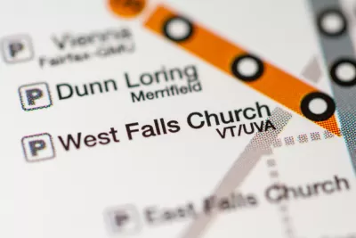
A press release from the Washington Metropolitan Area Transit Authority (Metro) announces an agreement for a joint development proposal and Comprehensive Plan amendment that will bring a large new mixed-use development to the station area on the West Falls Church Metro Station on the system's Orange Line.
The development, the result of a multi-year effort between Metro, the development team, and Fairfax County to amend the Comprehensive Plan will add a mixed-use community with over one million square feet of office, retail, and residential space, according to the release.
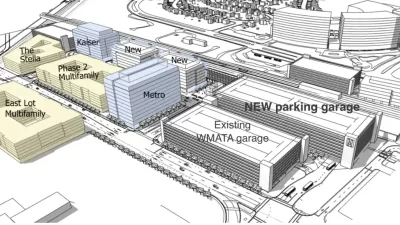
Over the next year, developer FGCP-Metro, LLC—an affiliated partnership with EYA, LLC (EYA), Hoffman & Associates, and Rushmark Properties—will move forward with a rezoning application that details plans to redevelop the station's parking lot with apartments, townhomes, neighborhood retail, and public green spaces.
"It will connect the proposed mixed-use redevelopment of the Meridian High School (formerly George Mason High School) site in the City of Falls Church to the West Falls Church Metro Station with new bike lanes, broad sidewalks, publicly accessible park spaces and a secondary grid of streets that will help alleviate some of the congestion in the area," according to the release.

Opinion: More TOD in the DC Area Could Improve Both Transit and Housing
Converting underutilized parking lots to housing could make transit more accessible and housing more affordable.

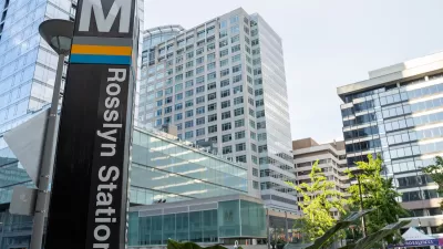
A New Transit Oriented Vision for Fairfax County, Virginia
A new transit station area plan is reaching the finishing line for the Huntington Metro station, serving the WMATA’s Yellow Line in Northern Virginia.
A New Transit-Oriented Downtown for New Carrollton, Maryland
The New Carrollton transit station will add Purple Line light rail to its multi-modal mix; planners at the Washington Metropolitan Area Transit Authority (Metro) hope to leverage the new transit for new land use and development around the station.

Maui's Vacation Rental Debate Turns Ugly
Verbal attacks, misinformation campaigns and fistfights plague a high-stakes debate to convert thousands of vacation rentals into long-term housing.

Planetizen Federal Action Tracker
A weekly monitor of how Trump’s orders and actions are impacting planners and planning in America.

In Urban Planning, AI Prompting Could be the New Design Thinking
Creativity has long been key to great urban design. What if we see AI as our new creative partner?

King County Supportive Housing Program Offers Hope for Unhoused Residents
The county is taking a ‘Housing First’ approach that prioritizes getting people into housing, then offering wraparound supportive services.

Researchers Use AI to Get Clearer Picture of US Housing
Analysts are using artificial intelligence to supercharge their research by allowing them to comb through data faster. Though these AI tools can be error prone, they save time and housing researchers are optimistic about the future.

Making Shared Micromobility More Inclusive
Cities and shared mobility system operators can do more to include people with disabilities in planning and operations, per a new report.
Urban Design for Planners 1: Software Tools
This six-course series explores essential urban design concepts using open source software and equips planners with the tools they need to participate fully in the urban design process.
Planning for Universal Design
Learn the tools for implementing Universal Design in planning regulations.
Appalachian Highlands Housing Partners
Gallatin County Department of Planning & Community Development
Heyer Gruel & Associates PA
Mpact (founded as Rail~Volution)
City of Camden Redevelopment Agency
City of Astoria
City of Portland
City of Laramie