


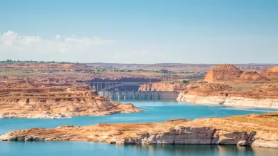
Developers have pulled plans that would have created two reservoirs upriver from where the Little Colorado and Colorado rivers meet in Grand Canyon National Park.

"A developer has withdrawn two of the three proposals to build a series of hydroelectric dams in the Little Colorado River watershed, projects that had drawn opposition from several tribes and environmentalists," reports Debra Utacia Krol.
"Phoenix-based Pumped Hydro Storage LLC relinquished preliminary permits for the Salt Trail Canyon and Little Colorado River proposals on July 26," Adds Krol. "The company told the Federal Energy Regulatory Commission that 'the study requirements and eventual environmentalist opposition makes investing resources in this project a very high risk.'"
The company left in place permits for a third project in nearby Big Canyon.
The demise of the projects is being hailed as a victory for environmentalists and several local tribes if indigenous people. The Salt Trail Canyon project was proposed on land sacred to the Hopi and Zuni peoples, and within the current boundaries of the Navajo Nation. "The Little Colorado River is also prime habitat for the threatened humpback chub and other species," according to the article.
More details on both of the proposed, and now rescinded, projects are included in the source article.
FULL STORY: Tribes cheer withdrawal of 2 Little Colorado hydropower projects but fear a 3rd

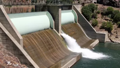
Colorado River Dams Could Stop Producing Hydropower
Officials are releasing water from upstream reservoirs as water levels in the river's major reservoirs fall to historic lows.
N.Y.C. Looking at Deal for Canadian Hydroelectricity
The city is considering a contract to purchase hydroelectricity from Quebec and might also provide funding for the energy infrastructure.
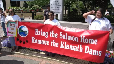
Last Dam in Klamath River Removal Project Comes Down
Salmon can now move freely along the river and its tributaries for the first time in over a century.

Planetizen Federal Action Tracker
A weekly monitor of how Trump’s orders and actions are impacting planners and planning in America.

Restaurant Patios Were a Pandemic Win — Why Were They so Hard to Keep?
Social distancing requirements and changes in travel patterns prompted cities to pilot new uses for street and sidewalk space. Then it got complicated.

Map: Where Senate Republicans Want to Sell Your Public Lands
For public land advocates, the Senate Republicans’ proposal to sell millions of acres of public land in the West is “the biggest fight of their careers.”

Maui's Vacation Rental Debate Turns Ugly
Verbal attacks, misinformation campaigns and fistfights plague a high-stakes debate to convert thousands of vacation rentals into long-term housing.

San Francisco Suspends Traffic Calming Amidst Record Deaths
Citing “a challenging fiscal landscape,” the city will cease the program on the heels of 42 traffic deaths, including 24 pedestrians.

California Homeless Arrests, Citations Spike After Ruling
An investigation reveals that anti-homeless actions increased up to 500% after Grants Pass v. Johnson — even in cities claiming no policy change.
Urban Design for Planners 1: Software Tools
This six-course series explores essential urban design concepts using open source software and equips planners with the tools they need to participate fully in the urban design process.
Planning for Universal Design
Learn the tools for implementing Universal Design in planning regulations.
Heyer Gruel & Associates PA
JM Goldson LLC
Custer County Colorado
City of Camden Redevelopment Agency
City of Astoria
Transportation Research & Education Center (TREC) at Portland State University
Camden Redevelopment Agency
City of Claremont
Municipality of Princeton (NJ)