


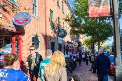
What does a '15-minute city' truly mean–and how achievable is it in the U.S.?
Alan Ehrenhalt explores the complications of the popular "15-minute city" concept, asking "[w]hat exactly makes a 15-minute city, anyway? And is it a new idea or just a slogan that has been grafted onto some urbanist schemes that have been floating around for many years?"
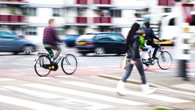
The crux of "15-minute city" discussions is "the simple idea that we should be able to buy or do just about anything we want by walking 15 minutes or less." This mile-long walk, argues Ehrenhalt, may actually be unattractive to many Americans. "That’s why some critics have said that if we are talking exclusively about walking, the idea of a five- or 10-minute city might be more realistic. It will also be much more difficult to achieve, to say the least." When it comes to biking, Ehrenhalt worries that "the number of bike lanes required to create a central element of the redesigned city are far more than we have built anywhere so far, even in the most progressive cities."
Ehrenhalt poses similar questions about transit: "what does 15-minute transit really mean? If you’re talking about door to door, there really aren’t many transit trips that can be completed in 15 minutes. If you’re talking about a bus or train station within 15 minutes of home, it’s something we clearly ought to work toward, but it doesn’t suggest brief and convenient trips."
While laudable, the goal of truly creating 15-minute cities and neighborhoods in many U.S. cities, Ehrenhalt writes, is "[n]ot impossible, but very difficult."
FULL STORY: The Elusive Dream of the 15-Minute City


What the ‘Walk Score’ Misses
A popular walkability assessment omits key factors that impact different demographics and can direct development resources to already wealthy neighborhoods.
Nightlife and the 15-Minute City
Plans for compact, walkable cities often don’t address nighttime concerns like transportation and lighting, which can make neighborhoods more vibrant and safe around the clock.
20 Safest and Most Dangerous US Cities for Pedestrians
Pedestrian safety is a vital component to a walkable city. Which large cities in the United States have a leg up, and which are trailing behind?

Planetizen Federal Action Tracker
A weekly monitor of how Trump’s orders and actions are impacting planners and planning in America.

Map: Where Senate Republicans Want to Sell Your Public Lands
For public land advocates, the Senate Republicans’ proposal to sell millions of acres of public land in the West is “the biggest fight of their careers.”

Restaurant Patios Were a Pandemic Win — Why Were They so Hard to Keep?
Social distancing requirements and changes in travel patterns prompted cities to pilot new uses for street and sidewalk space. Then it got complicated.

California Homeless Arrests, Citations Spike After Ruling
An investigation reveals that anti-homeless actions increased up to 500% after Grants Pass v. Johnson — even in cities claiming no policy change.

Albuquerque Route 66 Motels Become Affordable Housing
A $4 million city fund is incentivizing developers to breathe new life into derelict midcentury motels.

DC Area County Eliminates Bus Fares
Montgomery County joins a growing trend of making transit free.
Urban Design for Planners 1: Software Tools
This six-course series explores essential urban design concepts using open source software and equips planners with the tools they need to participate fully in the urban design process.
Planning for Universal Design
Learn the tools for implementing Universal Design in planning regulations.
Heyer Gruel & Associates PA
JM Goldson LLC
Custer County Colorado
City of Camden Redevelopment Agency
City of Astoria
Transportation Research & Education Center (TREC) at Portland State University
Camden Redevelopment Agency
City of Claremont
Municipality of Princeton (NJ)