


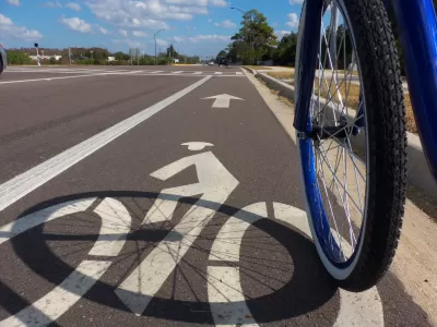
Arterial roads and poorly designed intersections pose significant threats to cyclist and pedestrian safety.
In a collaboration with BikeMaps.org dubbed the #2020CyclingDeaths project, Maura Fox and Luke Whelan assess cycling deaths on American roads in the past year to see where, how, and how many bicyclists are dying. "Record numbers of cyclists (and thousands of pedestrians) on our nation’s roads are being killed by drivers often without any media attention beyond a brief local news story," the authors write.
Their study captured 697 deaths between January 2020 and January 2021. "Since we were only able to count deaths reported by local media, the actual total is likely significantly higher." BikeMaps.org, a project started by Trisalyn Nelson, crowdsources information about cyclist crashes, near misses, traffic hazards, and bike thefts in the United States and Canada.
Key takeaways from the study show that more than a quarter of crashes are hit-and-runs, and cycling deaths occur all over (project data came from 47 states), with the highest numbers of deaths occurring in California and Florida, followed by New York and Texas. Surprisingly, rural, suburban, and urban areas have similar rates of cycling deaths. Despite lower density and less traffic, rural roads aren't designed to protect people on bikes. According to the data, the most dangerous place for cyclists is an arterial road, "a busy, multilane thoroughfare with traffic signals at intersections and speeds limits exceeding 30 miles per hour," which account for 65% of fatal crashes.
The authors suggest some solutions for planners and policymakers, including incorporating a car’s potential risk to cyclists and pedestrians with vehicle-safety ratings, improving education for drivers, and incentivizing cycling to induce more ridership.
FULL STORY: What We Learned from Tracking Cycling Deaths for a Year


Nation's Top Safety Board Recommends Protected Bike Lanes
The NTSB chair issued a stark warning on Nov. 5: "If we do not improve roadway infrastructure for bicyclists, bicyclists will die who otherwise would not," stated Robert Sumwalt in introducing their first report in 47 years devoted to bike safety.

Proposed Bill Would Direct Funds to Road Safety
The Sarah Debbink Langenkamp Active Transportation Safety Act was spurred by the death of a U.S. diplomat who was killed on her bicycle.
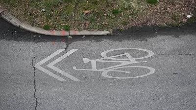
Sharrows Are Ineffective, Potentially Counterproductive
Research shows there’s no substitute for protected bike lanes, and sharrows may make roads more dangerous for cyclists.

Planetizen Federal Action Tracker
A weekly monitor of how Trump’s orders and actions are impacting planners and planning in America.

Maui's Vacation Rental Debate Turns Ugly
Verbal attacks, misinformation campaigns and fistfights plague a high-stakes debate to convert thousands of vacation rentals into long-term housing.

San Francisco Suspends Traffic Calming Amidst Record Deaths
Citing “a challenging fiscal landscape,” the city will cease the program on the heels of 42 traffic deaths, including 24 pedestrians.

Defunct Pittsburgh Power Plant to Become Residential Tower
A decommissioned steam heat plant will be redeveloped into almost 100 affordable housing units.

Trump Prompts Restructuring of Transportation Research Board in “Unprecedented Overreach”
The TRB has eliminated more than half of its committees including those focused on climate, equity, and cities.

Amtrak Rolls Out New Orleans to Alabama “Mardi Gras” Train
The new service will operate morning and evening departures between Mobile and New Orleans.
Urban Design for Planners 1: Software Tools
This six-course series explores essential urban design concepts using open source software and equips planners with the tools they need to participate fully in the urban design process.
Planning for Universal Design
Learn the tools for implementing Universal Design in planning regulations.
Heyer Gruel & Associates PA
JM Goldson LLC
Custer County Colorado
City of Camden Redevelopment Agency
City of Astoria
Transportation Research & Education Center (TREC) at Portland State University
Jefferson Parish Government
Camden Redevelopment Agency
City of Claremont