


When it comes to protecting the state from sea-level rise, Georgia is a step ahead of the rest thanks to a piece of legislation celebrating its 50th anniversary this year.
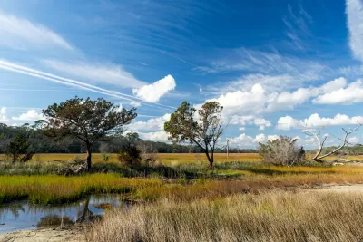
One hundred miles of coastal salt marsh along the Georgia coast is an integral part of the fabric of the state's identity, wildlife habitat, and natural landscape. Fifty years since a Georgia law was passed to protect the marsh, residents know that the 400,000 acres of tall grasses and shallow, muddy waters are appreciated and secure.
But this wasn't always the case, says Molly Samuel. "The marsh’s value and its beauty might be taken for granted now, but in the late-1960s, there was a proposal to mine Georgia’s salt marsh. To dig it up, then fill it in."
The legislation would later prove itself to be vital to the states future as sea-level rise threatening costal communities in the United States and beyond. Georgia's marshes make up about a third of salt marshland on the Eastern Seaboard, an indispensable buffer between land and sea.
Samuel recounts the history of Coastal Marshlands Protection Act. The desire to develop Georgia's 12 islands "largely owned by wealthy families that used them as vacation destinations" and a phosphate mining proposal turned out the masses during a state hearing on the matter.
Fifty years later, Georgia has a new beast to tackle. "On the Georgia coast, sea levels are getting higher by a little over a tenth of an inch a year, adding up to close to a foot a century," writes Samuel.
Experts say that as the sea-level rises, the marshlands will inch inland. "Georgia is working on ways to adapt to and prepare for increasingly high tides, asking local governments to plan for sea level rise, and protecting open space so that the marshes can keep moving inland," Samuel says.
FULL STORY: How Georgia Protected Its Salt Marsh 50 Years Ago, And Why That’s Important For The Future

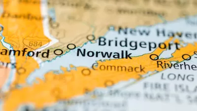
Mixed-Use Zoning in Waterfront Plan Attracts Controversy in Connecticut
Norwalk, Connecticut is figuring out how to balance the competing interests of development demand, public access, environmental risks, and historic preservation.
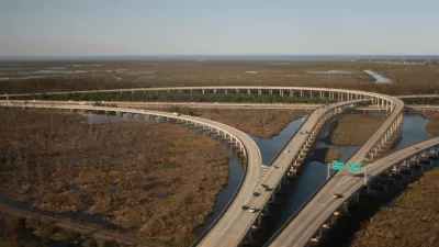
$50 Billion Coastal Master Plan Updated in Louisiana
Louisiana is losing coastal lands, quickly, along with the habitat and economic resources located there. A Coastal Master Plan plots $50 billion in spending to protect the coast.
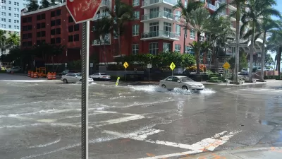
Florida Home Insurance Prices Increasingly a Burden for Residents
Climate change is coming for the state of Florida, and it’s already showing up in the insurance market.

Planetizen Federal Action Tracker
A weekly monitor of how Trump’s orders and actions are impacting planners and planning in America.

Map: Where Senate Republicans Want to Sell Your Public Lands
For public land advocates, the Senate Republicans’ proposal to sell millions of acres of public land in the West is “the biggest fight of their careers.”

Restaurant Patios Were a Pandemic Win — Why Were They so Hard to Keep?
Social distancing requirements and changes in travel patterns prompted cities to pilot new uses for street and sidewalk space. Then it got complicated.

Platform Pilsner: Vancouver Transit Agency Releases... a Beer?
TransLink will receive a portion of every sale of the four-pack.

Toronto Weighs Cheaper Transit, Parking Hikes for Major Events
Special event rates would take effect during large festivals, sports games and concerts to ‘discourage driving, manage congestion and free up space for transit.”

Berlin to Consider Car-Free Zone Larger Than Manhattan
The area bound by the 22-mile Ringbahn would still allow 12 uses of a private automobile per year per person, and several other exemptions.
Urban Design for Planners 1: Software Tools
This six-course series explores essential urban design concepts using open source software and equips planners with the tools they need to participate fully in the urban design process.
Planning for Universal Design
Learn the tools for implementing Universal Design in planning regulations.
Heyer Gruel & Associates PA
JM Goldson LLC
Custer County Colorado
City of Camden Redevelopment Agency
City of Astoria
Transportation Research & Education Center (TREC) at Portland State University
Camden Redevelopment Agency
City of Claremont
Municipality of Princeton (NJ)