


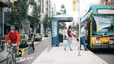
The Northeast Ohio Areawide Coordinating Agency (NOACA) is considering a new policy that will add considerations about regional economic inequities when evaluating potential highway projects.

"Recognizing that highways reward some areas and penalize others, [Northeast Ohio’s] top transportation planning agency is drafting a policy to quantify whether adding new interchanges to the system would exacerbate historical patterns of inequity," reports Steven Litt.
The Northeast Ohio Areawide Coordinating Agency (NOACA) is federally mandated to oversee transportation planning for the region that includes Cuyahoga, Lake, Geauga, Lorain and Medina counties.
"By developing the new policy, NOACA aims to look beyond a traditionally narrow focus on safety and mitigation of traffic congestion to consider broader impacts on regional economic development patterns, transit, and environmental sustainability," according to Litt.
"Criteria under consideration, and reviewed in the most recent meeting of NOACA’s policy committee on July 10, include whether a new interchange would facilitate redevelopment of 'declining and abandoned areas,‘' or encourage transit-oriented development in areas with higher densities of population." NOACA is expected to make a decision about the new policy by December. If approved, the new policy would immediately apply to eight projects in the planning pipeline.
An earlier article by Litt details NOACA's work on eNEO2050, a 20-year vision for the region that promised to focus on social equity, particularly for households without cars. That plan is expected for completion in 2021.


Equitable Transportation Planning Initiative Advances in Northeast Ohio
The Northeast Ohio Areawide Coordinating Agency (NOACA) is moving forward with a groundbreaking policy to consider regional economic inequities when evaluating potential highway projects.

L.A. Metro Plans for an Equitable Recovery
The pandemic has forced difficult confrontations with inequities that existed long before the novel coronavirus. L.A. Metro planners are responding by charting a path toward a transportation system that reverses and improves those previous realities.
Integrating Climate Protection, Public Health, and Equity Into Planning
The beta version of a comprehensive new evidence-based platform called Streetsmart helps policy makers, planners, and advocates make the case for healthy, inclusive, and sustainable transportation investments.

Maui's Vacation Rental Debate Turns Ugly
Verbal attacks, misinformation campaigns and fistfights plague a high-stakes debate to convert thousands of vacation rentals into long-term housing.

Planetizen Federal Action Tracker
A weekly monitor of how Trump’s orders and actions are impacting planners and planning in America.

In Urban Planning, AI Prompting Could be the New Design Thinking
Creativity has long been key to great urban design. What if we see AI as our new creative partner?

How Trump's HUD Budget Proposal Would Harm Homelessness Response
Experts say the change to the HUD budget would make it more difficult to identify people who are homeless and connect them with services, and to prevent homelessness.

The Vast Potential of the Right-of-Way
One writer argues that the space between two building faces is the most important element of the built environment.

Florida Seniors Face Rising Homelessness Risk
High housing costs are pushing more seniors, many of them on a fixed income, into homelessness.
Urban Design for Planners 1: Software Tools
This six-course series explores essential urban design concepts using open source software and equips planners with the tools they need to participate fully in the urban design process.
Planning for Universal Design
Learn the tools for implementing Universal Design in planning regulations.
Gallatin County Department of Planning & Community Development
Heyer Gruel & Associates PA
JM Goldson LLC
City of Camden Redevelopment Agency
City of Astoria
Transportation Research & Education Center (TREC) at Portland State University
Jefferson Parish Government
Camden Redevelopment Agency
City of Claremont