


Richmond, Virginia is hoping to make some big changes in time for its tricentennial in 2037, including a new cap park and a new form-based code.

"With development activity picking up on both sides of the freeway that 80 years ago cut the Jackson Ward area in half, Richmond planners are floating an idea to reconnect the historically Black neighborhood as part of the city’s proposed master plan," report Jonathan Spiers.
"Richmond 300, the draft update to the city’s master land-use plan that city planners and consultants have been rolling out in recent weeks, includes several strategies for improving road and pedestrian connections throughout town. Among them is a proposal to cap Interstate 64-95 with a bridge deck spanning the width of First and St. James streets, creating a platform the size of a city block that could be filled with a park, buildings, and new roads and walkways."
"The occasion marking Richmond’s 300th year also would mark 80 years since the completion, in 1957, of what is now I-64-95 through Jackson Ward. It cut a swath through the heart of the neighborhood, dividing Jackson Ward physically and destroying parts of what had become an epicenter of Black culture and commerce in Richmond, known along the East Coast as 'Black Wall Street,'" adds Spiers.
More details on the six big moves included in the Richmond 300 plan are included in the source article. The Executive Summary of the draft Richmond 300 plan also lists a zoning code update, including a move from a Euclidean zoning code to a form-based code are among the six big moves.
FULL STORY: Bridging the gap: Richmond 300 plan envisions reconnecting Jackson Ward


The Foundational Myth of America's Interstate Highway System
The erroneous belief that the negative impacts of interstate highways are simply "unintended consequences" fails to demand accountability for the project's failures.

Sioux Falls Multi-Family Development Outpaces Transportation Improvements
Sioux Falls, South Dakota is undergoing a multi-family development boom. Residents are increasingly concerned about the traffic the development brings, according to local news reports.
Planning for Congestion Relief
The third and final installment of Planetizen's examination of the role of the planning profession in both perpetuating and solving traffic congestion.

Planetizen Federal Action Tracker
A weekly monitor of how Trump’s orders and actions are impacting planners and planning in America.

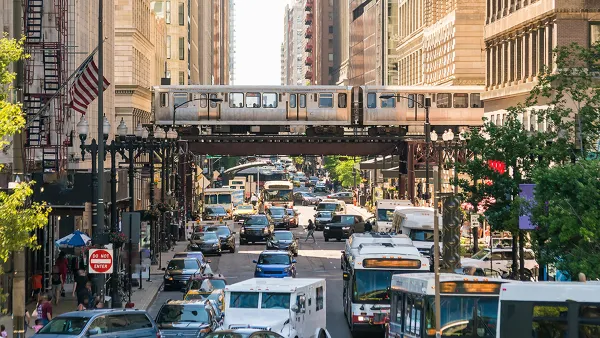
Chicago’s Ghost Rails
Just beneath the surface of the modern city lie the remnants of its expansive early 20th-century streetcar system.

Amtrak Cutting Jobs, Funding to High-Speed Rail
The agency plans to cut 10 percent of its workforce and has confirmed it will not fund new high-speed rail projects.

Ohio Forces Data Centers to Prepay for Power
Utilities are calling on states to hold data center operators responsible for new energy demands to prevent leaving consumers on the hook for their bills.

MARTA CEO Steps Down Amid Citizenship Concerns
MARTA’s board announced Thursday that its chief, who is from Canada, is resigning due to questions about his immigration status.

Silicon Valley ‘Bike Superhighway’ Awarded $14M State Grant
A Caltrans grant brings the 10-mile Central Bikeway project connecting Santa Clara and East San Jose closer to fruition.
Urban Design for Planners 1: Software Tools
This six-course series explores essential urban design concepts using open source software and equips planners with the tools they need to participate fully in the urban design process.
Planning for Universal Design
Learn the tools for implementing Universal Design in planning regulations.
Caltrans
City of Fort Worth
Mpact (founded as Rail~Volution)
City of Camden Redevelopment Agency
City of Astoria
City of Portland
City of Laramie