


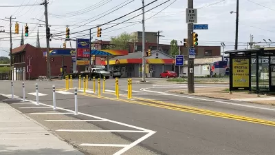
A renewed commitment to pedestrian friendly infrastructure is changing the face of Vancouver and making space for more density.

Frances Bula reports on the visible signs of pedestrian-oriented planning in the city of Vancouver.
In the past ten years, according to Bula, the city has added "100 curb bulges (corners where the sidewalk is extended into the usual crosswalk space to reduce the street-crossing time), 10 raised crosswalks, 730 intersections with countdown timers, at least three street closings to create new public hanging-out spaces, several street parklets that convert parking spaces to patios and dozens of new curb ramps, along with the requirement for wider sidewalks…"
The city has also required buildings to be setback to allow more space for sidewalks on busy commercial streets, or taking space from cars.
All of those changes have been implemented with a minimal amount of controversy in the public, according to Bula, in a city where new bike lanes can still cause controversies.
FULL STORY: Vancouver widens sidewalks in bid to adapt to city’s density

Pittsburgh Improves Road Safety With ‘Quick-Build’ Solutions
The city’s efforts to reduce crashes through traffic calming and crosswalk improvements is yielding positive results.
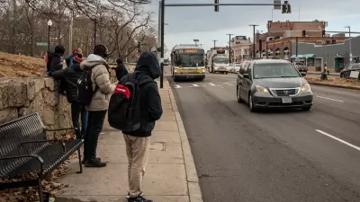
Boston’s Blue Hill Avenue to Get BRT, Safety Improvements
The key bus corridor serves over 37,000 bus riders daily.
Connecticut Launches Complete Streets Standards
The new policy calls for sidewalks, bike lanes, and crosswalks on state roads and state-funded road projects.

Maui's Vacation Rental Debate Turns Ugly
Verbal attacks, misinformation campaigns and fistfights plague a high-stakes debate to convert thousands of vacation rentals into long-term housing.

Planetizen Federal Action Tracker
A weekly monitor of how Trump’s orders and actions are impacting planners and planning in America.

San Francisco Suspends Traffic Calming Amidst Record Deaths
Citing “a challenging fiscal landscape,” the city will cease the program on the heels of 42 traffic deaths, including 24 pedestrians.

Defunct Pittsburgh Power Plant to Become Residential Tower
A decommissioned steam heat plant will be redeveloped into almost 100 affordable housing units.

Trump Prompts Restructuring of Transportation Research Board in “Unprecedented Overreach”
The TRB has eliminated more than half of its committees including those focused on climate, equity, and cities.

Amtrak Rolls Out New Orleans to Alabama “Mardi Gras” Train
The new service will operate morning and evening departures between Mobile and New Orleans.
Urban Design for Planners 1: Software Tools
This six-course series explores essential urban design concepts using open source software and equips planners with the tools they need to participate fully in the urban design process.
Planning for Universal Design
Learn the tools for implementing Universal Design in planning regulations.
Heyer Gruel & Associates PA
JM Goldson LLC
Custer County Colorado
City of Camden Redevelopment Agency
City of Astoria
Transportation Research & Education Center (TREC) at Portland State University
Jefferson Parish Government
Camden Redevelopment Agency
City of Claremont