


Lexington, Kentucky's growth boundary survived a comprehensive plan update in 2019, after years of controversy. A housing crisis, a growing city, and a broken land use system are rearranging the political arithmetic behind the greenbelt.
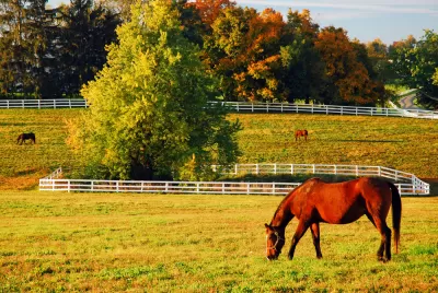
Nolan Gray reports on the controversy surrounding the future of the oldest growth boundary in the United States, established by Lexington, Kentucky in 1958.
The Lexington greenbelt has stirred controversy throughout the public process of updating the city's comprehensive plan, according to Gray:
Businesspeople and developers argued that a lack of developable land in Lexington is driving businesses away and housing costs up, while defenders of the greenbelt countered that there is still ample land to develop without extending the boundary further.
Gray provides the history of the greenbelt (enacted to protect the horse breading industry from expanding suburban development) and catches up to contemporary times, when Lexington is a city of 350,000 with a diverse economy. "Many of Lexington’s new residents are economic migrants from the Rust Belt and the coal fields of Eastern Kentucky—my parents among them. These new Lexingtonians have little connection to the horse industry," explains Gray.
Meanwhile, the city's planners are still talking about infill and transit oriented development, and generating new mechanisms for delivering on those goals, such as the Placebuilder program, which "aims to ease up on the permitting hurdles facing mixed-use urban infill," according to Gray.
FULL STORY: America’s First Greenbelt May Be in Jeopardy


Cascadia Expects Millions of New Residents. Should it Build New Cities or New Density?
A recent report calls for the region stretching from Oregon to British Columbia to think big about accommodating expected population growth. The report's recommendation to build four new, large cities isn't universally accepted, however.
Florida Law Would Change the Definition of ‘Sprawl’
One quick way to build sprawl.
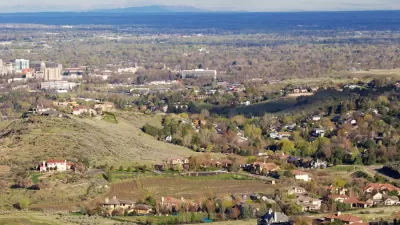
Different Approaches to Fast Growth in Idaho's Treasure Valley
Three cities on the periphery of the fast-growing Treasure Valley showcase different approaches to a sudden influx of newcomers.

Planetizen Federal Action Tracker
A weekly monitor of how Trump’s orders and actions are impacting planners and planning in America.

Restaurant Patios Were a Pandemic Win — Why Were They so Hard to Keep?
Social distancing requirements and changes in travel patterns prompted cities to pilot new uses for street and sidewalk space. Then it got complicated.

Maui's Vacation Rental Debate Turns Ugly
Verbal attacks, misinformation campaigns and fistfights plague a high-stakes debate to convert thousands of vacation rentals into long-term housing.

In California Battle of Housing vs. Environment, Housing Just Won
A new state law significantly limits the power of CEQA, an environmental review law that served as a powerful tool for blocking new development.

Boulder Eliminates Parking Minimums Citywide
Officials estimate the cost of building a single underground parking space at up to $100,000.

Orange County, Florida Adopts Largest US “Sprawl Repair” Code
The ‘Orange Code’ seeks to rectify decades of sprawl-inducing, car-oriented development.
Urban Design for Planners 1: Software Tools
This six-course series explores essential urban design concepts using open source software and equips planners with the tools they need to participate fully in the urban design process.
Planning for Universal Design
Learn the tools for implementing Universal Design in planning regulations.
Heyer Gruel & Associates PA
JM Goldson LLC
Custer County Colorado
City of Camden Redevelopment Agency
City of Astoria
Transportation Research & Education Center (TREC) at Portland State University
Camden Redevelopment Agency
City of Claremont
Municipality of Princeton (NJ)