The 2017 survey shows that most people drive, but income and housing location also affect people’s options and choices.


Stephen Fesler reports on the Puget Sound Regional Council’s release of its 2017 household travel survey data. The survey gathered information on travel behavior, parking and transit costs, and the factors related to mode choice.
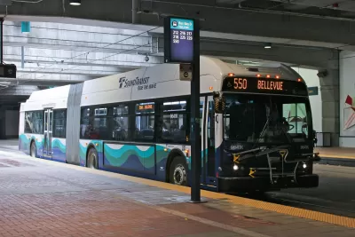
It finds that most people, over 80 percent, have free parking at work, and high-income workers have more access to subsidized transit passes. “Larger employers–which tend to be higher paying–are required to create a [Commute Trip Reduction] program for employees. These programs often include subsidized or free transit passes. However, that often leaves lower-income individuals without cheaper transit options unless they qualify for ORCA LIFT, a reduced fare program that King County launched in 2015,” writes Fesler. In addition, the majority of transit users are reaching transit on foot.
Most people across all income levels drive, but lower-income households are more likely to walk or use transit, the survey shows. Fesler describes the mode choice differences by race:
Asians had the highest drive-alone and biking rates while reporting lower shared driving trips. Black, Latino, and other multiracial households reported double the transit rate, substantially lower drive-alone rates, and higher shared driving trips. Caucasian households had the lowest transit use rates, but otherwise were middle of the pack for other modes.
The survey also examines the ways in which housing affects mode choice. People living in Seattle’s regional growth centers—higher density, mixed-use areas—are more likely to walk or use transit and less likely to drive than people living in centers outside of Seattle or those not living in centers.
In addition, most of the lower-income respondents report that living in a walkable area near activities is important to them. “This was increasingly less important to middle-income and higher-income households. It seems very likely that this is related to regular access to a car, which very low-income households generally lack,” notes Fesler. A similar income pattern emerged in terms of the importance of close transit, with a majority of low-income respondents indicating this was important.
Read the full story: PSRC’s 2017 Travel Survey Shows Transit Is Popular, Free Parking Induces Driving


New Long-Term Regional Plan for Puget Sound Approved
The regional planning organization for the four-county area around Puget Sound has adopted a new long-term plan for the future.
Planning for 1.8 Million New Residents Around Puget Sound
The state of Washington's 1990 Growth Management Act requires regions to create long-range growth plans. The Puget Sound Region Council is currently working on its latest iteration of the plan.
Getting the Politics of Cordon Tolling Right
With Mayor Jenny Durkan's announcement that Seattle will pursue cordon area congestion pricing coming five days after New York dropped its plan, a Washington State pro-business publication looks at the difficulties in getting the politics right.

Planetizen Federal Action Tracker
A weekly monitor of how Trump’s orders and actions are impacting planners and planning in America.

The state-sanctioned urbicide of Austin
People don’t kill cities. Freeways do.

US to reduce Colorado River water deliveries to Mexico
A new Colorado Treaty amendment reduces Mexico’s Colorado River water allocation by 250,000 acre feet.

Nation's most wind-powered state turns to coal as data centers increase energy demand
For the first time in decades, Iowa has increased its generation of coal power.

NYC cools commuters with city's first rain garden above a bus stop
New York City officials say the plants in the rain garden can absorb 16 gallons of rainwater during heavy storms.

Brightline West’s future may rely on $6 billion federal loan
The company has until Nov. 2 to make a $400 million equity investment into its proposed high-speed rail line.

FREE Course: Walkable City 1: Why Walkability?
After describing his path towards focusing on walkability as the essence of good planning, Jeff Speck marches through his five principal reasons for making more walkable places.
Reinventing Malls: Planning Alchemy—Turning Gray Fields Into Gold
The course focuses on the opportunities and imperatives that shape reinvention of mall sites.


Eagle County Government
Harvard University Graduate School of Design
Nashville Planning Department
The Architects Foundation
University of Cincinnati Online
The Pocatello Development Authority
The Urban Renewal Agency of the City of Pocatello
Journal of the American Planning Association