


The One Central development would transform 34 acres over Metro tracks near Soldier Field.
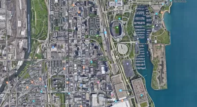
"Chicago’s skyline could extend all the way south to McCormick Place, under a multibillion-dollar development plan unveiled Wednesday that would create a row of gleaming skyscrapers atop a massive new transit center," reports Ryan Ori.
Landmark Development, owned by Wisconsin-based developer Bob Dunn, "envisions millions of square feet of high-rises constructed on a platform covering Metra tracks above the level of Lake Shore Drive. The site runs just west of Lake Shore Drive between the Field Museum and McCormick," according to Ori.
"The centerpiece of the development would be a transit center southwest of Soldier Field, across Lake Shore Drive. It would link Metra, CTA and Amtrak trains, as well as a wheeled tram route, topped by a few floors of restaurant, retail and entertainment space," adds Ori.
The article include a lot more description of the project, as well as effort to place the proposal in context of a "building boom" that has outlasted a decade, according to Ori. Lincoln Yards and The 78 are cited as other examples of mega-project to illustrate the claim about the city's ongoing boom.
FULL STORY: Skyscrapers, massive transit center could reshape area around Soldier Field


Massive Residential Development Revealed in Chicago's Near North Side
New details have emerged on a project the Chicago Tribune is calling this one of Chicago's most ambitious development proposals in decades.

Revealed: $2.2 Billion Redevelopment Plan for Philadelphia's Waterfront
The city of Philadelphia has a new, highly anticipated plan for a valuable site on the Delaware River waterfront.

A Development Bonanza in Philadelphia
The Philadelphia 76ers are one of the real estate interests with designs on remaking the Penn's Landing site on the Delaware River in Philadelphia. But the team's vision for the waterfront reaches far beyond a single parcel.

Planetizen Federal Action Tracker
A weekly monitor of how Trump’s orders and actions are impacting planners and planning in America.

Restaurant Patios Were a Pandemic Win — Why Were They so Hard to Keep?
Social distancing requirements and changes in travel patterns prompted cities to pilot new uses for street and sidewalk space. Then it got complicated.

Maui's Vacation Rental Debate Turns Ugly
Verbal attacks, misinformation campaigns and fistfights plague a high-stakes debate to convert thousands of vacation rentals into long-term housing.

In California Battle of Housing vs. Environment, Housing Just Won
A new state law significantly limits the power of CEQA, an environmental review law that served as a powerful tool for blocking new development.

Boulder Eliminates Parking Minimums Citywide
Officials estimate the cost of building a single underground parking space at up to $100,000.

Orange County, Florida Adopts Largest US “Sprawl Repair” Code
The ‘Orange Code’ seeks to rectify decades of sprawl-inducing, car-oriented development.
Urban Design for Planners 1: Software Tools
This six-course series explores essential urban design concepts using open source software and equips planners with the tools they need to participate fully in the urban design process.
Planning for Universal Design
Learn the tools for implementing Universal Design in planning regulations.
Heyer Gruel & Associates PA
JM Goldson LLC
Custer County Colorado
City of Camden Redevelopment Agency
City of Astoria
Transportation Research & Education Center (TREC) at Portland State University
Camden Redevelopment Agency
City of Claremont
Municipality of Princeton (NJ)