


A long term plan to add an additional bridge connection across the Chesapeake Bay is underway in Maryland.
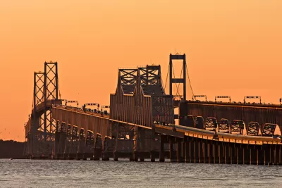
"It’s been discussed for several years, and now the state of Maryland and the Federal Highway Administration are conducting a $5 million study to look at where a new Chesapeake Bay Bridge crossing might work best," reports John Domen.
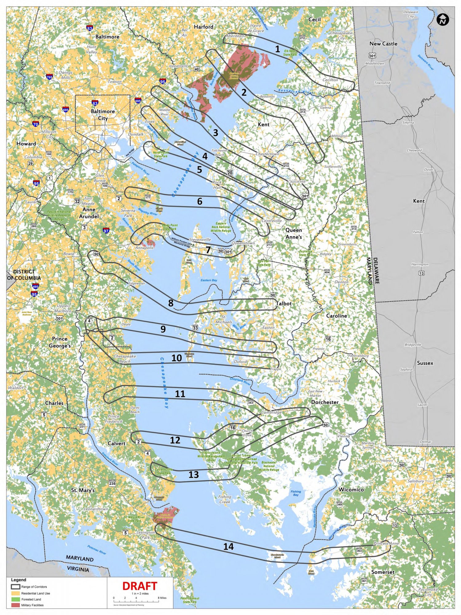
A series of maps [pdf] are already public, showing 14 potential crossings of the Chesapeake Bay, from Aberdeen to the north and Lexington Park to the south.
"This early in the process, there is a wide range of possibilities on the table, with different reasons for their impracticality," according to Domen. "But those that seem more feasible may find other roadblocks instead."
Domen describes a bit about each of the 14 potential crossings, and also highlights some of the potential political backlash a new bridge could face from either side of the political aisle.
FULL STORY: Potential new Bay Bridge crossings revealed


Maryland Spending $5 Million to Study Another Span for the Bay Bridge
Maryland Governor Larry Hogan has thrown support behind a study to add a third span to the Bay Bridge that spans the Chesapeake Bay.

Potential Routes for New Bridge Across the Chesapeake Winnowed From 14 to 3
The Maryland Transportation Authority has been studying the potential of a new bridge across the Chesapeake Bay, connecting Annapolis to Queen Anne's County to the East.
Editorial: The Best New Chesapeake Bay Bridge Is No New Chesapeake Bay Bridge
The Baltimore Sun Editorial Board finds numerous faults with the state of Maryland's preliminary investigation of an idea to add another bridge across the Chesapeake Bay near Annapolis.

Maui's Vacation Rental Debate Turns Ugly
Verbal attacks, misinformation campaigns and fistfights plague a high-stakes debate to convert thousands of vacation rentals into long-term housing.

Planetizen Federal Action Tracker
A weekly monitor of how Trump’s orders and actions are impacting planners and planning in America.

In Urban Planning, AI Prompting Could be the New Design Thinking
Creativity has long been key to great urban design. What if we see AI as our new creative partner?

Pedestrian Deaths Drop, Remain Twice as High as in 2009
Fatalities declined by 4 percent in 2024, but the U.S. is still nowhere close to ‘Vision Zero.’

King County Supportive Housing Program Offers Hope for Unhoused Residents
The county is taking a ‘Housing First’ approach that prioritizes getting people into housing, then offering wraparound supportive services.

Researchers Use AI to Get Clearer Picture of US Housing
Analysts are using artificial intelligence to supercharge their research by allowing them to comb through data faster. Though these AI tools can be error prone, they save time and housing researchers are optimistic about the future.
Urban Design for Planners 1: Software Tools
This six-course series explores essential urban design concepts using open source software and equips planners with the tools they need to participate fully in the urban design process.
Planning for Universal Design
Learn the tools for implementing Universal Design in planning regulations.
planning NEXT
Appalachian Highlands Housing Partners
Mpact (founded as Rail~Volution)
City of Camden Redevelopment Agency
City of Astoria
City of Portland
City of Laramie