


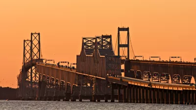
The Maryland Transportation Authority has been studying the potential of a new bridge across the Chesapeake Bay, connecting Annapolis to Queen Anne's County to the East.
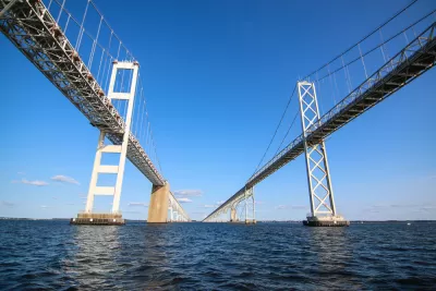
"Maryland transportation officials have determined that building a bridge adjacent to the Chesapeake Bay Bridge would relieve traffic backups better than an additional crossing much farther to the north or south," reports Katherine Shaver.
With the announcement, the state narrowed down the number of choices for a new Bay Bridge alignment from 14 to three, but the aforementioned route adjacent to the Chesapeake Bay Bridge has already been identified as the most likely to reduce congestion.
"The Bay Bridge connects U.S. routes 50 and 301 between Crofton in Anne Arundel County on the western shore with the same road in Queenstown in Queen Anne’s County on the east," explains Shaver. The possibility of a new expanse has worried residents on either side of the body of water that the bridge would bring new traffic to local roads.
FULL STORY: A new bridge close to Chesapeake Bay Bridge would provide the most traffic relief, study says

14 Potential Locations for a New Bridge Across the Chesapeake Bay
A long term plan to add an additional bridge connection across the Chesapeake Bay is underway in Maryland.
Maryland Spending $5 Million to Study Another Span for the Bay Bridge
Maryland Governor Larry Hogan has thrown support behind a study to add a third span to the Bay Bridge that spans the Chesapeake Bay.
Editorial: The Best New Chesapeake Bay Bridge Is No New Chesapeake Bay Bridge
The Baltimore Sun Editorial Board finds numerous faults with the state of Maryland's preliminary investigation of an idea to add another bridge across the Chesapeake Bay near Annapolis.

Maui's Vacation Rental Debate Turns Ugly
Verbal attacks, misinformation campaigns and fistfights plague a high-stakes debate to convert thousands of vacation rentals into long-term housing.

Planetizen Federal Action Tracker
A weekly monitor of how Trump’s orders and actions are impacting planners and planning in America.

In Urban Planning, AI Prompting Could be the New Design Thinking
Creativity has long been key to great urban design. What if we see AI as our new creative partner?

King County Supportive Housing Program Offers Hope for Unhoused Residents
The county is taking a ‘Housing First’ approach that prioritizes getting people into housing, then offering wraparound supportive services.

Researchers Use AI to Get Clearer Picture of US Housing
Analysts are using artificial intelligence to supercharge their research by allowing them to comb through data faster. Though these AI tools can be error prone, they save time and housing researchers are optimistic about the future.

Making Shared Micromobility More Inclusive
Cities and shared mobility system operators can do more to include people with disabilities in planning and operations, per a new report.
Urban Design for Planners 1: Software Tools
This six-course series explores essential urban design concepts using open source software and equips planners with the tools they need to participate fully in the urban design process.
Planning for Universal Design
Learn the tools for implementing Universal Design in planning regulations.
planning NEXT
Appalachian Highlands Housing Partners
Mpact (founded as Rail~Volution)
City of Camden Redevelopment Agency
City of Astoria
City of Portland
City of Laramie