


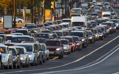
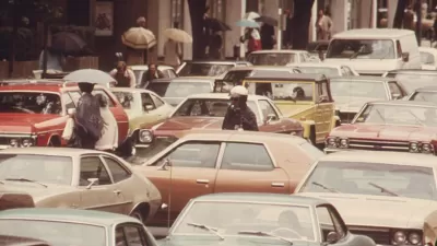
Passenger vehicle ownership and vehicle miles traveled per person and per household remain below their historic peaks set in 2006 and 2004, respectively, but they have been on the upswing for the past four to five years, according to new data.
University of Michigan transportation researcher Michael Sivak released his 10th "peak motorization" report last month [see abstract (pdf)] in a series that began June 2013. Sivak, who founded and directs Sustainable Worldwide Transportation at the University of Michigan Transportation Institute (UMTRI), focuses on two aspects of "peak car:" changes in ownership of passenger vehicles and distance driven, or vehicle miles traveled (VMT).
Both are measured as rates, per person and per household, as opposed to total VMT, which the Federal Highway Administration reports monthly in Traffic Volume Trends. The period examined was 1984 to 2016.
- Auto ownership per person measured 0.766 in 2016, highest since 2008. Measured per household, it was 1.968, highest since 2009. [Peaks for both rates were set in 2006]
- VMT per person was 8,819 miles, highest since 2007. Measured per household, it was 22,649 miles, also highest since 2007. [Peaks for both rates set in 2004]
Southern California comparison
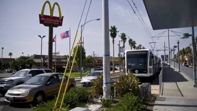
According to research released last month by the UCLA-Institute of Transportation Studies on causes for the decline in public transit ridership in Southern California, increased auto ownership was the primary reason.
Between 2000 and 2015, private vehicle ownership dramatically increased among households in the Southern California Association of Governments region, from 1.7 to 2.4 vehicles per household.
Contrast those nationwide rates provided by Dr. Sivak: 2.031 vehicles per HH in 2000 to 1.950 per HH in 2015. The UMTRI data would appear to more than verify the findings of UCLA-ITS in pointing to increased car ownership as the primary reason for the decline in transit ridership in Southern California.
FULL STORY: On the road again: Vehicle ownership, miles driven continue to rise

Southern California's Declining Transit Ridership, Explained
More Southern Californians are purchasing motor vehicles, particularly those who were previously transit-dependent, which largely explains the region's declining transit ridership, according to a newly released study.
If Congestion Is Getting Worse, Why Are We Spending Less Time Traveling?
The University of Michigan Transportation Research Institute released its eighth report on peak motorization in the U.S., an evaluation of time spent traveling for a broad category of purposes, not just work. From 2004 to 2014, total time decreased.
U.S. Gasoline Consumption Up, Oil Production Down
Gas prices are on the rise, though they will remain well below 2014 levels through this year. U.S. oil production dropped by 600,000 barrels from last year, while gas consumption is on track to break the 2007 record thanks to cheap gas and more SUVs.

Maui's Vacation Rental Debate Turns Ugly
Verbal attacks, misinformation campaigns and fistfights plague a high-stakes debate to convert thousands of vacation rentals into long-term housing.

Planetizen Federal Action Tracker
A weekly monitor of how Trump’s orders and actions are impacting planners and planning in America.

In Urban Planning, AI Prompting Could be the New Design Thinking
Creativity has long been key to great urban design. What if we see AI as our new creative partner?

King County Supportive Housing Program Offers Hope for Unhoused Residents
The county is taking a ‘Housing First’ approach that prioritizes getting people into housing, then offering wraparound supportive services.

Researchers Use AI to Get Clearer Picture of US Housing
Analysts are using artificial intelligence to supercharge their research by allowing them to comb through data faster. Though these AI tools can be error prone, they save time and housing researchers are optimistic about the future.

Making Shared Micromobility More Inclusive
Cities and shared mobility system operators can do more to include people with disabilities in planning and operations, per a new report.
Urban Design for Planners 1: Software Tools
This six-course series explores essential urban design concepts using open source software and equips planners with the tools they need to participate fully in the urban design process.
Planning for Universal Design
Learn the tools for implementing Universal Design in planning regulations.
planning NEXT
Appalachian Highlands Housing Partners
Mpact (founded as Rail~Volution)
City of Camden Redevelopment Agency
City of Astoria
City of Portland
City of Laramie