


Minneapolis officials are touting Super Bowl LII as "the most transit-reliant Super Bowl ever played."
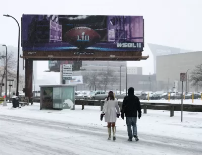
With its downtown location and adjacent light rail service, U.S. Bank Stadium will take on a notably urban feel compared to the more suburban climes of most NFL stadiums.
Katie Pyzyk provides in-depth coverage of the transit planning and investment that enabled Minneapolis' claim to the title of "the most transit-reliant Super Bowl ever played." (Mark Benedict, director of light rail operations and transportation for metro Transit, is cited in the article as the source of that claim.)
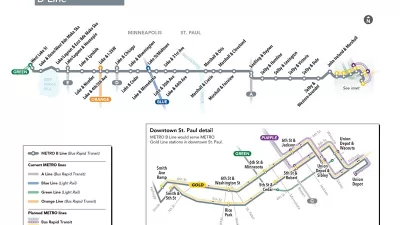
Pyzyk starts out by noting the plan to sequester all light rail service for ticket-holding fans—news about the special service broke, to the chagrin of many transit advocates, in November. Pyzyk provides additional details about the light rail service on game day, including official security screening for the game at light rail stations. In effect, once you get on a train, you're at the game.
Pyzyk also details about how Metro Transit has redesigned the bus system to accommodate regular riders while the light rail system is devoted to ticket holders.
Another key aspect of the use of transit for the game is the cold weather climate of Minneapolis, which "creates the need for more Super Bowl transportation contingency plans than in cities with temperate weather." As football fans know, the Super Bowl has only very rarely been held in cold weather cities. The first "cold weather" Super Bowl, Super Bowl XVI in Pontiac, Michigan, was hit by a snow storm before the game that caused a lot of scrambling to get fans to the game.
Finally, Pyzyk also examines the process by which Minneapolis prepared for the Super Bowl by following the model provided by Santa Clara and Houston, the last two cities to host the Super Bowl.
FULL STORY: Minneapolis prepares for the 'most transit-reliant Super Bowl ever played'

New Bus Rapid Transit Route Breaks Ground in the Twin Cities
The Twin Cities are on a mission to become the bus rapid transit capital of the United States. The latest improvement to advance that ambition broke ground earlier this week.

Blue Line Extension North of Minneapolis in Jeopardy
A planned extension of the Metro Blue Line north from Minneapolis depended on eight miles of BNSF track.

Twin Cities Trains Move to Fewer Cars, Higher Frequency
Headways will drop from 15 minutes to 12 minutes.

Maui's Vacation Rental Debate Turns Ugly
Verbal attacks, misinformation campaigns and fistfights plague a high-stakes debate to convert thousands of vacation rentals into long-term housing.

Planetizen Federal Action Tracker
A weekly monitor of how Trump’s orders and actions are impacting planners and planning in America.

Chicago’s Ghost Rails
Just beneath the surface of the modern city lie the remnants of its expansive early 20th-century streetcar system.

Bend, Oregon Zoning Reforms Prioritize Small-Scale Housing
The city altered its zoning code to allow multi-family housing and eliminated parking mandates citywide.

Amtrak Cutting Jobs, Funding to High-Speed Rail
The agency plans to cut 10 percent of its workforce and has confirmed it will not fund new high-speed rail projects.

LA Denies Basic Services to Unhoused Residents
The city has repeatedly failed to respond to requests for trash pickup at encampment sites, and eliminated a program that provided mobile showers and toilets.
Urban Design for Planners 1: Software Tools
This six-course series explores essential urban design concepts using open source software and equips planners with the tools they need to participate fully in the urban design process.
Planning for Universal Design
Learn the tools for implementing Universal Design in planning regulations.
planning NEXT
Appalachian Highlands Housing Partners
Mpact (founded as Rail~Volution)
City of Camden Redevelopment Agency
City of Astoria
City of Portland
City of Laramie