


Photos, videos, and characteristics of truly cyclist-friendly cities.
"Good bicycling infrastructure...doesn't mean a 'bike route' sign and a white stripe along the arterial. It doesn't mean a meandering trail shared with joggers, strollers, and skaters.
Bike friendly means a complete, continuous, interconnected network of named bicycle roads...It means a parallel network interlaced with the other urban grids: the transit grid on road or rail; the street grid for cars, trucks, and taxis; and the sidewalk grid for pedestrians. It means separation from those grids...
Picture a street more than half of which is reserved for people on foot, bikes, buses, or rail; on which traffic signals and signs, street design, and landscaping all conspire to treat bicycles as the equals of automobiles...
Moreover, the quality of biking infrastructure matters as much as the quantity. Slapping a 'bike route' sign on a road may qualify it for a city's registry but doesn't help cyclists much. Conversely, traffic calming on residential streets may make entire neighborhoods bike friendly without adding a mile to the bikeway count."
FULL STORY: What "bike friendly" looks like

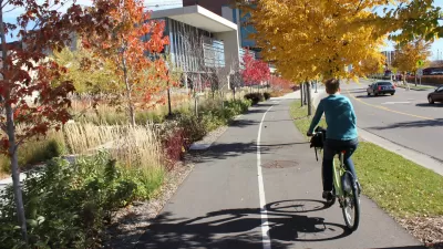
How Bike-Friendly Is Your City?
PeopleForBikes just released its annual rankings.
11 Most-Improved Bike Networks in the US
PeopleForBikes has evaluated bike networks in thousands of cities across the United States and identified several that have achieved “incredible increases” in just a few years.
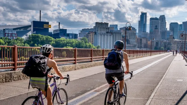
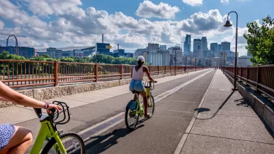
Touring One of the U.S.’s Best Biking Cities: Minneapolis
The latest Streetfilms release offers an in-person, on-bike tour of Minneapolis.

Planetizen Federal Action Tracker
A weekly monitor of how Trump’s orders and actions are impacting planners and planning in America.

Map: Where Senate Republicans Want to Sell Your Public Lands
For public land advocates, the Senate Republicans’ proposal to sell millions of acres of public land in the West is “the biggest fight of their careers.”

Restaurant Patios Were a Pandemic Win — Why Were They so Hard to Keep?
Social distancing requirements and changes in travel patterns prompted cities to pilot new uses for street and sidewalk space. Then it got complicated.

Platform Pilsner: Vancouver Transit Agency Releases... a Beer?
TransLink will receive a portion of every sale of the four-pack.

Toronto Weighs Cheaper Transit, Parking Hikes for Major Events
Special event rates would take effect during large festivals, sports games and concerts to ‘discourage driving, manage congestion and free up space for transit.”

Berlin to Consider Car-Free Zone Larger Than Manhattan
The area bound by the 22-mile Ringbahn would still allow 12 uses of a private automobile per year per person, and several other exemptions.
Urban Design for Planners 1: Software Tools
This six-course series explores essential urban design concepts using open source software and equips planners with the tools they need to participate fully in the urban design process.
Planning for Universal Design
Learn the tools for implementing Universal Design in planning regulations.
Heyer Gruel & Associates PA
JM Goldson LLC
Custer County Colorado
City of Camden Redevelopment Agency
City of Astoria
Transportation Research & Education Center (TREC) at Portland State University
Camden Redevelopment Agency
City of Claremont
Municipality of Princeton (NJ)