


Planetizen is pleased to present the best of the latest crop of mobile apps by planners and for planners.
Planners, like professionals in countless other industries, are under a lot of pressure to stay current with the creation and adoption of new apps for smartphones. The good news is that as more industries and businesses invest in mobile app technology, it becomes easier to scale mobile app technology into new corners of daily life. With innovation moving at such a quick pace due to all these investments, there's always more to learn about how smartphone technology can help planners explore and enhance communities. Luckily, planners who continue to stay current with the new mobile app technology will routinely pleased with what they discover.
Since 2012, Jennifer Evans Cowley and colleagues have conducted an annual survey of planners to gauge the state of mobile app technology in professional and academic planning. A lot of the same apps listed in previous posts are still proving useful in 2018, but we also see new and better apps emerging, useful to a wider scope of uses and accessible to a wider base of users. The hope should be that mobile technology provides both the public and the profession with access to better information and tools to improve their communities.
The staff at Planetizen is taking over for Jennifer Evans Cowley now that she's moved on to a new position, but she's owed a debt of gratitude in beginning this long-term study of mobile app technology in the field of planning.
From March to April 2018, Planetizen opened a survey to the planning profession at large, through a post on the Planetizen website, social media blasts, targeted communications to online groups, and direct correspondence to colleagues. Here's a breakdown of the professional and academic level of the survey respondents:
- Students: 9.84%
- Professional (Less than 5 years): 25.41%
- Professional (5 to 10 years): 18.03%
- Professional: (10 to 20 years): 23.77%
- Professional (20 or more years): 20.49%
- Retired: 2.46%
And another breakdown by career type:
- Public sector: 42.03%
- Private sector: 24.64%
- Non-profit: 10.14%
- Student: 6.52%
- Academia: 14.49%
- Advocacy: 2.17%
The resulting list provides an idea about the use of smartphone technology in the planning community at-large, with the usual disclaimer about the limitations of surveys in producing scientific results. The survey also helped us generate a crowd-sourced list of popular apps that planners are currently using to make their lives easier and their role as planners more effective and powerful. We have also gleaned some information about some of challenges smartphone technology must still overcome to find higher levels of adoption in the planning profession.
So long, flip phones.
According to the survey, smartphones are a fact of life for planners. Over 98 percent of respondents say they own a smartphone. Most of the remainder say they plan on buying one soon.
A majority of the survey's respondents, 65%, use Apple's iOS. Following Apple's popularity is Android, with 33% of respondents. Windows Phone claims a little more than 1% of respondents. Reflecting a healthy work-life balance (we tease), many planners use more than one smart phone for work (41% of respondents), and almost all planners use smart phones for work purposes (86% of respondents). We didn't ask about what kind of phones planners use while on vacation.
Planning apps are still finding their place in the world.
We did ask about the kinds of apps used by planners, and how often they use them. Social media apps are the most popular, presumably for community engagement and not self-promotion (again, we tease). Over 68 percent of respondents said they use social media apps on a daily basis. Over 46% of respondents said they use productivity apps like Photoshop and Safari on a daily basis, and just under 40% of respondents say they use file sharing apps like Dropbox or Google Drive on a daily basis.
On the other end of the spectrum, just under 61% of respondents say they never use planning specific apps, indicating that smartphones have yet to build-out the same kind of usefulness in the nitty-gritty of the planning profession as they have in the social and administrative aspects of the daily life of planners. We also received multiple responses to the survey expressing concern with the prospect of public sector planners developing apps at all (for an argument in favor of public sector development of apps, especially for public transit purposes, see an article by Ratma Amin and Arielle Fleisher for SPUR).
But the relative lack of adoption, as well as the reluctance for public sector planners to enter the app development market, is where this post can help. The bulk of the survey asked for examples of mobile apps used by planners, as well as apps developed by and for planners. We found that there are a lot of great mobile apps already in use by professional and academic planners all over the country, a lot of apps developed by public sector entities for the benefit of the public, and a lot more ideas ready for the enterprising developer to bring to the mobile market.
Mapping
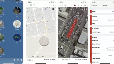
ArcGIS (Explorer, Collector, Navigator, Survey123, Business Analyst) – These apps were most commonly referenced by survey respondents. Planning is, after all, still a professional practice requiring technical skills in spatial analysis, visual presentation, and systems modeling. The most amazing thing about apps like the ArcGIS suite is how much power to do that kind of planning work is available in such small devices.
Apartments and Rentals by Walk Score – In case you hadn't heard, there's a crippling shortage of apartments available in urban areas at rents affordable to all but the most wealthy. Fortunately, finding a new apartment doesn't require the use of the classified ads in the newspaper anymore. Now would-be renters have tools like this that layer critical information about walkability and transit access into the search for a new home.
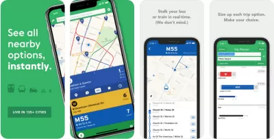
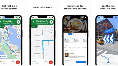
Google Maps – Remember that "Lazy Sunday" music video made for Saturday Night Live by an early incarnation of Lonely Island? Andy Samberg and Chris Parnell probably don't get enough credit as the first pop culture reference of Google's domination of the mobile map and navigation market. Double True.
Google MyMaps – Save and customize your own maps. The professional and personal applications of this concept are too numerous to count. My Maps isn't its own app, but a function of the Google Maps app. Tap on the "hamburger" icon while signed into the Google Maps app, and then follow "Your Places" to "Maps."
Google Street View – Use Google Street View to fact check locations in the field while at your desk, or to escape temporarily to some exotic location. Perhaps a visit to Sitka, Alaska is in order? Google Street View allows powers of near ubiquity to the frequently sedentary. Google Street View is also the platform for all those 360 degree photos people are taking with spherical cameras these days.
Google Earth – Google Earth hardly resembles its early versions, for those of us who remember what the first game-changing version of Google Earth looked like. Now Google Earth works more like an augmented reality tour guide of the world, with multiple methods of accessing and recording information about pretty much every corner of the planet. 
This is not Generation X's Google Earth.
Refuge Restrooms – This app maps safe restrooms for transgender, intersex, and gender nonconforming individuals, until the day all places are safe for everyone.
Mapillary – An app for building visual records of street-level imagery and integrating that archive with location data. Mapillary relies on the power of its network of contributors to build better maps and records of conditions on the ground.
National Park Service Tours – This app has a perfect 5.0 rating on the Apple App Store. Developed by OnCell, the app offers tours to supplement visits to national parks or armchair adventures. The app offers more than 70 tours at locations like the Grand Canyon, Appomattox Courthouse, and the totem poles of Sitka, Alaska.
Site Design
AutoCAD – Autodesk has created an official mobile version of the AutoCAD software that is so essential to drawing and marking up site designs during the design and approvals process.
Netatmo – Netatmo is a mobile developer that offers environmental and security apps like Netatmo Weather (which doubles as a "smart weather station"), Netatmo Security, and Netatmo Energy ("smart" thermostat and valve functionality).
Data
Social Explorer (iPad and Android tablets only) – Demographers rejoice. The Social Explorer app offers access to current and historical census data. Some reviewers complain that the free version of this app is too limited to be of value.
Eco-Link (Android only) – Retrieve data from pedestrian and bike traffic counts at all kinds of sites.
Fulcrum – Fulcrum is a tool for creating the right kind of forms for the right data collection job. Custom forms allow mobile users to collect data like text, photos, SpatialVideo, SpatialAudio, GPS Location, and more.
Zoom Prospector (Mobile Internet only) – A widely used site selection platform—business owners looking for the right location can go to the ZoomProspector website to search and filter data on communities on hundreds of criteria.
OppSites (Mobile Internet only) – Another site selection platform that connects real estate developers with economic development opportunities. Both sides of the real estate and economic development equation can post and search opportunities, like posting or looking for jobs on Craigslist.
Oakland Zoning Check and Oakland Business Permitting (Mobile Internet only) – These online platforms serve as innovative economic development tools, lending transparency to the process of siting and permitting new business in the city of Oakland, California.
Community Engagement/Social Media
SeeClickFix – By definition, SeeClickFix is actually an app developer that offers a platform for cities and communities to build out their own SeeClickFix app. Many U.S. cities already have adopted this platform for apps that gives the public the power to report safety and infrastructure issues.
Discover Newberry – Another example of the kind of community engagement and reporting platform cities can create to offer residents a line of communication with the services and systems operated by local government. Newberry, Florida's "Discover" app was created by Qbiki Networks.
NextDoor – NextDoor has emerged from its early days as the headline grabbing "Facebook for neighborhoods" into a widely adopted platform for neighborhood-centric conversations, collaborations, and, yes, controversies.
Flickr – Flickr once had the potential to become a dominant social media platform at the level of Twitter and Snapchat, but instead has become a vast repository of crowdsourced images. The savvy company or public agency also knows how to leverage Flickr's Creative Commons license for public and media relations.
Pinterest – In the 2015 Top Websites post, Planetizen documented Pinterest's emerging role in the planning community as a platform to curate and brainstorm ideas and themes. Given Pinterest's availability as a mobile app, it can also serve as a great on-the-go reference tool, when looking for inspiration in the field or on the road.
Professional News
APA Conference App – Once every year, this app is essential, and it's a great touchpoint with the national organization throughout the rest of year.
Planning Magazine – Yes, the APA's magazine is available in a mobile app format. You deserve it.
NPR One – A great example of a national news organization making its offerings available in a mobile app to ensure it stays current with how people use the Internet.
LinkedIn – The career-minded social media platform should be a staple of any career-minded planner. Great for networking while on the job and while on the job hunt.
Twitter – Even if you never send one tweet, the number of voices on Twitter leading the discussion about every possible planning-related subject is too immense to count. Twitter could also easily have been included in the above category as an essential tool for community engagement.
Mobility as a Service
The emergence of the "mobility-as-a-service" app has enabled the most profound evolution of society's interests with regard to transportation since the Model T. While Transportation Network Companies like Uber and Lyft make news, both good and bad, every day, dockless bike and scooter share companies like Bird, Lime, and oBike have burst onto the scene like the radical new kid at school. Apps like flexicar and PlugShare are helping people rethink the role of cars in communities and their lives. The navigation services of apps like Google Maps and Waze offer people the chance every day to analyze spatial dynamics of their communities (Waze creates controversies of its own, as well).
But there's another thread to the mobility as a service app, best exemplified by apps like Transit and Go LA, which offer a platform for a full collection of mobility choices—from transit to walking to ride-hailing. Here's hoping the usability of these apps marks a truly game-changing evolution in how urban dwellers make mobility choices. The app developer Passport Parking has created a series of parking apps and transit tailored to local environments. Check out GoTucson Parking and GoTucson Transit as an example of how Passport Parking's mobile apps can be crafted to fit local transportation needs. More local examples of mobile apps for local transportation include DaBus – The Oahu Bus App and SLO Transit.
There are also few notable examples of navigation and mapping apps that potentially broaden the thinking about the reach of "mobility-as-a-service" apps:
Bike Maps – The Bike Maps app boasts 3.5 million bike routes around the world, offers personalized bike routes, and voice controlled navigation. There are many other examples of apps that offer this kind of functionality, but this one topped this list with survey respondents.
Triplinx – An app for trip planning and transportation information in the Toronto and Hamilton region in Ontario, Canada. This mobile app platform offers services and information across modes, with 13 participating transit agencies.
GreenTrips – This app encourages Nashville-area residents to share rides, walk and bike, or take public transit. Use the app to record your "Green Trip" and earn your way to rewards.
Drawing, Visual Apps, and Note Taking
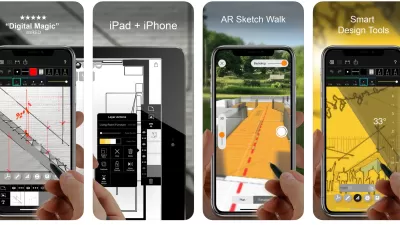
Planners have an obvious need for apps that allow them to sketch and supplement images. Apps that were mentioned in the survey included Sketchbook, Pixelmator, Morpholio Trace, and Concepts. For contemporary methods of note taking, or the production of visual assets, apps like Photoshop, Camera, and Camera+ were recommended. For more traditional note taking, survey respondents recommended Evernote, OneNote, and Penultimate (iPad only).
Productivity and Project Management
Planners also have a lot of need for (ahem) planning apps. We'd also call these software productivity or project management apps. Recommendations include Doodle, Todoist, Trello, Orgzly (Android), Basecamp, Prosperworks, and Clio. Many survey respondents also recommended communication apps, like UberConference, Slack, Telegram, Skype, and Zoom. Other common productivity apps in the planner's toolbox include Dropbox, Google Drive, PowerPoint, and Excel.
Tools of the Map App Trade
Survey respondents mentioned Carto and Mapbox multiple times, so we decided to list them here with the major caveat that these are not apps, but the tools for building apps. The software development kits (commonly referred to as SDKs) are two of the leading technologies for mapping apps, and worth looking into if you're ready to take your mobile app knowledge to the next level.
What's an App Anyway?
The discussion about SDKs raises a final point about the definitions of a mobile app. For the purposes of this list, we tried to stick to a purist's definition of a mobile app—a standalone piece of software that downloads to a mobile device. However, survey respondents mentioned many software tools that didn't quite fit that mold while offering similar functionality. We thus decided to expand our definition to include websites that offer functionality on a mobile site without requiring a software download. We decided not to include software that can be downloaded to a computer but cannot be used on mobile phones. Obviously it's worth noting that many people have a very broad definition for the term app, as its commonly understood: Apps are a software tool that connects to the Internet (or not) that can be downloaded (or powered through a website). It's not as simple as it seems like it could be, but it's probably better to have too many options than too few.

Top Planning Apps for 2019
Insights into the mobile app technology used in the practice and study of planning.
Best Apps for Urban Planning in 2022
Mobile apps continue to redefine the practices of planning—urban planning, regional planning, transportation planning, community planning, and rural planning included.
Recommended Mobile Apps for Urban Planning in 2023
Planetizen's annual list of top apps for planners is back, ten years after its first appearance on the site. Scores of apps have been recommended by planners as examples of planning in action, or tools for planning action.

Planetizen Federal Action Tracker
A weekly monitor of how Trump’s orders and actions are impacting planners and planning in America.

Map: Where Senate Republicans Want to Sell Your Public Lands
For public land advocates, the Senate Republicans’ proposal to sell millions of acres of public land in the West is “the biggest fight of their careers.”

Restaurant Patios Were a Pandemic Win — Why Were They so Hard to Keep?
Social distancing requirements and changes in travel patterns prompted cities to pilot new uses for street and sidewalk space. Then it got complicated.

DC Area County Eliminates Bus Fares
Montgomery County joins a growing trend of making transit free.

Platform Pilsner: Vancouver Transit Agency Releases... a Beer?
TransLink will receive a portion of every sale of the four-pack.

Toronto Weighs Cheaper Transit, Parking Hikes for Major Events
Special event rates would take effect during large festivals, sports games and concerts to ‘discourage driving, manage congestion and free up space for transit.”
Urban Design for Planners 1: Software Tools
This six-course series explores essential urban design concepts using open source software and equips planners with the tools they need to participate fully in the urban design process.
Planning for Universal Design
Learn the tools for implementing Universal Design in planning regulations.
Heyer Gruel & Associates PA
JM Goldson LLC
Custer County Colorado
City of Camden Redevelopment Agency
City of Astoria
Transportation Research & Education Center (TREC) at Portland State University
Camden Redevelopment Agency
City of Claremont
Municipality of Princeton (NJ)