


A particularly frustrating 1.2-mile stretch became a whole lot smoother when simple orange cones turned a parking lane and a bike lane into a lane for buses.
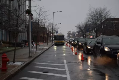
In Boston, the tricks of "tactical urbanism" are coming in handy for legitimate transit operators. Regarding one snarled stretch, Angie Schmitt writes, "The intense traffic congestion can drag out the approximately 1.2 mile-long trip between Roslindale Square and the Forest Hills Orange Line station as long as 45 minutes."
But in a recent trial run, "Bus riders got a dramatically faster ride thanks to a one-day pilot in which Boston DOT and the MBTA converted a parking lane and a bike lane into a bus lane using just orange cones."
The improvised bus lane was a hit, shaving around 30 minutes from many riders' commutes. "This is an incredibly cost-effective way to move more people more efficiently along our streets without the time and resources required for capital projects," remarked Andrew McFarland of Boston's LivableStreets Alliance. Similar and longer experiments of the same kind are planned for the new year.
FULL STORY: Boston Tests Faster Bus Service Simply By Laying Out Orange Cones


Boston Bus Signal Priority Project Yields Faster Travel Times
The city now plans to expand a year-long pilot project that reduced the time buses waited at traffic signals.
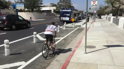
Opinion: Los Angeles Must Prioritize Bikes and Buses
L.A. has a plan for improving mobility. Why are city leaders ignoring it?
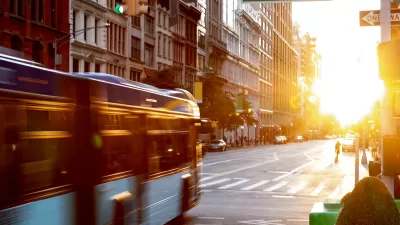
NYC Bus Service Hindered by Congestion
Sharing lanes with car traffic may make it impossible for the MTA to increase service frequency.

Maui's Vacation Rental Debate Turns Ugly
Verbal attacks, misinformation campaigns and fistfights plague a high-stakes debate to convert thousands of vacation rentals into long-term housing.

Planetizen Federal Action Tracker
A weekly monitor of how Trump’s orders and actions are impacting planners and planning in America.

San Francisco Suspends Traffic Calming Amidst Record Deaths
Citing “a challenging fiscal landscape,” the city will cease the program on the heels of 42 traffic deaths, including 24 pedestrians.

Adaptive Reuse Will Create Housing in a Suburban Texas Strip Mall
A developer is reimagining a strip mall property as a mixed-use complex with housing and retail.

Study: Anti-Homelessness Laws Don’t Work
Research shows that punitive measures that criminalized unhoused people don’t help reduce homelessness.

In U.S., Urban Gondolas Face Uphill Battle
Cities in Latin America and Europe have embraced aerial transitways — AKA gondolas — as sustainable, convenient urban transport, especially in tricky geographies. American cities have yet to catch up.
Urban Design for Planners 1: Software Tools
This six-course series explores essential urban design concepts using open source software and equips planners with the tools they need to participate fully in the urban design process.
Planning for Universal Design
Learn the tools for implementing Universal Design in planning regulations.
Heyer Gruel & Associates PA
JM Goldson LLC
Custer County Colorado
City of Camden Redevelopment Agency
City of Astoria
Transportation Research & Education Center (TREC) at Portland State University
Jefferson Parish Government
Camden Redevelopment Agency
City of Claremont