


New Orleans could create the largest stretch of public riverfront in the U.S., thanks to a public land swap.
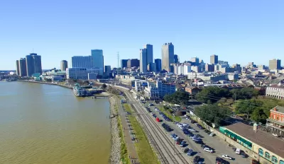
A vision to develop a contiguous public parkway along the New Orleans riverfront originated in the 2008 Reinventing the Crescent plan. Now, a missing piece of the proposed stretch of land has become available through an agreement between the Port of New Orleans and the Public Belt Railroad to trade riverfront properties. Jackson Rollings writes in the Architect's Newspaper:
In the swap, PNO took ownership of a stretch of railroad along the Mississippi River and PBR took ownership of two large wharves–Esplanade Avenue and Governor Nicholls Street Wharves. PBR is owned by the City of New Orleans, which now plans to redevelop both wharves as public space (à la Mandeville Wharf). This redevelopment will connect two existing riverfront parks, Bywater’s Crescent Park and the French Quarter’s Woldenburg Park.
The new park is one of several major redevelopments slated for the Mississippi River waterfront, coming to hundreds of millions of dollars. The city began a resurgence of park-building activity in 2014.
FULL STORY: New Orleans property swap may yield largest public riverfront in the U.S.


Louisiana Coast Will Disappear, Study Says. The Only Question Is How Soon.
Sea-level rise has passed a tipping point in the Gulf of Mexico.

Ensuring Equity in Memphis Riverfront Development
One of the city’s biggest assets is its riverfront, but equity and inclusion need to be an important part of what development brings to residents and communities.
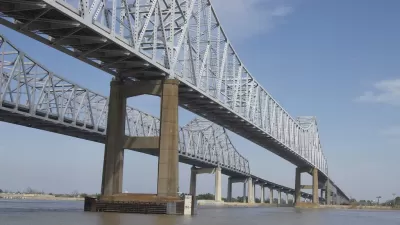
As the Mississippi River Rises, So Does the Threat to New Orleans
Climate change and channelization have made high water levels the norm along the river. But low-lying New Orleans lies in its path, and the consequences could be monumental.

Planetizen Federal Action Tracker
A weekly monitor of how Trump’s orders and actions are impacting planners and planning in America.

Congressman Proposes Bill to Rename DC Metro “Trump Train”
The Make Autorail Great Again Act would withhold federal funding to the system until the Washington Metropolitan Area Transit Authority (WMATA), rebrands as the Washington Metropolitan Authority for Greater Access (WMAGA).

DARTSpace Platform Streamlines Dallas TOD Application Process
The Dallas transit agency hopes a shorter permitting timeline will boost transit-oriented development around rail stations.

San Francisco's School District Spent $105M To Build Affordable Housing for Teachers — And That's Just the Beginning
SFUSD joins a growing list of school districts using their land holdings to address housing affordability challenges faced by their own employees.

Car-Centric LA Suburb Looks to a Train-Oriented Future
City leaders in Rancho Cucamonga, the future western terminus of the Brightline West rail line to Las Vegas, want to reimagine the city as a transit-oriented, pedestrian-friendly community.

New Alaska Bitcoin Mine Would Burn as Much Energy as the State’s Largest Coal Plant
Fueled by “stranded” natural gas, the startup hopes to become the largest in the US, and to make Alaska an industry center.
Urban Design for Planners 1: Software Tools
This six-course series explores essential urban design concepts using open source software and equips planners with the tools they need to participate fully in the urban design process.
Planning for Universal Design
Learn the tools for implementing Universal Design in planning regulations.
Municipality of Princeton
Roanoke Valley-Alleghany Regional Commission
City of Mt Shasta
City of Camden Redevelopment Agency
City of Astoria
Transportation Research & Education Center (TREC) at Portland State University
US High Speed Rail Association
City of Camden Redevelopment Agency
Municipality of Princeton (NJ)