


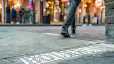
An efficient and fair transportation system must serve diverse users. The "Transportation for Everyone" rating system evaluates transport system diversity and, therefore, its ability to serve all community members.


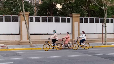
To be efficient and fair, a transportation system must serve diverse demands, including the needs of people who for any reason cannot, should not, or prefer not to drive. For example, it is inefficient if inadequate sidewalks and paths force parents to chauffeur children to local destinations to which they would rather walk or bicycle, or if inadequate travel options force urban commuters to drive although they would prefer to use more affordable and resource-efficient modes such as ridesharing and public transit. It is also unfair if automobile-oriented planning deprives non-drivers of their share of transportation investment dollars, and of the mobility options they need to access to basic services and activities.
Transportation diversity [pdf] is particularly important for physically, economically, and socially disadvantaged people, who tend to use multiple modes and value affordable options, but even people who primarily drive can benefit from having alternatives in their community that reduce their traffic problems and chauffeuring burdens, and from having options that that they may need sometime in the future.
I can report from personal experience that it is possible to be happy and successful without a car, if you live in an accessible and multimodal community. My wife and I have been blissfully car-free for almost a decade, which is possible because we live in an older urban neighborhood with good walking and cycling conditions, adequate public transit, and abundant nearby services.
Multimodal planning was normal before 1950, but for most of the last century planning has focused on accommodating automobile travel, with major investments in roads and parking facilities, and dispersed development that is difficult to access without driving. Such planning ignored non-automobile travel demands, such as those in the following box.
Non-Automobile Travel Demands
|
There are several ways to describe the value of improving transportation options. You can say that transport planning should be more diverse and multi-modal, and less automobile-dependent. You can evaluate the degree that a community is accessible or location-efficient, and whether it is walkable, bikeable. or transit-oriented, and whether it is suitable for living car-free.
Good planning requires quantitative analysis. Multimodal analysis is an emerging field. New multimodal level-of-service ratings can be used to evaluate walking, cycling and public transit service quality, to identify barriers to their use, and to set targets for improvement. New accessibility mapping systems, such as those described in the following box, calculate the time required to reach various destinations by different modes.
|
Accessibility Mapping Tools This box describes tools for measuring the time and money required to reach common services and activities (shops, schools, jobs, etc.) by various modes. Access Scoring uses GIS mapping tools to measure people’s mobility demands, their ability to access work and common non-work activities by various modes and at various times and locations, and indicate how specific transportation system changes will affect that accessibility. It can even account for factors such as travel comfort and safety based on roadway size and type (arterial vs. neighborhood), and traffic speeds. Access to Everyday Destinations The study,What Makes Housing Accessible to Everyday Destinations in Southern California?analyzed the accessibility of five million Southern California homes to 31 destination types including stores, banks, schools, hospitals and open space. They find that accessibility tends to be greater in older neighborhoods. This is a leading resource for the research and application of accessibility-based transportation system evaluation. The Brookings Institution’sMoving to Access (MTA) Initiativeaims to inform and promote a more socially focused, access-first approach to urban transportation policy, planning, investment, and services. New York City Transit Explorer This mapping system indicates the time required to reach any destination by public transit in New York City, and allows users to compare travel times of different routes. This program ranks locations in 350 U.S. cities based on the number of jobs that can be accessed within a 30-minute walk or transit ride. This program provides interactive maps and data for measuring location efficiency, including the effects of the built environment on per capita vehicle travel, and methods for measuring access to jobs and workers by public transportation. Sugar Accessis an integrated Geographic Information Systems (GIS) software program that communities can use to quantify the access (time and financial costs) of accessing various types of services and activities (healthcare, shops, schools, jobs, parks, etc.) by various travel modes in a particular area. The Metropolitan ChicagoAccessibility Exploreris an easy-to-use mapping system that measures the number of activities, including various types of jobs, schools, parks, stores and libraries, that Chicago region neighborhood residents can reach within a given travel time, by a particular mode and time of day. It represents current state-of-art for multi-modal accessibility mapping. The results are displayed on maps which can be adjusted by scale and area. This tool can help policy makers, planners and residents easily evaluate how transportation system and land use change could alter accessibility. |
Although these tools are useful, none is truly comprehensive. Some measure local walking and cycling conditions, some the availability of neighborhood services, some indicate regional driving and transit travel speeds, but few consider travel financial costs, emerging mobility options such as taxi, ridehailing, and delivery services, and none integrates all of this information into a comprehensive accessibility index. These tools are also constrained by their complexity and cost: they require lots of data and analysis, and so can cost millions of dollars to create and manage. Although this may be an excellent investment, it is often infeasible. As a result, few communities have the information needed for comprehensive multimodal planning.
To fill this gap I developed the Transportation for Everyone rating system, based on extensive research concerning factors that affect accessibility. For example, good research indicates that increasing land use density and mix tends to increase the services and activities that can be reached within a given travel time, and that people who live in more walkable, bikeable, and transit-oriented neighborhoods, with carsharing services, tend to own fewer vehicles, drive less, and rely more on alternative modes. The rating system identifies ten specific factors that affect non-drivers' ability to access services and activities which are rated from 1 (worst) to 10 (best), resulting in a total score from 10 to 100. This analysis can be applied at any geographic scale, from an individual house to a neighborhood, city or region.
Transportation for Everyone Rating System
| Rating Factors |
Rate from 1 to 10 |
| 1. Compact, mixed urban development which creates Transit-Oriented Development (if located near a major transit station) or Urban Villages (if pedestrian oriented), where most commonly-used services (shops, restaurants, bank machine, schools, parks and recreation centers, public transit stops, etc.) can be reached within a 5-10 minute walk or bicycle ride of most homes and worksites. | |
| 2. Good walking and cycling conditions, including adequate sidewalks, crosswalks, paths, bike lanes, bike parking, and motor vehicle traffic speed control. | |
| 3. High quality public transit services, with good geographic coverage, frequency, comfort, safety and affordability, both within the urban region and connecting to other regions. | |
| 4. Good connectivity, including dense walking and road networks, and intermodal connections such as walking and cycling access, and taxi services at transit stations. | |
| 5. Convenient and affordable carsharing and bikesharing, taxi and ride-hailing services (e.g., Uber and Lyft). | |
| 6. Universal design (transportation systems and services accommodate people with diverse needs and abilities, including those with disabilities and heavy loads). | |
| 7. Good telework options, such as on-line shopping, banking and municipal services. | |
| 8. Efficient delivery services by mail, courier and local shops. | |
| 9. Convenient user information concerning transportation options, such as integrated public transit websites. | |
| 10. Social marketing that promotes non-automobile modes and enhances their status. | |
|
Total |
|
This table identifies ten factors that contribute to a multi-modal transportation system. They can be rated from 1 to 10 to provide an overall "Transportation for Everyone" score.
Of course, individuals' abilities and needs vary. Some people need an automobile for their work or personal activities, or because they have an impairment which limits their walking. On the other hand, skilled cyclists who live close to their work and have minimal caregiving responsibilities (they don't care for children or people with disabilities) may manage to live car-free in automobile-dependent areas, but these are exceptions. For most people, transportation system diversity determines whether they can meet their needs without driving. This rating system provides a good indication of an area's transportation diversity, and therefore the feasibility of households reducing their automobile ownership and use, and associated costs. An area's overall Transportation for Everyone score is indicated below.
Transportation for Everyone Score
70–100 Multimodal – A car is unnecessary for most daily travel. Many households are car-free.
50–69 Mixed – It is possible but often difficult to rely on non-automobile modes. Most households have at least one car.
0–49 Automobile Dependent – It is difficult to live without a personal car. Most households have one car per driver.
An important point is that multimodal accessibility requires an integrated system of transportation options. Multimodal planning therefore involves identifying and correcting the weakest link in the mobility chain. For example, a high public transit service rating is good but insufficient if stations have poor pedestrian access, or lack convenient taxi services and user information; this rating system can help identify those gaps.
People sometimes criticize multimodal planning as a "war on cars," but everybody can benefit from a more diverse transport system: Living in a multimodal community can provide a variety of savings and benefits, including direct user benefits and indirect external benefits, as summarized below.
Direct User Benefits |
Indirect and External Benefits |
|
Transportation cost savings Reduced time spent driving Improved mobility for non-drivers Reduced chauffeuring burdens Improved fitness and health Increased enjoyment |
Reduced traffic and parking congestion Public infrastructure cost savings Increased safety Energy conservation and emission reductions Improved neighborhood quality Local economic development |
The Transportation for Everyone is a small but important step toward more comprehensive and multimodal transportation planning. It is a work in progress. Please let me know what you think and how it can be improved.

New Orleans Makes Push for Accessibility Improvements Ahead of Super Bowl
Major sporting events like the Olympics and the Super Bowl can serve as catalysts for major changes in transportation infrastructure and accessibility.

Planning for Accessibility: Proximity is More Important than Mobility
Accessibility-based planning minimizes the distance that people must travel to reach desired services and activities. Measured this way, increased density can provide more total benefits than increased speeds.
An International Comparison of Transportation Modes
Access (the ease of reaching desired destinations) is a key factor in transport, sustainability, and urban planning. This new study applies multimodal accessibility analysis to 4 modes in 117 cities in 6 countries, illustrated graphically.

Planetizen Federal Action Tracker
A weekly monitor of how Trump’s orders and actions are impacting planners and planning in America.

Maui's Vacation Rental Debate Turns Ugly
Verbal attacks, misinformation campaigns and fistfights plague a high-stakes debate to convert thousands of vacation rentals into long-term housing.

Restaurant Patios Were a Pandemic Win — Why Were They so Hard to Keep?
Social distancing requirements and changes in travel patterns prompted cities to pilot new uses for street and sidewalk space. Then it got complicated.

In California Battle of Housing vs. Environment, Housing Just Won
A new state law significantly limits the power of CEQA, an environmental review law that served as a powerful tool for blocking new development.

Boulder Eliminates Parking Minimums Citywide
Officials estimate the cost of building a single underground parking space at up to $100,000.

Orange County, Florida Adopts Largest US “Sprawl Repair” Code
The ‘Orange Code’ seeks to rectify decades of sprawl-inducing, car-oriented development.
Urban Design for Planners 1: Software Tools
This six-course series explores essential urban design concepts using open source software and equips planners with the tools they need to participate fully in the urban design process.
Planning for Universal Design
Learn the tools for implementing Universal Design in planning regulations.
Heyer Gruel & Associates PA
JM Goldson LLC
Custer County Colorado
City of Camden Redevelopment Agency
City of Astoria
Transportation Research & Education Center (TREC) at Portland State University
Jefferson Parish Government
Camden Redevelopment Agency
City of Claremont