


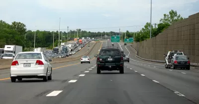
The current plan for the widening of I-66 in Virginia would place a bike lane between vehicle traffic and a sound wall.
Canaan Merchant critiques plans "to widen I-66 include building a new bike trail that runs from where the Custis Trail ends in Arlington all the way out to Centreville."
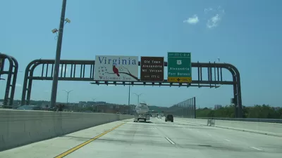
The bike lane would be added to the Outside the Beltway Project—the proposal to widen I-66 that David Alpert critiqued in April 2012. The public-private partnership between the Virginia Department of Transportation (VDOT) and the Department of Rail and Public Transportation (DRPT), and private partner, I-66 Express Mobility Partners, will expand I-66 to ten lanes between Haymarket and Falls Church.
According to Merchant, "one positive aspect is that the project will include a new trail that extends from the Custis Trail, which runs parallel to I-66 in Arlington, from its western end to Centreville (it'd go there at first, but then even farther). The 22-mile extension would make the Custis one of the longest trails in the region, giving a lot of local neighborhoods a new option for biking and walking."
Merchant's argument, however, is that for all the benefits of gaining a new bike trail, this one could be a lot better:
As it is currently planned, the new trail would put trail users in a squeeze, literally. Plans show it running along the highway side of the sound barrier, the big wall that separates 66 from where people live. That means trail users would be closer to high-speed traffic and farther from the neighborhood connections, which likely means far fewer people would be willing to get out and use it.
To help conjure an idea about what the experience of this trail would be like, the Fairfax Alliance for Better Bicycling created the following visualization.
Merchant has a better idea: "move the trail to the opposite side of the sound wall, and make it at least 12 feet wide."
FULL STORY: A new bike trail will basically run along the shoulder of I-66

Construction of I–66 Toll Lanes Outside the Capital Beltway Begins this Weekend
Widening of Interstate 66 for 22.5 miles in Northern Virginia will accommodate two toll lanes in each direction, accessible to trucks. The $3.7 billion project, to be built by public-private partnership at no cost to the state, will open in 2022.
Popularity of Express Lanes Spreads Beyond Virginia
Dan Vock of Governing takes a broad look at congestion pricing, beginning with the success of Virginia's 66 Express Lanes, the ones where tolls initially topped $40. Notwithstanding complaints, managed lanes are spreading, but challenges remain.

Olympia Draft Transportation Plan Zeroes in on Complete Streets, Bike Infrastructure
The city’s comprehensive plan update could signal a shift in transportation planning priorities to a more comprehensive approach that ensures safer roads for all users.

Maui's Vacation Rental Debate Turns Ugly
Verbal attacks, misinformation campaigns and fistfights plague a high-stakes debate to convert thousands of vacation rentals into long-term housing.

Planetizen Federal Action Tracker
A weekly monitor of how Trump’s orders and actions are impacting planners and planning in America.

San Francisco Suspends Traffic Calming Amidst Record Deaths
Citing “a challenging fiscal landscape,” the city will cease the program on the heels of 42 traffic deaths, including 24 pedestrians.

Defunct Pittsburgh Power Plant to Become Residential Tower
A decommissioned steam heat plant will be redeveloped into almost 100 affordable housing units.

Trump Prompts Restructuring of Transportation Research Board in “Unprecedented Overreach”
The TRB has eliminated more than half of its committees including those focused on climate, equity, and cities.

Amtrak Rolls Out New Orleans to Alabama “Mardi Gras” Train
The new service will operate morning and evening departures between Mobile and New Orleans.
Urban Design for Planners 1: Software Tools
This six-course series explores essential urban design concepts using open source software and equips planners with the tools they need to participate fully in the urban design process.
Planning for Universal Design
Learn the tools for implementing Universal Design in planning regulations.
Heyer Gruel & Associates PA
JM Goldson LLC
Custer County Colorado
City of Camden Redevelopment Agency
City of Astoria
Transportation Research & Education Center (TREC) at Portland State University
Jefferson Parish Government
Camden Redevelopment Agency
City of Claremont