


Greater Greater Washington likes what it sees from the District Mobility data portal.
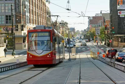
"Rejoice, transportation wonks! DDOT's newest toy, the District Mobility data portal, is a deep dive into how Washingtonians use DC streets."
That moment of ebullience is written by Nicole Cacozza, who details the offerings available on the District Mobility data portal, from "ridership at individual bus stops, to which streets are safe for children to bike on." According to Cacozza the new data portal, the work of the District Department of Transportation's District Mobility Project, represents the most data on D.C. transportation ever complied into a single source.
"DDOT put this together so its workers will have easy access to the crucial information they need to plan and operate DC's streets," writes Cacozza. "It'll help identify problem areas, prioritize construction projects, and provide a benchmark to measure future progress."
Cacozza also pulls some of the most interesting takeaways from the portal, and asks for reader help in pulling more insights from the expansive archive of data.
FULL STORY: DDOT’s new statistics portal, District Mobility, is nirvana for data nerds


Key Virginia Rail Bridge Project Completes Environmental Review
A $1.9 billion project to add a second set of rail tracks to the Long Bridge that connects Virginia to D.C. is ready to move forward with a recently completed Environmental Impact Statement.

5 Transit Projects to Watch in the D.C. Region in 2020
Light rail, bus rapid transit, subway cell service, and more.

D.C. Speeds Up Protected Bike Lane Plans
The District Department of Transportation last week promised to double the pace of its planned construction of protected bike lanes, but advocates say the District still isn't doing enough to provide safe accommodations for people on bikes.

Planetizen Federal Action Tracker
A weekly monitor of how Trump’s orders and actions are impacting planners and planning in America.

Maui's Vacation Rental Debate Turns Ugly
Verbal attacks, misinformation campaigns and fistfights plague a high-stakes debate to convert thousands of vacation rentals into long-term housing.

Restaurant Patios Were a Pandemic Win — Why Were They so Hard to Keep?
Social distancing requirements and changes in travel patterns prompted cities to pilot new uses for street and sidewalk space. Then it got complicated.

In California Battle of Housing vs. Environment, Housing Just Won
A new state law significantly limits the power of CEQA, an environmental review law that served as a powerful tool for blocking new development.

Boulder Eliminates Parking Minimums Citywide
Officials estimate the cost of building a single underground parking space at up to $100,000.

Orange County, Florida Adopts Largest US “Sprawl Repair” Code
The ‘Orange Code’ seeks to rectify decades of sprawl-inducing, car-oriented development.
Urban Design for Planners 1: Software Tools
This six-course series explores essential urban design concepts using open source software and equips planners with the tools they need to participate fully in the urban design process.
Planning for Universal Design
Learn the tools for implementing Universal Design in planning regulations.
Heyer Gruel & Associates PA
JM Goldson LLC
Custer County Colorado
City of Camden Redevelopment Agency
City of Astoria
Transportation Research & Education Center (TREC) at Portland State University
Jefferson Parish Government
Camden Redevelopment Agency
City of Claremont