


Associate Professors Yunwoo Nam and lead PI Changbum Ahn from the University of Nebraska-Lincoln, were recently awarded an NSF grant entitled "Human-Centric Sensing Platform to Assess Neighborhood Physical Disorder."
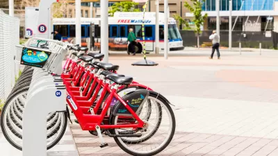
Walking, unmistakably, is one of the most common things we do as humans, but as researchers will tell you, where we walk, how we walk, how often we walk and how fast we walk are all influenced by a myriad of factors, including the physical environment. Yunwoo Nam, Associate Professor of Community and Regional Planning and lead PI Changbum Ahn, Assistant Professor of Construction Engineering in the College of Engineering at the University of Nebraska-Lincoln, were recently awarded a National Science Foundation grant for a project entitled “Human-Centric Sensing Platform to Assess Neighborhood Physical Disorder.”
This collaborative research team is seeking to measure how environmental, physical “disorders” (such as sidewalk defects, graffiti, broken windows, peeling paint, etc.), affect a pedestrian's physiological response. If uncomfortable or hazardous enough, these environmental conditions could have a real impact on a neighborhood’s health and safety. Why is this important? The more walkable a neighborhood is, the healthier and more desirable it is. The big question here is, can this research and technology help measure and detect built environment abnormalities and, therefore, be used to improve the overall wellbeing of a neighborhood and community? Perhaps someday this technology can be used to respond to the needs for community improvements, like sidewalk repair, in a faster and more efficient manner.
Ideally, Nam and Ahn are seeking to change how neighborhoods are assessed by community planners, non-profits and various governmental agencies. Traditionally, the approach of community assessments involved visual audits and perception surveys. However, the collaborators are seeking to include more evidence-based research data in the development of additional assessment tools. Their pilot research project intends to measure a participant’s physiological responses by collecting data through the use of a smartphone and sensors. The phone is synced with Inertial Measurement Unit (IMU) motion sensors that are attached to the participant’s right ankle to measure gait stability and walking patterns and Photoplethysmography (PPG) sensors attached to the wrist and earlobe for measuring heartrate and skin temperature. Location information will be detected by Global Positioning System (GPS) technology within the smartphone.
Together, this technology has the capacity to synergistically let researchers ascertain problem areas in a neighborhood based on the physiological data they collect. For example, if 20 of their test subjects happen upon a pothole, at that precise GPS location, a statistically significant number of the participants might show an increased heartrate, a fluctuation in gait or even a skin temperature variance, enough to establish a common pattern.
“Though we know our physiological responses are directly related to our physical environment, no one has actually measured or assessed it, particularly in connection with the community outdoor environment. By using this method, will we be able to find out how much the physical environment impacts the body? We can assume some visible characteristics or physical obstacles in the community environment may cause more distress or impact our physiological responses, but maybe not, because we’ve never tested it,” commented Nam. “That is a significant research gap, and the NSF is interested in our pursuit of those research questions. So they funded our pilot study, which may turn into a larger research grant later.”
This research project has numerous collaborators, each entity contributing its own strengths and supporting functions. NeighborWorks-Lincoln, a non-profit organization dedicated to community revitalization, in conjunction with Dr. Nam, will be developing the community engagement framework and participating in the experiment design and analysis of results. Dr. Ahn will be developing a new collective response entropy model, designing a sensing platform and developing assessment metrics. Plus, 16 UNL students are assisting with testing equipment, field observation and data collection and analysis.
The first year of this two-year research project is intended to verify the research approach, framework and methodology. The second year will focus on field testing of the methodology in selected Lincoln neighborhoods. For this phase, the researchers will have a predetermined established path which they will ask subjects to walk while simultaneously using the sensors to collect the subjects’ physiological data. If analysis of the field-collected data verifies that the pilot is successful, it will be expanded and replicated in other areas of the Lincoln community.
Further research expansion possibilities include refining the sensors, software and hardware into one piece of equipment for data collection. “We’ve already started to talk with developers about creating those devices,” Nam explained. “But that would require more grant funding.”
Other research options include deeper examination of participant demographics and their results and how they differ from each other in response to environmental stimuli. “Perhaps elderly will have different physiological responses to environmental disorders than, let’s say, millennials,” Nam said. “These types of questions can’t be answered using our traditional types of visual analysis.”
In the future, the research may expand to include a health component and perhaps computer science, envisions Nam and Ahn.
This is not the first research project for either one of the professors. Nam brings a significant amount of experience analyzing and evaluating community environments with past partnerships that include the Woods Charitable Fund in Lincoln, NeighborWorks-Lincoln and the City of Lincoln. Ahn has worked extensively on sensing and modeling human behaviors toward the applications in construction safety and environmental sustainability in the built environment, so in many ways this has been a perfect pairing for this collaborative research project.
“I was surprised by the network that Community and Regional Planning, and especially Dr. Nam, has with the city government agencies and nonprofit organizations. They are open to partnering with us and are open to new research ideas,” Ahn commented on the resources that each has brought to the table. “I think that speaks to the legacy of the CRP department and Dr. Nam’s previous work and projects.”
Long-term, Ahn said he hopes this project will close the knowledge gap and broaden the understanding of how humans respond physiologically to their environment, and perhaps his students might gain more practical experience and expand their research horizons and scope. In the end, Nam’s ambitions are filled with optimism for a better community.
“I hope the community employs our recommendations and makes the needed changes to make our neighborhoods more walkable,” Nam said. “My aspirations for this research are that eventually, it will be used to create better, safer and healthier neighborhoods. Walking is an important physical activity that produces many health benefits such as preventing obesity, diabetes and high blood pressure. In addition, a neighborhood’s walkability offers a range of theoretically attractive benefits in the context of key public policy challenges such as urban sprawl, traffic congestion and public health. Therefore, the development of more walkable communities is one effective way to encourage active living and a healthy community. The way we design and build our communities can and will affect a resident’s quality of life.”
FULL STORY: National Science Foundation Awards Ahn and Nam a Research Grant for Walking Study

How Streets and Social Justice Intersect
A look at how streets affect health, social interaction, and economic development by Marissa Reilly, a Berkeley-based urban planner and Lillian Jacobson, a master’s candidate at MIT.
Multimodal Millennials? A Closer Look Using Multifaceted Traveler Types
Kelcie Ralph guest blogs about a new article in the Journal of Planning Education and Research.
The E-commerce Revolution
The internet has revolutionized the way people shop. From Amazon's Prime service, to grocery stores offering online ordering and delivery or store pick-up, the retail landscape has changed and so have brick-and-mortar shops and delivery methods.

Maui's Vacation Rental Debate Turns Ugly
Verbal attacks, misinformation campaigns and fistfights plague a high-stakes debate to convert thousands of vacation rentals into long-term housing.

Planetizen Federal Action Tracker
A weekly monitor of how Trump’s orders and actions are impacting planners and planning in America.

In Urban Planning, AI Prompting Could be the New Design Thinking
Creativity has long been key to great urban design. What if we see AI as our new creative partner?

King County Supportive Housing Program Offers Hope for Unhoused Residents
The county is taking a ‘Housing First’ approach that prioritizes getting people into housing, then offering wraparound supportive services.

Researchers Use AI to Get Clearer Picture of US Housing
Analysts are using artificial intelligence to supercharge their research by allowing them to comb through data faster. Though these AI tools can be error prone, they save time and housing researchers are optimistic about the future.

Making Shared Micromobility More Inclusive
Cities and shared mobility system operators can do more to include people with disabilities in planning and operations, per a new report.
Urban Design for Planners 1: Software Tools
This six-course series explores essential urban design concepts using open source software and equips planners with the tools they need to participate fully in the urban design process.
Planning for Universal Design
Learn the tools for implementing Universal Design in planning regulations.
planning NEXT
Appalachian Highlands Housing Partners
Mpact (founded as Rail~Volution)
City of Camden Redevelopment Agency
City of Astoria
City of Portland
City of Laramie