


A new mapping tool shows the potential devastation along the Rhode Island coast caused by rising waters from climate change and storm surges.
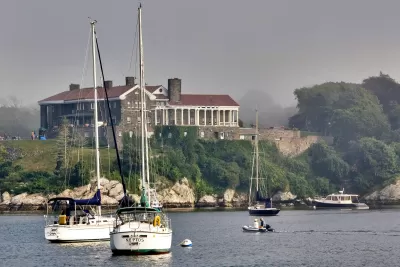
Researchers at the University of Rhode Island and the Rhode Island Coastal Resources Management Council have developed a new mapping tool that models potential flooding damage from rising seas and the storm surge from potentially deadly hurricanes. Alex Kuffner of the Providence Journal writes that the new mapping tool known as CERI (short for Coastal Environmental Risk Index)combines Google Earth data along with a pre-existing mapping software knows as StormTools to give users a predictive model of what would happen in different scenarios, including a strike by a 100 year storm. The tool further combines data about existing housing along the coast with estimates of damage from the Army Corps of Engineers.
The maps incorporate information on housing structures from Rhode Island’s E-911 emergency response database, which not only pinpoints houses using satellite information but also divides them into general categories: with basement or without, elevated or not, one story or two, and so on.
The results of the simulations from CERI are impacting how towns along the coast plan ahead for potentially damaging flooding. The director of planning for Warwick, RI says that the data could influence how emergency response is managed and the requirement for height of future homes above grade.
FULL STORY: Rising seas, rising stakes: R.I. researchers project future flooding


Providence Could Ban New Gas Stations
The city could prohibit the construction of new fueling stations within city limits to discourage driving and pave the way for more renewable transportation infrastructure.

New Tool Aims to Make Parks More Resilient to Climate Change
The interactive mapping platform helps park managers understand the risks in their area and create long-term resilience plans.

Transitioning from Climate Justice Planning to Climate Justice Action
The Providence Climate Justice Plan offers an exemplary approach to prioritizing the communities and neighborhoods most impacted by the environmental effects of development and industrial pollution.

Planetizen Federal Action Tracker
A weekly monitor of how Trump’s orders and actions are impacting planners and planning in America.

Congressman Proposes Bill to Rename DC Metro “Trump Train”
The Make Autorail Great Again Act would withhold federal funding to the system until the Washington Metropolitan Area Transit Authority (WMATA), rebrands as the Washington Metropolitan Authority for Greater Access (WMAGA).

The Simple Legislative Tool Transforming Vacant Downtowns
In California, Michigan and Georgia, an easy win is bringing dollars — and delight — back to city centers.

The States Losing Rural Delivery Rooms at an Alarming Pace
In some states, as few as 9% of rural hospitals still deliver babies. As a result, rising pre-term births, no adequate pre-term care and "harrowing" close calls are a growing reality.

The Small South Asian Republic Going all in on EVs
Thanks to one simple policy change less than five years ago, 65% of new cars in this Himalayan country are now electric.

DC Backpedals on Bike Lane Protection, Swaps Barriers for Paint
Citing aesthetic concerns, the city is removing the concrete barriers and flexposts that once separated Arizona Avenue cyclists from motor vehicles.
Urban Design for Planners 1: Software Tools
This six-course series explores essential urban design concepts using open source software and equips planners with the tools they need to participate fully in the urban design process.
Planning for Universal Design
Learn the tools for implementing Universal Design in planning regulations.
Smith Gee Studio
City of Charlotte
City of Camden Redevelopment Agency
City of Astoria
Transportation Research & Education Center (TREC) at Portland State University
US High Speed Rail Association
City of Camden Redevelopment Agency
Municipality of Princeton (NJ)