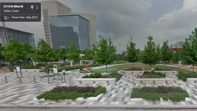
The interactive mapping platform helps park managers understand the risks in their area and create long-term resilience plans.

A new tool helps park managers understand the potential impacts of climate change on their parks and plan accordingly, writes Peter Yeung in Next City. "NRPA [National Recreation and Park Association] and design firm Sasaki partnered to develop Climate.Park.Change, an interactive platform that launched last month to allow park professionals to explore the impacts of climate change by region – such as drought, heatwaves and erosion—and to discover proven, effective strategies to fight them."
The platform was developed to help parks find "strategies for mitigating climate challenges" using data specific to their area. According to Kristin Riker, director of public lands for Salt Lake City, the tool is "a really great database of park-specific, climate-related information and idea-sharing opportunities in the park and recreation realm to understand what’s been done, what’s worked and what hasn’t worked." Salt Lake City's Glendale Water Park, one of the case studies for the platform, presents "some interesting challenges" in terms of climate mitigation that Climate.Park.Change helped park officials analyze.
"Over time, the plan is also for the database to become richer and richer thanks to a function that lets park professionals submit their own strategies and experiences in the critical fight against climate change. The team also hopes to, where possible, increase the granularity of the data from country level down to city level."
FULL STORY: New Mapping Tool Helps Parks Plan for Climate Change

Maui's Vacation Rental Debate Turns Ugly
Verbal attacks, misinformation campaigns and fistfights plague a high-stakes debate to convert thousands of vacation rentals into long-term housing.

Planetizen Federal Action Tracker
A weekly monitor of how Trump’s orders and actions are impacting planners and planning in America.

In Urban Planning, AI Prompting Could be the New Design Thinking
Creativity has long been key to great urban design. What if we see AI as our new creative partner?

Cal Fire Chatbot Fails to Answer Basic Questions
An AI chatbot designed to provide information about wildfires can’t answer questions about evacuation orders, among other problems.

What Happens if Trump Kills Section 8?
The Trump admin aims to slash federal rental aid by nearly half and shift distribution to states. Experts warn this could spike homelessness and destabilize communities nationwide.

Sean Duffy Targets Rainbow Crosswalks in Road Safety Efforts
Despite evidence that colorful crosswalks actually improve intersection safety — and the lack of almost any crosswalks at all on the nation’s most dangerous arterial roads — U.S. Transportation Secretary Duffy is calling on states to remove them.
Urban Design for Planners 1: Software Tools
This six-course series explores essential urban design concepts using open source software and equips planners with the tools they need to participate fully in the urban design process.
Planning for Universal Design
Learn the tools for implementing Universal Design in planning regulations.
Appalachian Highlands Housing Partners
Gallatin County Department of Planning & Community Development
Heyer Gruel & Associates PA
Mpact (founded as Rail~Volution)
City of Camden Redevelopment Agency
City of Astoria
City of Portland
City of Laramie


