


Following an 11 percent drop in ridership in the last quarter, transportations experts are left scratching their heads as to where D.C.'s Metrorail riders have gone.
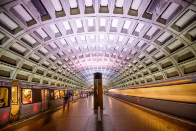
Lori Aratani of The Washington Post reports that transportation experts and Metro officials are trying to explain just where the transit system's riders have gone to after an 11 percent drop in ridership during the last quarter. While Metro Board chairman Jack Evans believes former riders have switched to single-person private vehicles ("I can tell by the congestion on the streets"), surveys have shown that commuters are finding alternatives that include bike share, Uber, Car2Go, and an increase in tele-commuting. One former rider notes that the switch away from Metrorail may also have something to do with the system's poor performance.
Melissa Dentch, 30, is an example of someone who is no longer wedded to a single way of getting around. She lives 2 1/2 blocks from a Metro station and used to use the transit system to get to her job at Georgetown University almost exclusively. Metro’s troubles prompted her to find other ways.
“I kind of feel like I’m Metro’s worst nightmare,” she said, explaining how she gets around town. “I own my own car, I have a Car2Go membership, I own a bike and I do bike share. There are so many options for the price that Metro’s charging . . . unless things improve, people are just going to find other options.”
FULL STORY: Metro’s multimillion-dollar mystery: Where have our riders gone?

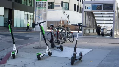
How E-Scooters Can Complement Public Transit
With some strategic planning on the part of transit agencies and operators, shared e-scooters can be an important ally in the fight against car dependence.

Smartphone Fare Cards Now Available for D.C. Metro
The future is now.
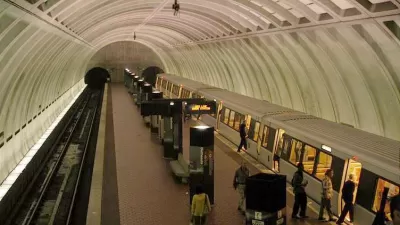
Density Increases Near Transit Station in D.C. But Ridership Does Not
D.C.'s ridership is down even as density around stations is up. More residents are choosing to drive or bike.

Maui's Vacation Rental Debate Turns Ugly
Verbal attacks, misinformation campaigns and fistfights plague a high-stakes debate to convert thousands of vacation rentals into long-term housing.

Planetizen Federal Action Tracker
A weekly monitor of how Trump’s orders and actions are impacting planners and planning in America.

In Urban Planning, AI Prompting Could be the New Design Thinking
Creativity has long been key to great urban design. What if we see AI as our new creative partner?

King County Supportive Housing Program Offers Hope for Unhoused Residents
The county is taking a ‘Housing First’ approach that prioritizes getting people into housing, then offering wraparound supportive services.

Researchers Use AI to Get Clearer Picture of US Housing
Analysts are using artificial intelligence to supercharge their research by allowing them to comb through data faster. Though these AI tools can be error prone, they save time and housing researchers are optimistic about the future.

Making Shared Micromobility More Inclusive
Cities and shared mobility system operators can do more to include people with disabilities in planning and operations, per a new report.
Urban Design for Planners 1: Software Tools
This six-course series explores essential urban design concepts using open source software and equips planners with the tools they need to participate fully in the urban design process.
Planning for Universal Design
Learn the tools for implementing Universal Design in planning regulations.
planning NEXT
Appalachian Highlands Housing Partners
Mpact (founded as Rail~Volution)
City of Camden Redevelopment Agency
City of Astoria
City of Portland
City of Laramie