


The San Francisco Chronicle's John King continues his ongoing, in-depth coverage of sea-level rise and its potential impacts on local and regional concerns in the San Francisco Bay Area.
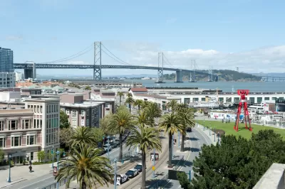
"San Francisco’s Mission Bay neighborhood might need large levees or a tidal barrier to help protect it from the impacts of sea level rise in coming decades," reports John King.
That conclusion is drawn from a study by SPUR and several local and regional partners, released at the end of September. King describes the significance of the study:
The 80-page study is billed as “an imaginative exercise” and consists of design concepts rather than formal recommendations. Still, the emphasis on eventually altering the shoreline — one concept would turn Mission Creek into a lake — is a strong signal that local government sees the tidal aspects of climate change not as a distant possibility, but as a likelihood that needs to be planned for now.
Kind provides more details on specific recommendations from the study, many of which might seem "outlandish" to his audience in San Francisco. Many of the most ambitious proposals, however, have antecedents in cities like Tokyo and London, however. The themes of all these proposed solutions is a need to rethink the regional approach to the San Francisco Bay, considering both environmental and infrastructural concerns.
FULL STORY: Mission Bay may need tidal barriers, huge levees as sea rises

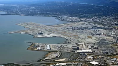
As the Waters Rise Toward San Francisco International Airport, So Do the Costs of Staying Dry
San Francisco International Airport lies on 5,171-acres of land on eight miles of shoreline along the west side of the San Francisco Bay. Protecting the property from sea-level rise is becoming a more challenging, and expensive, task.
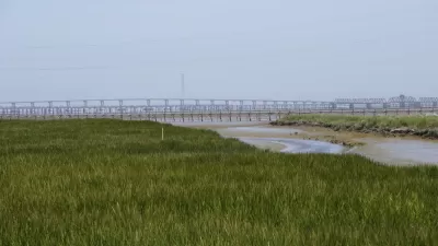
A New Plan for Sea Level Rise in the San Francisco Bay Area
The San Francisco Bay has 400 miles of shoreline, and a dire need for a new approach to dealing with the effects of rising water levels. An estimated $100 billion in potential property damage is at risk.
A $350 Million Bond to Repair San Francisco's Seawall
As seas rise, San Francisco is looking to shore up its costal protection against earthquakes and extreme weather events.

Maui's Vacation Rental Debate Turns Ugly
Verbal attacks, misinformation campaigns and fistfights plague a high-stakes debate to convert thousands of vacation rentals into long-term housing.

Planetizen Federal Action Tracker
A weekly monitor of how Trump’s orders and actions are impacting planners and planning in America.

In Urban Planning, AI Prompting Could be the New Design Thinking
Creativity has long been key to great urban design. What if we see AI as our new creative partner?

King County Supportive Housing Program Offers Hope for Unhoused Residents
The county is taking a ‘Housing First’ approach that prioritizes getting people into housing, then offering wraparound supportive services.

Researchers Use AI to Get Clearer Picture of US Housing
Analysts are using artificial intelligence to supercharge their research by allowing them to comb through data faster. Though these AI tools can be error prone, they save time and housing researchers are optimistic about the future.

Making Shared Micromobility More Inclusive
Cities and shared mobility system operators can do more to include people with disabilities in planning and operations, per a new report.
Urban Design for Planners 1: Software Tools
This six-course series explores essential urban design concepts using open source software and equips planners with the tools they need to participate fully in the urban design process.
Planning for Universal Design
Learn the tools for implementing Universal Design in planning regulations.
planning NEXT
Appalachian Highlands Housing Partners
Mpact (founded as Rail~Volution)
City of Camden Redevelopment Agency
City of Astoria
City of Portland
City of Laramie