


The phrase "traffic congestion" can be misleading; some reductions in traffic speed are less harmful than others.

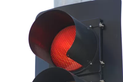
There has been much debate in planning circles (including Planetizen's own blogs) about how to measure traffic congestion. The most widely cited measurement, the Texas Transportation Institute's Urban Mobility Scorecard, compares automobile traffic speeds to "free flow" speeds (that is, auto speeds in the absence of significant traffic). By this definition, a road is congested if people drive 40 miles per hour on a road where they could be driving 50 miles per hour.
But not all "congestion" is equally noxious. For example, suppose people drive 20 mph on a two-lane urban street where the free-flow speed is 40 mph. In such a situation, drivers lose a few seconds here and there, but traffic might flow fairly evenly. Here, lower speeds actually benefit the public in a variety of ways. Slower speeds mean that accidents (both between cars and between cars and pedestrians) are less likely to lead to death or significant bodily injury. A pedestrian hit by a car going 40 mph has more than an 80 percent chance of death, while one hit by a car going 20 mph has about a 5 percent chance of death. Similarly, streets designed to accommodate slower traffic tend to be less dangerous for drivers, because it is more dangerous, other things being equal, for a car to be hit by a fast-moving object than by a slow-moving object. Moreover, drivers are only slightly inconvenienced by slower speeds where the lower-speed street is part of an urban grid; in such places, the congestion is easy to avoid, because a driver can easily switch to another street.
By contrast, imagine the stereotypical traffic jam: bumper-to-bumper traffic on an interstate highway. This form of congestion is more irritating to drivers for two reasons. First, drivers have no alternative route, and thus feel more helpless. Second, "stop and go" traffic is less predictable than slow, even traffic; if I am stuck on I-75 going 5 mph, I have no idea when I will reach my destination. Finally, highway congestion lacks the public benefit caused by "congestion" on a traditional street: since there are generally no pedestrians on interstate highways, slow speeds on such highways do nothing to protect pedestrians. Even on an arterial street with sidewalks, a traffic jam creates only small safety benefits because traffic can rapidly go from 5 mph to 50 mph and back again.
In sum, stop-and-go interstate highway congestion is the worst form of congestion, low speeds on an urban grid actually create public benefits. So to measure congestion appropriately, we should focus on the former.
A postscript: other than criticizing how congestion is measured, does any of this have any practical application for government policymakers? It seems to me that my ideas cut against the common idea that "congestion" justifies turning neighborhood streets into speedways.

A Critical Evaluation of the Urban Mobility Report
The Urban Mobility Report (UMR) evaluates traffic congestion problems and recommends congestion reduction solutions. How well does it reflect travelers' priorities?
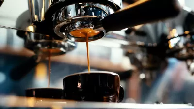
If Traffic Costs Americans Billions, What About Waiting for Coffee?
The folks over at City Observatory brew up a "Cappuccino Congestion Index" to show that anything can be shown to cost Americans vast sums of money.

Judge Extends NYC Congestion Pricing Through at Least June 9
A federal judge halted the Trump administration’s effort to kill the program, which remains in limbo as a lawsuit filed by the MTA moves forward.

Planetizen Federal Action Tracker
A weekly monitor of how Trump’s orders and actions are impacting planners and planning in America.

Maui's Vacation Rental Debate Turns Ugly
Verbal attacks, misinformation campaigns and fistfights plague a high-stakes debate to convert thousands of vacation rentals into long-term housing.

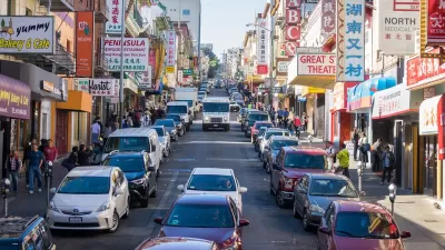
San Francisco Suspends Traffic Calming Amidst Record Deaths
Citing “a challenging fiscal landscape,” the city will cease the program on the heels of 42 traffic deaths, including 24 pedestrians.

Defunct Pittsburgh Power Plant to Become Residential Tower
A decommissioned steam heat plant will be redeveloped into almost 100 affordable housing units.

Trump Prompts Restructuring of Transportation Research Board in “Unprecedented Overreach”
The TRB has eliminated more than half of its committees including those focused on climate, equity, and cities.

Amtrak Rolls Out New Orleans to Alabama “Mardi Gras” Train
The new service will operate morning and evening departures between Mobile and New Orleans.
Urban Design for Planners 1: Software Tools
This six-course series explores essential urban design concepts using open source software and equips planners with the tools they need to participate fully in the urban design process.
Planning for Universal Design
Learn the tools for implementing Universal Design in planning regulations.
Heyer Gruel & Associates PA
JM Goldson LLC
Custer County Colorado
City of Camden Redevelopment Agency
City of Astoria
Transportation Research & Education Center (TREC) at Portland State University
Jefferson Parish Government
Camden Redevelopment Agency
City of Claremont