


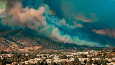
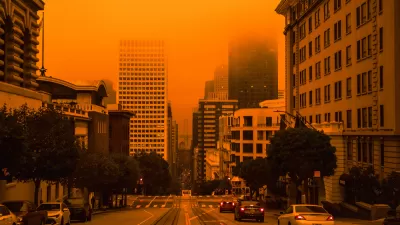
A summer of drought and devastating fires has demonstrated the dangers of allowing residential developments to sprawl ever farther into wild, natural environments.
According to on article by Laura Bliss, "as we make more and more homes along the very fringes of metropolitan areas, the more we come into contact with natural habitats."
The U.S.D.A. Forest Service has a term for these fringe places: "wildland-urban interface." According to Bliss, "Putting aside conservation concerns, higher numbers in the 'wildland/urban interface' (or the “WUI,” as the U.S.D.A Forest Service calls it) means higher numbers of homes vulnerable to wildfire."
"As of 2010, 99 million people, or about one-third of all people in the United States, lived in the WUI," reports Bliss. And the map of the WUI [pdf] is expanding.
For more on the development patterns that exacerbated the fire season in California, the Los Angeles Times also published an interview by Patt Morrison of Char Miller, professor of environmental analysis at Pomona College.
FULL STORY: Mapping America's Unprecedented Vulnerability to Wildfires

Home Insurers Are Fleeing California
Homeowners in the state are finding it increasingly difficult to secure insurance policies thanks to the growing risks of wildfire, drought, and other climate threats.
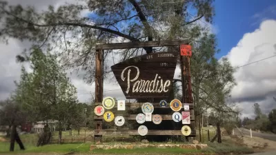
California's Fastest Growing City: Paradise
Paradise, California—devastated by the deadly Camp Fire of 2018—is attracting new and returning residents as the city rebuilds its housing stock.
6 Principles to Manage Wildfire Risk With Effective Housing Policy
The connection between housing policy and climate change is made clear by the increasing damage of wildfires in California.

Planetizen Federal Action Tracker
A weekly monitor of how Trump’s orders and actions are impacting planners and planning in America.

San Francisco's School District Spent $105M To Build Affordable Housing for Teachers — And That's Just the Beginning
SFUSD joins a growing list of school districts using their land holdings to address housing affordability challenges faced by their own employees.

Can We Please Give Communities the Design They Deserve?
Often an afterthought, graphic design impacts everything from how we navigate a city to how we feel about it. One designer argues: the people deserve better.

The EV “Charging Divide” Plaguing Rural America
With “the deck stacked” against rural areas, will the great electric American road trip ever be a reality?

Judge Halts Brooklyn Bike Lane Removal
Lawyers must prove the city was not acting “arbitrarily, capriciously, and illegally” in ordering the hasty removal.

Engineers Gave America's Roads an Almost Failing Grade — Why Aren't We Fixing Them?
With over a trillion dollars spent on roads that are still falling apart, advocates propose a new “fix it first” framework.
Urban Design for Planners 1: Software Tools
This six-course series explores essential urban design concepts using open source software and equips planners with the tools they need to participate fully in the urban design process.
Planning for Universal Design
Learn the tools for implementing Universal Design in planning regulations.
Borough of Carlisle
Smith Gee Studio
City of Camden Redevelopment Agency
City of Astoria
Transportation Research & Education Center (TREC) at Portland State University
City of Camden Redevelopment Agency
Municipality of Princeton (NJ)