Open data can be a powerful tool for illustrating the risks to public safety that will have to be overcome as more cities adopt Vision Zero initiatives.


"Montgomery County now publishes detailed traffic violation data, which goes online daily here," according to a post by Jacob Mason. "This data allows anyone to see where and when the police are issuing citations, and to whom." Mason used that data, for instance, to create a map of speeding violations covering June 1 through August 16. On the map, the size of the bubbles representing violations even correspond to how far over the speed limit the driver was traveling when cited.
With the map as an illustration, Mason argues for more and better open data projects by local governments. Mason pays specific attention to the Washington, D.C.'s region, which he says had made progress but can still improve.
Read the full story: When governments make road data public, anyone can help make roads safer

Let’s End Traffic Stops
The technology to make traffic enforcement obsolete is becoming available. But in the U.S. willing to use it?
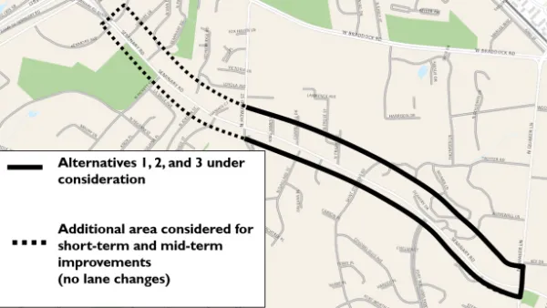
When it Comes to Road Diets, Evidence Doesn't Matter
Drivers are a powerful enough lobby to overcome all evidence of the need to redesign streets for safety. Examples from Maryland and Virginia provide the latest case studies in Vision Zero futility.
Speeding Camera Issues 6,000 Tickets in a Day—Is it Unfair?
After issuing 6,000 speeding tickets in one day, a speeding camera in Sheepshead Bay in New York City has already influenced driving habits. But some in the community are calling the location of the cameras a trap.

Planetizen Federal Action Tracker
A weekly monitor of how Trump’s orders and actions are impacting planners and planning in America.

California plans to bury El Niño’s downpour
If the state plays its cards right, it may be able to store a billion acre-feet of El Niño’s water in aquifers.

Desperate measures: Advocates weigh draining Lake Powell to fill Colorado River
Draining the reservoir could reduce evaporation losses by a couple hundred thousand acre-feet.

Chicago voters approve permanent festival grounds, penalty for vacant property owners
Currently, major summer and fall festivals take over public parks for weeks at a time, drawing criticism from nearby residents

NYC votes to cut outdoor dining red tape, speed up permitting
New York City also voted to allow the Department of Transportation to begin work on urgent projects before notifying elected officials.

California appears to reject Prop. 45
The proposition would have expanded the projects that qualify for a streamlined environmental review, effectively paring down the California Environmental Quality Act.

FREE Course: Walkable City 1: Why Walkability?
After describing his path towards focusing on walkability as the essence of good planning, Jeff Speck marches through his five principal reasons for making more walkable places.
Reinventing Malls: Planning Alchemy—Turning Gray Fields Into Gold
The course focuses on the opportunities and imperatives that shape reinvention of mall sites.

City of Rosemead
Rutgers University, Edward J. Bloustein School of Planning and Public Policy
One Hundred Miles
Hunter College, City University of New York (CUNY)
The Architects Foundation
University of Cincinnati Online
City of Cambridge
Montrose County
The Pocatello Development Authority