


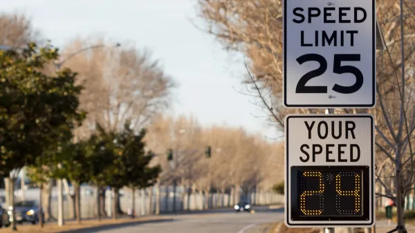
A new study indicates that the safest urban streets have lanes that measure 10-10.5 feet wide. Narrower and wider lanes have higher crash frequencies, and wider lanes have higher crash severity.

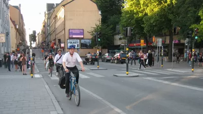
The "forgiving highway" approach to traffic engineering holds that wider is safer when it comes to street design. After decades of adherence to these standards, American cities are now criss-crossed by streets with 12-foot wide lanes. As Walkable City author Jeff Speck argued in a column last year, this is actually terrible for public safety and the pedestrian environment.
A new study reinforces the argument that cities need to reconsider lane widths and redesign streets accordingly. In a paper to be presented at the Canadian Institute of Traffic Engineers annual conference, author Dewan Masud Karim presents hard evidence that wider lanes increase risk on city streets.
Karim conducted a wide-ranging review of existing research as well as an examination of crash databases in two cities, taking into consideration 190 randomly selected intersections in Tokyo and 70 in Toronto. Looking at the crash databases, Karim found that collision rates escalate as lane widths exceed about 10.5 feet. Roads with the widest lanes—12 feet or wider—were associated with greater crash rates and higher impact speeds. Karim also found that crash rates rise as lanes become narrower than about 10 feet, though this does not take impact speeds and crash severity into account. He concluded that there is a sweet spot for lane widths on city streets, between about 10 and 10.5 feet.

The rate of side impact crashes is lowest on urban streets with lanes about 10.5 feet wide — much narrower than the standard 12 feet. Graph: Dewan Karim
In Toronto, where traffic lanes are typically wider than in Tokyo, the average crash impact speed is also 34 percent higher, Karim found, suggesting that wider lanes not only result in more crashes but in more severe crashes.
The "inevitable statistical outcome" of the "wider-is-safer approach is loss of precious life, particularly by vulnerable citizens," Karim concluded.
FULL STORY: Compelling Evidence That Wider Lanes Make City Streets More Dangerous

Rethinking Streets: New Report Illustrates Complete Streets Projects
"Rethinking Streets," a new report by the University of Oregon's Sustainable Cities Initiative, provides detailed information on 25 complete streets and streetscaping projects. It is available free in PDF and hard copy format.

Maryland Plans Quick-Build Complete Streets Projects
The state will use low-cost interventions to improve road safety in five Maryland counties.
Philadelphia Launches ‘Speed Slots’ Traffic Calming Pilot
The project focuses on a 1.4-mile stretch of Lincoln Drive where cars frequently drive above the posted speed limit.

Planetizen Federal Action Tracker
A weekly monitor of how Trump’s orders and actions are impacting planners and planning in America.

Maui's Vacation Rental Debate Turns Ugly
Verbal attacks, misinformation campaigns and fistfights plague a high-stakes debate to convert thousands of vacation rentals into long-term housing.

Restaurant Patios Were a Pandemic Win — Why Were They so Hard to Keep?
Social distancing requirements and changes in travel patterns prompted cities to pilot new uses for street and sidewalk space. Then it got complicated.

In California Battle of Housing vs. Environment, Housing Just Won
A new state law significantly limits the power of CEQA, an environmental review law that served as a powerful tool for blocking new development.

Boulder Eliminates Parking Minimums Citywide
Officials estimate the cost of building a single underground parking space at up to $100,000.

Orange County, Florida Adopts Largest US “Sprawl Repair” Code
The ‘Orange Code’ seeks to rectify decades of sprawl-inducing, car-oriented development.
Urban Design for Planners 1: Software Tools
This six-course series explores essential urban design concepts using open source software and equips planners with the tools they need to participate fully in the urban design process.
Planning for Universal Design
Learn the tools for implementing Universal Design in planning regulations.
Heyer Gruel & Associates PA
JM Goldson LLC
Custer County Colorado
City of Camden Redevelopment Agency
City of Astoria
Transportation Research & Education Center (TREC) at Portland State University
Jefferson Parish Government
Camden Redevelopment Agency
City of Claremont