


Just to the north of Washington D.C., Montgomery County will soon begin an update to its Bicycle Master Plan in the hopes of taking advantage of the evolving world of alternative transportation.
Sean Emerson makes a persuasive and passionate argument on the Around the Corners blog about the importance of the ongoing Bicycle Master Plan update process in Montgomery County. The process officially launches on July 1, and, according to Emerson, "will focus on evaluating new facilities such as buffered bike lanes, bike boulevards, and secure bicycle storage facilities."
Emerson explains that Montgomery County last updated its bicycle master plan in 2005 and notes that the county already has some ambitious projects on the planning books that have yet to come to fruition. Yet, says Emerson, "[t]he Bicycle Master Plan update is our chance to demand adequate bike facilities." He goes on to list a wish-list of desired projects like buffered bike paths and bike and pedestrian bridges at specific locations.
In other recent coverage of the bike planning process, Aaron Kraut reports that "[Montgomery County planners] will create a bicycle 'stress map' on which every street in Montgomery County will be assessed in terms of how stressful it is to bicyclists." The stress map methodology is the result of a 2012 study by San Jose State University’s Mineta Transportation Institute.
Kate S. Alexander covered the announcement of the bike planning process in April 2015. According to Alexander's coverage, the planning process will focus "on developing a bicycle network aimed at providing access to future Corridor Cities Transitway stations and coordinating with the Life Science Center Loop, an off-road trail being designed by the planning department."
FULL STORY: Bicycle Master Plan update is an opportunity for Four Corners

How Montgomery County Will Implement its Ambitious Bicycle Master Plan
Montgomery County, Maryland planners were trying to raise the bar for bicycle infrastructure planning and design in North America.

Biking's Billion-Dollar Value, Right Under Our Wheels
A strategic switch to biking would dramatically reduce the depth of roads, saving untold billions over the next generation.
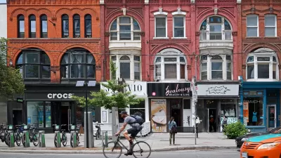
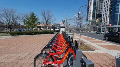
Biking Takes Off in Toronto
People in cities all over the world are choosing the bike as their preferred mode of transportation as the coronavirus shakes up work and travel patterns. Residents of the largest city in Canada are no exception.

Planetizen Federal Action Tracker
A weekly monitor of how Trump’s orders and actions are impacting planners and planning in America.

Chicago’s Ghost Rails
Just beneath the surface of the modern city lie the remnants of its expansive early 20th-century streetcar system.

San Antonio and Austin are Fusing Into one Massive Megaregion
The region spanning the two central Texas cities is growing fast, posing challenges for local infrastructure and water supplies.

Since Zion's Shuttles Went Electric “The Smog is Gone”
Visitors to Zion National Park can enjoy the canyon via the nation’s first fully electric park shuttle system.

Trump Distributing DOT Safety Funds at 1/10 Rate of Biden
Funds for Safe Streets and other transportation safety and equity programs are being held up by administrative reviews and conflicts with the Trump administration’s priorities.

German Cities Subsidize Taxis for Women Amid Wave of Violence
Free or low-cost taxi rides can help women navigate cities more safely, but critics say the programs don't address the root causes of violence against women.
Urban Design for Planners 1: Software Tools
This six-course series explores essential urban design concepts using open source software and equips planners with the tools they need to participate fully in the urban design process.
Planning for Universal Design
Learn the tools for implementing Universal Design in planning regulations.
planning NEXT
Appalachian Highlands Housing Partners
Mpact (founded as Rail~Volution)
City of Camden Redevelopment Agency
City of Astoria
City of Portland
City of Laramie