What would a policy that requires development to make more efficient use of land and resources (like water, for instance) look like?



The California drought has highlighted an impressive disparity in per capita water use across the state's communities, ranging from 50 to 500 gallons per day per person in October 2014 according to State Water Resources Control Board data. A major reason for this difference is residential outdoor irrigation, which is driven in large part by lot size. More yard, more watering—especially in warmer parts of the state. And parcel size, or density, influences not only water use, but other elements of community sustainability as well, from energy use to economic competitiveness.
In the face of global water and climate trends, it therefore seems reasonable to ask whether we can afford to let development density exacerbate conditions and limit our options for achieving greater resilience. Perhaps the time has come to discuss national minimum urban density standards. The rationale for minimum urban densities is simple: in locations where achievement of public policy depends on compactness, the capacity of a finite amount of land in a community is too valuable to use insufficiently, and doing so is detrimental for everyone.
According to the Census Bureau Characteristics of New Housing, the national median lot size of detached, single-family homes completed in 2013 was 9,664 sq. ft., or about 3.4 dwelling units (DU) per net acre, assuming 75 percent net of gross acreage. The median size of the houses built on those lots was 2,384 sq. ft. Each home therefore had an outdoor area of approximately 7,200 sq. ft. (which undercounts because of multi-story houses). Using 2.5 persons per household means each occupant has about 2,900 sq. ft. of outdoor space, or 120 percent of the entire house for each person. And multi-family housing isn't occurring at appreciably high densities; a 2014 National Association of Home Builders survey found new multi-family projects had a median density of about 8.5 DU/net acre (assuming 75 percent net of gross acreage).
The ripple effect of using land this way is enormous, and there is ample evidence of its negative environmental, economic, and social consequences. Alternatively, there is compelling evidence of the benefits of using density proactively to fashion sustainable and prosperous neighborhoods. As density increases, there are generally corresponding decreases in per capita water and energy use, stormwater runoff, and air pollutant and greenhouse gas emissions. As density increases, multi-modal travel becomes more feasible, improving choices for non-drivers and public health through active transportation, as well as cost savings for households. There is also convincing data that density, when used strategically, can improve economic productivity, real estate values, and business activity. And for local governments, more compact land use lowers per capita infrastructure capital and operating costs and increases tax revenue per acre.
There are already three voluntary national standards for minimum urban densities. These apply to development projects that are seeking green certification at the neighborhood scale. The LEED for Neighborhood Development program requires at least 7 to 12 DU/net acre and 0.5 to 0.8 floor area ratio (FAR) for residential and non-residential uses, respectively, depending on transit service level. The Enterprise Green Communities program requires at least 5 to 15 DU/net acre depending on housing type and community size. And the Living Community Challenge program requires at least 0.5 to 3.0 FAR for all uses in urban zones, or about 10 DU/net acre for residences at the low end. Interestingly, the APA Sustaining Places comprehensive plan standards only address density in qualitative terms, without any mention of the appropriateness of minimums for achieving policy goals.
Minimum densities are already required by some localities and states to support transit investments, enable neighborhood retail, expand housing choices, protect open space, and reduce greenhouse gas emissions. Examples include multi-family zones in Portland, Oregon that require one dwelling for every 1,000 sq. ft. of lot area and TOD districts in Charlotte, North Carolina that require 20 DU/net acre for residences and 0.75 FAR for non-residential and mixed uses. Like many metropolitan regions, Minneapolis-Saint Paul has set long-range targets for minimum densities, in this case 5, 10, and 20 DU/net acre by 2040 for suburban areas, urban communities, and urban centers, respectively. And California greenhouse gas reduction legislation offers TOD projects that achieve 20 DU/net acre or 0.75 FAR streamlined environmental reviews.
At the federal level, the closest to a minimum density standard is the Federal Transit Administration (FTA) land use rating criteria for projects seeking FTA 'new start' funds. A transit station area must have 2,560 to 15,000 persons/sq. mile to achieve low to high ratings, respectively, or about 2 to 8 DU/net acre (for reference, the Census Bureau breakpoint between urban and suburban land use is approximately 3,200 persons/sq. mile, or about 3 DU/net acre).
What would a national density standard look like? How would it be developed and by whom? And under whose sponsorship? The HUD-DOT-EPA Partnership for Sustainable Communities could be one candidate for leading such an effort, perhaps in collaboration with a standards organization like the American National Standards Institute. Using an advisory group of experts, a recommended set of standards should be possible to draft in a year. The additional time required for federal rule-making or legislation becomes a question of political resolve; at least 3 to 4 years seems a reasonable estimate, depending on the severity of other intervening water and climate crises.
If it started now, the federal government could theoretically produce authorized standards by 2020 that, in broad strokes, could be:
- Organized in a hierarchy of Census regions, community sizes, and place types. One size would not fit all, but in round numbers, a region-weighted national minimum for general urban neighborhoods in medium-size cities seems reasonable somewhere around 8-10 DU/net acre and 0.75 FAR, which are enough to confidently support investments in multi-modal travel. As with auto fuel efficiency standards, the land-use minimums could be set to gradually increase over time.
- Applied to residential and non-residential uses inside municipal and urban growth boundaries where public policy and investments are premised on compactness and its benefits (e.g., transit corridors and neighborhood-serving retail catchment areas).
- Calibrated to existing conditions to ensure that minimum densities are feasibly attainable. The EPA Smart Location Database and Census Bureau data already provide a national density baseline down to the block level.
- Phased, beginning with a voluntary adoption phase that incentivizes early adopters with enhanced eligibility for federal housing, transportation, water, and wastewater funding. This would be followed by a mandatory adoption phase when, to maintain federal financial assistance eligibility, minimum densities would have to be incorporated into the next update of municipal comprehensive plans and zoning ordinances.
Local adoption is likely to accelerate when municipalities begin to experience the positive benefits of minimum densities. Assuming we start now, and allowing a decade for national implementation after authorization, the standards could be fully adopted by the nation's 19,000 municipalities by roughly 2030. Yes, there are thousands of obstacles and devils lurking in the details of the concept, but we've proven it's realizable with national air and water quality standards. There’s no reason to believe we can't achieve the same outcome with our equally-valuable urban land resources.
In the last century, Jane Jacobs described density as "a great and exuberant richness" propelling cities. In this century, density appears to be one of the most critical levers we have for also imbuing cities with an equally great resilience.And the drought in the West should be a wake-up call for a national discussion about ways that minimum urban densities can help secure a sustainable future for the next century.
Eliot Allen, LEED AP-ND, is a principal of Criterion Planners of Portland, Oregon and a curator at TransformativeTools.org.
Additional Reading
- Building Better Budgets, Smart Growth America
- Characteristics of New Housing, Census Bureau
- Fiscal Implications of Development Patterns, Smart Growth America
- Growing Cooler, Urban Land Institute
- Our Built & Natural Environments, U.S. EPA
- Smart Growth & Economic Success, U.S. EPA


In Phoenix, Sustainability Will Be Built by Node
If the desert metropolis wants to survive, it will need a strategy built on something other than a denser, more urban downtown.
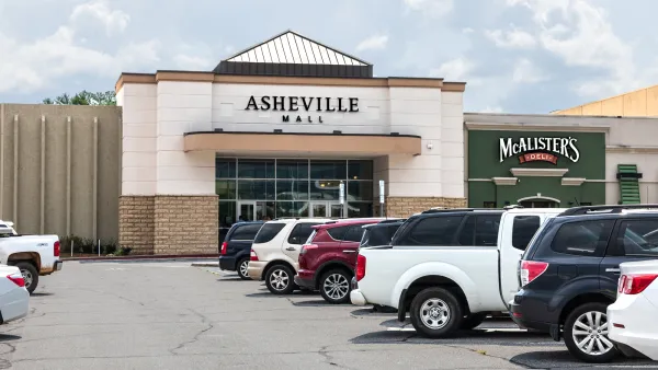
Asheville reconsiders parking minimums as surface parking eats up over a third of downtown real estate
Housing advocates say parking requirements are unnecessary and induce sprawl.

Texas Could Have the Nation’s 3 Largest Cities by 2100. Are They Ready to Embrace Density?
Houston, Dallas, and Austin are growing fast. The old sprawl model is no longer sustainable.

Planetizen Federal Action Tracker
A weekly monitor of how Trump’s orders and actions are impacting planners and planning in America.

Amtrak, CN end decades-long dispute with eight-year agreement
The new operating agreement establishes an updated framework for the companies to work together, including processes to resolve disputes.
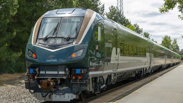
Northwest rail fans eager for Sept. 30 debut of Amtrak’s Airo fleet
Get ready for that new train smell and more seats. But they won’t go faster or run more frequently on the Cascades route in Washington and Oregon.

Brightline Florida files for bankruptcy
The transit company is over $5 billion in debt.

St. Louis Metro to test if single-car trains can reduce operating costs, maintain rider satisfaction
The pilot program will run from October to spring 2027, and begin with one single-car train operating on Metrolink’s Red and Blue lines.

Pennsylvania is building data centers in abandoned mines
Housing data centers in mines provides an alternative to destroying local forests and may spare residents from data centers’ noise and air pollution.

FREE Course: Walkable City 1: Why Walkability?
After describing his path towards focusing on walkability as the essence of good planning, Jeff Speck marches through his five principal reasons for making more walkable places.
Reinventing Malls: Planning Alchemy—Turning Gray Fields Into Gold
The course focuses on the opportunities and imperatives that shape reinvention of mall sites.

City of Thousand Oaks
City of Wisconsin Rapids
Harvard University Graduate School of Design
The Architects Foundation
University of Cincinnati Online
The Pocatello Development Authority
The Urban Renewal Agency of the City of Pocatello

