


The San Francisco Chronicle's urban design critic, John King, knows his San Francisco parklets—from the first ones that started the nationwide urban movement five years ago, to the ones currently in the hopper at the city planning office.
Take a photographic tour of San Francisco's parklets in the Mission District, North Beach, and the Outer Sunset, to name a few locations of this San Francisco invention that is now recognized as a legitimate use of parking space, though they have their critics complaining about the loss of parking space.
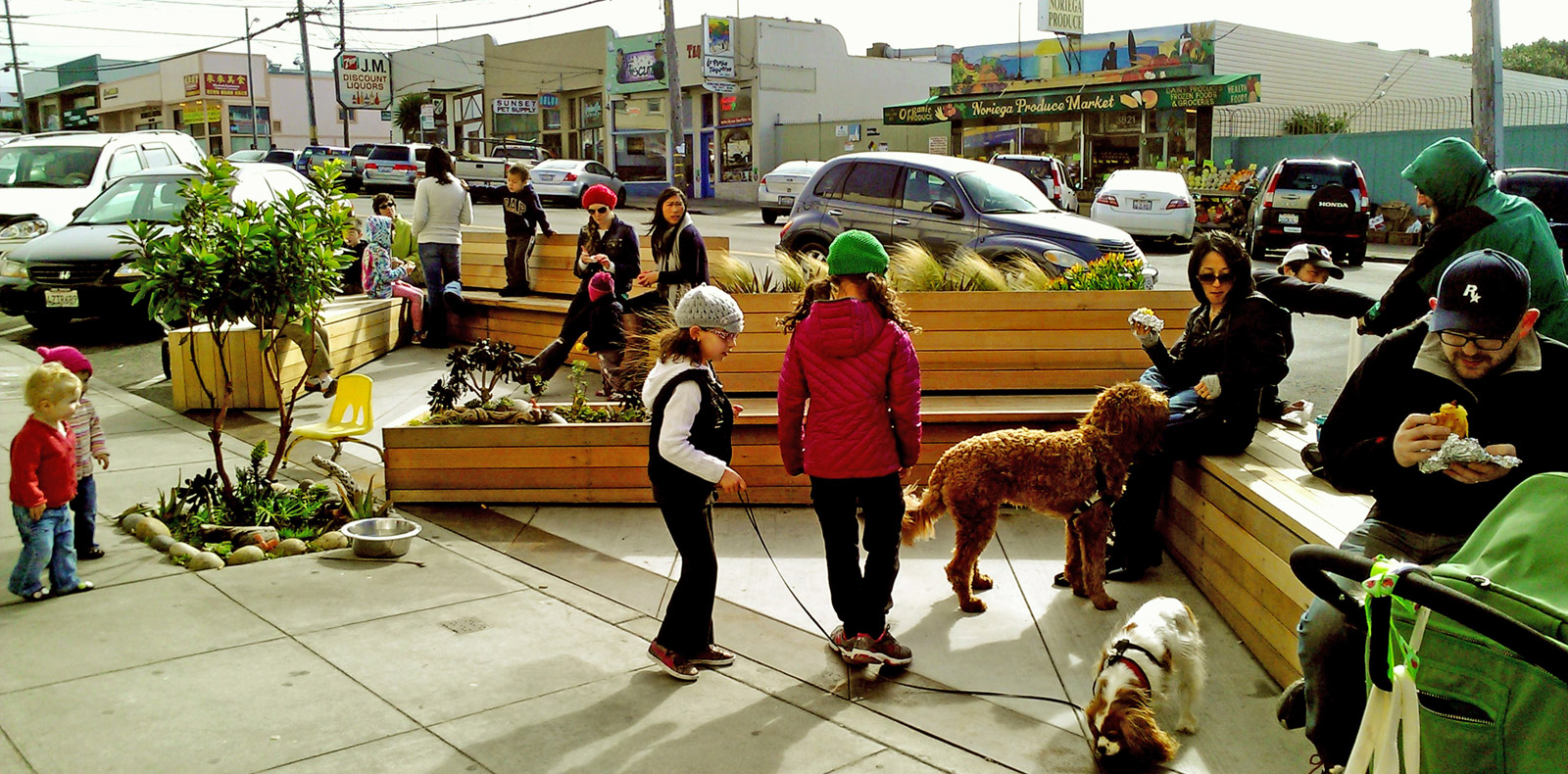
credit: San Francisco Pavement to Parks Program
John King has been covering them since their inception—two of his past articles can be accessed under "Related" below.
"The best parklets combine design ambition with a genuine desire to engage passersby," he writes. "Others are no more than glorified sidewalk seating for the businesses that install and maintain them. They are, in short, as varied and problematic as the city in which they were born."
“They’re important when they’re seen as representing our right as citizens to shape our environment and prod cities to do better,” said Blaine Merker of Gehl Studio [who was involved in the creation of parklets five years ago.]
Not all parklets were a success. King notes that one "was removed in 2013 because of the raucous users it attracted overnight" as did Planetizen, based on a San Francisco Examiner the same year aptly titled, "S.F.'s parklets program learns from failure, moves ahead."
Want more information on the city's parklet program? A good contact would be Robin Abad Ocubillo of the Pavement to Parks Program.
I’m biased — I love all of them,” said Robin Abad Ocubillo, who oversees the parklets program for the city’s Planning Department. “I can think of very few spaces where they’re doing a poor job. ... Exquisite design isn’t always what we need.”
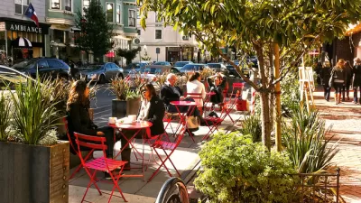
About Pavement to Parks: "San Francisco's streets and public rights-of-way make up 25% of the city's land area; more space than all the public parks combined. Many of our streets are excessively wide and contain large underutilized areas, especially at intersections. San Francisco's 'Pavement to Parks' program seeks to test the possibilities of these underused areas of land by quickly and inexpensively converting them into new pedestrian spaces."
Hat tip: John Holtzclaw, Sierra Club Transportation Program
FULL STORY: How S.F.’s parklet movement has grown across globe [subscription may be required]

Predictions for San Francisco’s Public Spaces
In 2023, will the city’s public spaces be reclaimed by cars, or will pandemic-era interventions lead to permanent change?
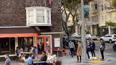
San Francisco Supervisors Vote to Keep Parklets, Close Them at Night
The pandemic-era outdoor seating arrangements can stay, but a last-minute amendment lets business owners close them overnight.
The Metrics of Outdoor Dining
Outdoor dining programs are proving popular in cities all over the United States, as a lifeline for both restaurants and residents seeking some social normalcy. Data from San Francisco reveal the numbers behind the phenomenon.

Maui's Vacation Rental Debate Turns Ugly
Verbal attacks, misinformation campaigns and fistfights plague a high-stakes debate to convert thousands of vacation rentals into long-term housing.

Planetizen Federal Action Tracker
A weekly monitor of how Trump’s orders and actions are impacting planners and planning in America.

In Urban Planning, AI Prompting Could be the New Design Thinking
Creativity has long been key to great urban design. What if we see AI as our new creative partner?

Portland Raises Parking Fees to Pay for Street Maintenance
The city is struggling to bridge a massive budget gap at the Bureau of Transportation, which largely depleted its reserves during the Civd-19 pandemic.

Spokane Mayor Introduces Housing Reforms Package
Mayor Lisa Brown’s proposals include deferring or waiving some development fees to encourage more affordable housing development.

Houston Mayor Kills Another Bike Lane
The mayor rejected a proposed bike lane in the Montrose district in keeping with his pledge to maintain car lanes.
Urban Design for Planners 1: Software Tools
This six-course series explores essential urban design concepts using open source software and equips planners with the tools they need to participate fully in the urban design process.
Planning for Universal Design
Learn the tools for implementing Universal Design in planning regulations.
Gallatin County Department of Planning & Community Development
Heyer Gruel & Associates PA
JM Goldson LLC
City of Camden Redevelopment Agency
City of Astoria
Transportation Research & Education Center (TREC) at Portland State University
Jefferson Parish Government
Camden Redevelopment Agency
City of Claremont