


In some cities, it can feel like a new era of transportation—with new options like real-time bus arrival data, on-demand cars-for-hire, and more, all available through a smart phone. Which cities are out in front of the new world?
Lindsey Hallock and Jeff Inglis share news of the new "Innovative Transportation Index" [pdf], created by the Frontier Group.
Here's how the index works and some of what it finds: "This report reviews the availability of 11 technology-enabled transportation services – including online ridesourcing, carsharing, ridesharing, taxi hailing, static and real-time transit information, multi-modal apps, and virtual transit ticketing – in 70 U.S. cities. It finds that residents of 19 cities, with a combined population of nearly 28 million people, have access to eight or more of these services, with other cities catching up rapidly."
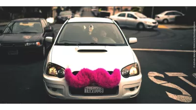
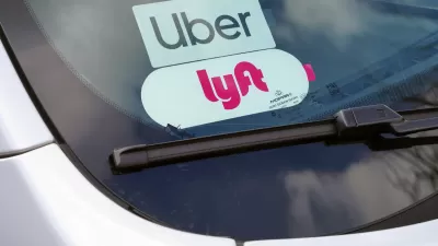
It's important to note that some of the technologies measured in the index are only available in select cities, while start-ups scale-up technology in cooperation with local governments. RideScout comes to mind. Other of the technologies are currently the source of rampant and ever-evolving controversy about the nature of regulation and the market. Uber comes to mind.
Austin comes out on top of the rankings, followed by San Francisco and Washington, D.C.
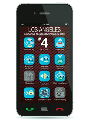 Frontier Group also shares graphics available for sharing and to showcasing the accomplishments of individual cities. That means that images, such as the one to the right, are available, for example, for calling-out cities that aren't as technologically advanced as some local politicians claim. Like cities that completely lack bikeshare, for example.

Minnesota Lawmakers Reach Ride Share Compromise
A law awaiting the governor’s signature establishes wage rates for drivers. Ride share companies say if the law passes, they plan to continue service in the state.
Study Finds UberPOOL Adds to City Traffic by Competing with the Subway
Past studies have shown how ride hailing services have added to congestion. A new study by Bruce Schaller suggests that even ride shares add to traffic, because they pull riders off of more efficient transit options like public transit.
Lyft Partnering With Amtrak for First-Last Mile Connections
Amtrak is partnering with Lyft to offer train passengers a discounted option for first and last mile needs. New Lyft riders qualify for a $5 savings on each of their first four rides.

Maui's Vacation Rental Debate Turns Ugly
Verbal attacks, misinformation campaigns and fistfights plague a high-stakes debate to convert thousands of vacation rentals into long-term housing.

Planetizen Federal Action Tracker
A weekly monitor of how Trump’s orders and actions are impacting planners and planning in America.

San Francisco Suspends Traffic Calming Amidst Record Deaths
Citing “a challenging fiscal landscape,” the city will cease the program on the heels of 42 traffic deaths, including 24 pedestrians.

Defunct Pittsburgh Power Plant to Become Residential Tower
A decommissioned steam heat plant will be redeveloped into almost 100 affordable housing units.

Trump Prompts Restructuring of Transportation Research Board in “Unprecedented Overreach”
The TRB has eliminated more than half of its committees including those focused on climate, equity, and cities.

Amtrak Rolls Out New Orleans to Alabama “Mardi Gras” Train
The new service will operate morning and evening departures between Mobile and New Orleans.
Urban Design for Planners 1: Software Tools
This six-course series explores essential urban design concepts using open source software and equips planners with the tools they need to participate fully in the urban design process.
Planning for Universal Design
Learn the tools for implementing Universal Design in planning regulations.
Heyer Gruel & Associates PA
JM Goldson LLC
Custer County Colorado
City of Camden Redevelopment Agency
City of Astoria
Transportation Research & Education Center (TREC) at Portland State University
Jefferson Parish Government
Camden Redevelopment Agency
City of Claremont