


What better way to wind down from a long week thinking about cities and maps and transportation than by taking a quiz to show off your knowledge of cities and maps and transportation?
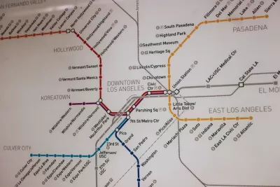
Christopher Ingraham has complied a quiz on the "subway/train/metro system maps of 10 cities" by stripping them of all identifying information and asking you to choose from multiple options to guess the city. The quiz mostly focuses on American cities, but a few foreign maps conclude the quiz.
The transit quiz follows up a quiz by Ingraham last week that used a similar format but with street grids.
For this record, this Planetizen editor did better on the transit maps, but got 100 percent of American cities correct in either mode.
FULL STORY: Quiz: Can you name these cities just by looking at their subway maps?

Pop Quiz: Can You Recognize Cities by Their Bike Lane Network?
Friday fun in the form of a mapping challenge from the Washington Post's Wonkblog.
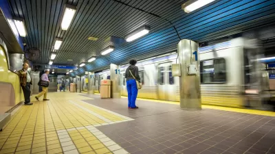
Coming Soon: A New Transit Map for Philadelphia
Transit is getting a new look.
Pop Quiz: Can You Identify Cities By Density Alone?
A Planetizen editor failed this quiz.

Planetizen Federal Action Tracker
A weekly monitor of how Trump’s orders and actions are impacting planners and planning in America.

Congressman Proposes Bill to Rename DC Metro “Trump Train”
The Make Autorail Great Again Act would withhold federal funding to the system until the Washington Metropolitan Area Transit Authority (WMATA), rebrands as the Washington Metropolitan Authority for Greater Access (WMAGA).

The Simple Legislative Tool Transforming Vacant Downtowns
In California, Michigan and Georgia, an easy win is bringing dollars — and delight — back to city centers.

The States Losing Rural Delivery Rooms at an Alarming Pace
In some states, as few as 9% of rural hospitals still deliver babies. As a result, rising pre-term births, no adequate pre-term care and harrowing close calls are a growing reality.

The Small South Asian Republic Going all in on EVs
Thanks to one simple policy change less than five years ago, 65% of new cars in this Himalayan country are now electric.

DC Backpedals on Bike Lane Protection, Swaps Barriers for Paint
Citing aesthetic concerns, the city is removing the concrete barriers and flexposts that once separated Arizona Avenue cyclists from motor vehicles.
Urban Design for Planners 1: Software Tools
This six-course series explores essential urban design concepts using open source software and equips planners with the tools they need to participate fully in the urban design process.
Planning for Universal Design
Learn the tools for implementing Universal Design in planning regulations.
Smith Gee Studio
City of Charlotte
City of Camden Redevelopment Agency
City of Astoria
Transportation Research & Education Center (TREC) at Portland State University
US High Speed Rail Association
City of Camden Redevelopment Agency
Municipality of Princeton (NJ)