


Spatial analysis of income and education over time in U.S cities provides further evidence for the “New Donut” theory of the city. Wealthier and more educated residents are more likely to move to the urban core or exurbs than to inner-ring suburbs.

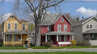
The riots in Ferguson, MO brought mainstream media attention to a phenomenon that has been happening slowly for the last two decades. The old conception of cities as poor, minority-dominated slums surrounded by affluent suburbs has ceased to be an accurate description for most cities. Instead, revitalized urban centers are surging in popularity.
This doesn’t signal abandonment of the suburbs, however. Newer and larger suburbs continue to be built around major metropolitan areas, accounting for most of their population growth, and leaving an inner ring of less desirable older suburbs that will be the new centers of poverty and economic stagnation.
This story has been supported by anecdotal evidence across the country, but researchers have thus far failed to provide statistical evidence. Existing research centers on population growth, but this is an inaccurate gauge of the desirability and economic vitality of an area that has already been urbanized. In fact, a surge in popularity often attracts wealthier residents with smaller household sizes, which may reduce total population.
Instead, Luke Juday looks at income and education as an indicator of who lives in different zones. He looks at four major metropolitan areas: Charlotte, Atlanta, Denver, and Houston. Each is roughly geographically symmetrical and has a single clear city center, making them likely to represent the donut shape. They are also experiencing significant growth, have relatively low housing prices, and have few unique land use restrictions that might distort migration trends.
The results are striking. In 1990, each city had something close to a "hump" graph. Low rates of education and income in the city center gave way to high rates in the suburbs and then fell again in rural areas. Today, this has turned into an "S-curve," with high rates of education and income in the core, low rates several miles outside of it, and high rates in more distant suburbs.
FULL STORY: A funny thing is happening in many US cities

Proposing a New Model for Regional Stratification: 'The New Donut'
Aaron Renn presents a new model for conceptualizing the health of the many layers of communities that make up metropolitan regions, namely the "new donut."

Philadelphia Gentrification: A Historical Perspective
Gentrified in the 1960s during the height of urban renewal, Society Hill is a historical precedent as Philadelphia confronts present-day gentrification.
Inner Suburbs Face Identity Crisis
Places like Columbia Heights, an older suburb north of Minneapolis, lie at the focal point of conflict over development and gentrification. Can these places support a 21st-century urbanism?

Planetizen Federal Action Tracker
A weekly monitor of how Trump’s orders and actions are impacting planners and planning in America.

Map: Where Senate Republicans Want to Sell Your Public Lands
For public land advocates, the Senate Republicans’ proposal to sell millions of acres of public land in the West is “the biggest fight of their careers.”

Restaurant Patios Were a Pandemic Win — Why Were They so Hard to Keep?
Social distancing requirements and changes in travel patterns prompted cities to pilot new uses for street and sidewalk space. Then it got complicated.

Platform Pilsner: Vancouver Transit Agency Releases... a Beer?
TransLink will receive a portion of every sale of the four-pack.

Toronto Weighs Cheaper Transit, Parking Hikes for Major Events
Special event rates would take effect during large festivals, sports games and concerts to ‘discourage driving, manage congestion and free up space for transit.”

Berlin to Consider Car-Free Zone Larger Than Manhattan
The area bound by the 22-mile Ringbahn would still allow 12 uses of a private automobile per year per person, and several other exemptions.
Urban Design for Planners 1: Software Tools
This six-course series explores essential urban design concepts using open source software and equips planners with the tools they need to participate fully in the urban design process.
Planning for Universal Design
Learn the tools for implementing Universal Design in planning regulations.
Heyer Gruel & Associates PA
JM Goldson LLC
Custer County Colorado
City of Camden Redevelopment Agency
City of Astoria
Transportation Research & Education Center (TREC) at Portland State University
Camden Redevelopment Agency
City of Claremont
Municipality of Princeton (NJ)