


For the second installment in a five-part series on economic segregation in U.S. metros, Richard Florida examines the cities where poverty stays most hidden from "everyone else."
Richard Florida worked with his colleagues at the Martin Prosperity Institute to measure and map the distribution of poverty across the country. Some of the most telling of Florida and company’s findings:
- As the map shows, the metros where the poor are the most segregated are mostly found along the Eastern Seaboard from New England to the Mid-Atlantic states, across the Midwest and the Great Lakes region, and in parts of Texas, Arizona, Nevada, and Colorado.
- The large metros where the poor are most segregated are in the Midwest and the Northeast. Milwaukee has the highest level, followed by Hartford, Philadelphia, Cleveland, Detroit, New York, Buffalo, Denver, Baltimore, and Memphis. Many of these are Rustbelt metros with large minority populations that have been hit hard by deindustrialization.
- When medium and smaller-sized metros are taken into account, many of the places with the most concentrated poverty turn out to be college towns, where the town-gown divide seems to be very real.
Florida goes on to point out a few pithy observations of the associations between variables, including “[the] poor face higher levels of segregation in larger, denser metros.”
FULL STORY: The U.S. Cities Where the Poor Are Most Segregated From Everyone Else


What We Really Mean When We Say Gentrification
The focus on gentrifying communities has, in many cases, eclipsed the similar problems facing more stagnant neighborhoods.
The Political Segregation of U.S. Cities
Not all urban dwellers are as liberal as conventional wisdom would have us believe.

Revitalization Should Not Overshadow the Continued Decline in Cities
When gentrification takes center stage, neglected places facing poverty, segregation, and disinvestment are overlooked.

Planetizen Federal Action Tracker
A weekly monitor of how Trump’s orders and actions are impacting planners and planning in America.

Restaurant Patios Were a Pandemic Win — Why Were They so Hard to Keep?
Social distancing requirements and changes in travel patterns prompted cities to pilot new uses for street and sidewalk space. Then it got complicated.

Map: Where Senate Republicans Want to Sell Your Public Lands
For public land advocates, the Senate Republicans’ proposal to sell millions of acres of public land in the West is “the biggest fight of their careers.”

Maui's Vacation Rental Debate Turns Ugly
Verbal attacks, misinformation campaigns and fistfights plague a high-stakes debate to convert thousands of vacation rentals into long-term housing.

San Francisco Suspends Traffic Calming Amidst Record Deaths
Citing “a challenging fiscal landscape,” the city will cease the program on the heels of 42 traffic deaths, including 24 pedestrians.

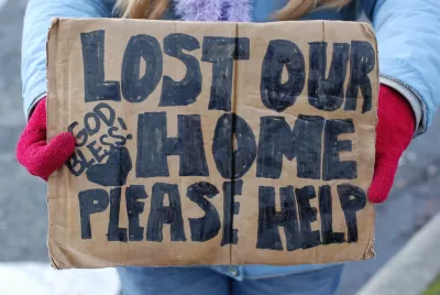
California Homeless Arrests, Citations Spike After Ruling
An investigation reveals that anti-homeless actions increased up to 500% after Grants Pass v. Johnson — even in cities claiming no policy change.
Urban Design for Planners 1: Software Tools
This six-course series explores essential urban design concepts using open source software and equips planners with the tools they need to participate fully in the urban design process.
Planning for Universal Design
Learn the tools for implementing Universal Design in planning regulations.
Heyer Gruel & Associates PA
JM Goldson LLC
Custer County Colorado
City of Camden Redevelopment Agency
City of Astoria
Transportation Research & Education Center (TREC) at Portland State University
Camden Redevelopment Agency
City of Claremont
Municipality of Princeton (NJ)