


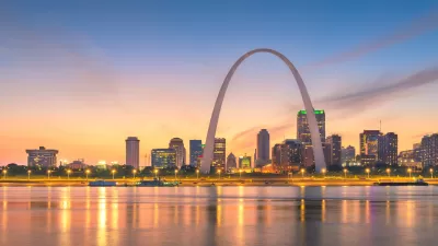
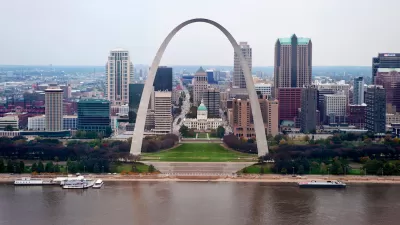
Along an eight-mile corridor that runs westward from the Gateway Arch, the population has jumped 10 percent since 2000. Tim Bryant examines the ingredients that define the place "where St. Louis succeeds as a city."
Along a narrow corridor from the riverfront to Interstate 170, bounded by Delmar Boulevard to the north and Interstate 64 (Highway 40) to the south, St. Louis is experiencing an urban renaissance. Rail transit, cultural institutions, thriving businesses, civic offices, high-quality green spaces, and historic buildings are among the ingredients that add up to the place "where St. Louis succeeds as a city," writes Bryant.
"Sarah Coffin, associate professor of public policy studies at SLU, and other urban experts said the corridor’s growing vitality will continue to attract new residents who prefer to walk more and drive less. 'People’s tastes are changing about how they want to live and where they want to live,' Coffin said."
The successes of the corridor are flowing into adjoining areas as well, adds Bryant. "Experts said that central corridor development is promoting overdue growth elsewhere, particularly south to the Botanical Heights and Shaw neighborhoods and through the Forest Park Southeast area to the Grove entertainment district."
“The idea of building off success instead of leaving it as an isolated instance is taking shape,” said Zack Boyers, chief executive of St. Louis-based U.S. Bancorp Community Development Corp.
FULL STORY: Anchors and transit spur growth of St. Louis corridor

St. Louis Zeroing in on Safe Streets
The city is creating its first Department of Transportation and using hundreds of millions in federal funding to launch road safety projects.

Moving Beyond Crash Statistics to Understand Road Safety
Why measuring traffic deaths alone doesn’t paint a full picture.
St. Louis to Introduce Traffic Calming Downtown
The city will redesign three major streets to slow traffic and improve safety.

Planetizen Federal Action Tracker
A weekly monitor of how Trump’s orders and actions are impacting planners and planning in America.

Restaurant Patios Were a Pandemic Win — Why Were They so Hard to Keep?
Social distancing requirements and changes in travel patterns prompted cities to pilot new uses for street and sidewalk space. Then it got complicated.

Map: Where Senate Republicans Want to Sell Your Public Lands
For public land advocates, the Senate Republicans’ proposal to sell millions of acres of public land in the West is “the biggest fight of their careers.”

Maui's Vacation Rental Debate Turns Ugly
Verbal attacks, misinformation campaigns and fistfights plague a high-stakes debate to convert thousands of vacation rentals into long-term housing.

San Francisco Suspends Traffic Calming Amidst Record Deaths
Citing “a challenging fiscal landscape,” the city will cease the program on the heels of 42 traffic deaths, including 24 pedestrians.

California Homeless Arrests, Citations Spike After Ruling
An investigation reveals that anti-homeless actions increased up to 500% after Grants Pass v. Johnson — even in cities claiming no policy change.
Urban Design for Planners 1: Software Tools
This six-course series explores essential urban design concepts using open source software and equips planners with the tools they need to participate fully in the urban design process.
Planning for Universal Design
Learn the tools for implementing Universal Design in planning regulations.
Heyer Gruel & Associates PA
JM Goldson LLC
Custer County Colorado
City of Camden Redevelopment Agency
City of Astoria
Transportation Research & Education Center (TREC) at Portland State University
Camden Redevelopment Agency
City of Claremont
Municipality of Princeton (NJ)