


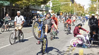
With bike use exploding across North America, The New York Times has asked its readers to submit their suggestions for how best to navigate their city streets on two wheels. Covering 16 cities, the project has received 4,614 comments to date.

On interactive maps for Los Angeles, Chicago, Austin, Boston, and 14 other cities, readers have pinpointed obstacles, short cuts, advisories and observations in ten words or less. Comments cover a range of local wisdom, from where recent accidents and assaults have taken place to the best routes to access bike paths and circumvent construction.
The New York maps also include a guide to "popular routes into Manhattan based on hundreds of thousands of rides taken by users of Strava, a running and cycling app."
FULL STORY: Your Biking Wisdom in 10 Words

Why Do People Hate Cyclists?
At the Association of Collegiate Schools of Planning conference, several researchers shared their work examining why people hate bicyclists and what can be done about that animosity.
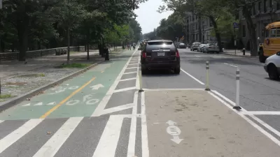
More Bicycle Infrastructure Equals More Riders
Analysis of Census data shows that, while still small in number, more Americans are taking to two-wheels as part of their daily commute.
Florida Pilots Bike Lanes on Highway Bridges
In an effort to create safer walking and biking environments, Miami-Dade counties have built bike lanes along two highways connecting the Miami with its eastern island beaches, reducing travel distances by 75 percent for cyclists.

Planetizen Federal Action Tracker
A weekly monitor of how Trump’s orders and actions are impacting planners and planning in America.

Maui's Vacation Rental Debate Turns Ugly
Verbal attacks, misinformation campaigns and fistfights plague a high-stakes debate to convert thousands of vacation rentals into long-term housing.

San Francisco Suspends Traffic Calming Amidst Record Deaths
Citing “a challenging fiscal landscape,” the city will cease the program on the heels of 42 traffic deaths, including 24 pedestrians.

Amtrak Rolls Out New Orleans to Alabama “Mardi Gras” Train
The new service will operate morning and evening departures between Mobile and New Orleans.

The Subversive Car-Free Guide to Trump's Great American Road Trip
Car-free ways to access Chicagoland’s best tourist attractions.

San Antonio and Austin are Fusing Into one Massive Megaregion
The region spanning the two central Texas cities is growing fast, posing challenges for local infrastructure and water supplies.
Urban Design for Planners 1: Software Tools
This six-course series explores essential urban design concepts using open source software and equips planners with the tools they need to participate fully in the urban design process.
Planning for Universal Design
Learn the tools for implementing Universal Design in planning regulations.
Heyer Gruel & Associates PA
JM Goldson LLC
Custer County Colorado
City of Camden Redevelopment Agency
City of Astoria
Transportation Research & Education Center (TREC) at Portland State University
Jefferson Parish Government
Camden Redevelopment Agency
City of Claremont