


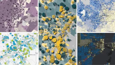
For planners searching for hard to find historic census data in a GIS-ready format, the National Historical Geographic Information System (NHGIS) may be the one-stop shop you've been looking for.
Begun in 2001 as a project of the Minnesota Population Center, a unit of the
University of Minnesota, with funding from the National Science
Foundation, NHGIS was created with "an ambitious goal to collect, format, and freely disseminate all
available aggregate census information for the entire country from the
past 220 years," write Jason Borah and Jonathan Schroeder. With an "ever-expanding cache of 15,000 tables and 430 shapefiles," NHGIS admirably fills in the gaps in data available through the U.S. Census Bureau's American FactFinder.
One of the major advantages of the historical information disseminated by NHGIS is that it is provided as standardized shapefiles, for use with GIS software.
"Until recently, the data needed for assessing demographic change have
often been impossible to find, difficult to use, or too expensive to
obtain," note Borah and Schroeder. "With NHGIS and others making ever increasing amounts of
demographic data available through integrated systems that let users
assemble multiple years of data quickly, you will now be able to spend
more of your time analyzing data and putting it to use. Spending
valuable time aimlessly searching for needed census or GIS data
shouldn't be your job."
FULL STORY: Demographic Data for a Changing Nation


Trump Cuts Decimate Mapping Agency
The National Geodetic Survey maintains and updates critical spatial reference systems used extensively in both the public and private sectors.
Explore US Demographics With the New ACS Atlas Collection
Esri's new ACS Atlas Collection offers interactive applications that visualize the latest U.S. demographic and socio-economic data, enabling users to explore over 175 curated web maps across various thematic areas.

Fighting Forest Pests With AI: A Hemlock Success Story
Fairfax County utilized GeoAI and ArcGIS technology to efficiently map and protect its hemlock trees from the invasive woolly adelgid, ensuring targeted pest management and preservation of its evergreen canopy.

Planetizen Federal Action Tracker
A weekly monitor of how Trump’s orders and actions are impacting planners and planning in America.

Maui's Vacation Rental Debate Turns Ugly
Verbal attacks, misinformation campaigns and fistfights plague a high-stakes debate to convert thousands of vacation rentals into long-term housing.

Restaurant Patios Were a Pandemic Win — Why Were They so Hard to Keep?
Social distancing requirements and changes in travel patterns prompted cities to pilot new uses for street and sidewalk space. Then it got complicated.

In California Battle of Housing vs. Environment, Housing Just Won
A new state law significantly limits the power of CEQA, an environmental review law that served as a powerful tool for blocking new development.

Boulder Eliminates Parking Minimums Citywide
Officials estimate the cost of building a single underground parking space at up to $100,000.

Orange County, Florida Adopts Largest US “Sprawl Repair” Code
The ‘Orange Code’ seeks to rectify decades of sprawl-inducing, car-oriented development.
Urban Design for Planners 1: Software Tools
This six-course series explores essential urban design concepts using open source software and equips planners with the tools they need to participate fully in the urban design process.
Planning for Universal Design
Learn the tools for implementing Universal Design in planning regulations.
Heyer Gruel & Associates PA
JM Goldson LLC
Custer County Colorado
City of Camden Redevelopment Agency
City of Astoria
Transportation Research & Education Center (TREC) at Portland State University
Jefferson Parish Government
Camden Redevelopment Agency
City of Claremont