


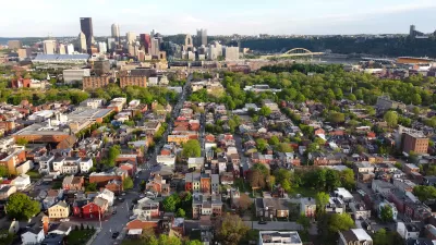
As the U.S. experiences its worst drought in over half a century, Kaid Benfield questions the connection with the country's suburban growth patterns over that same period.
With 55% of the U.S. in moderate-to-severe drought, and the situation predicted to only get worse, Kaid Benfield, of the NRDC's Switchboard blog, analyzes sprawl's role in worsening drought and whether smart growth is the answer. "[S]prawling land use can exacerbate some of its impacts," states Benfield, "...the large-lot residential development characteristic of sprawl uses significantly more water than do neighborhoods built to a more walkable scale, contributing to water shortages."
Low-density development can also lead to greater urban runoff, much of it polluted. "[M]ore compact growth patterns with an average of eight houses per acre reduce runoff per household by 74 percent compared to sprawling patterns of one house per acre," finds the author, citing EPA research, "...more compact growth requires less runoff-causing pavement for streets, roads and parking lots than does sprawl."
Is smart growth, with greater densities, the answer to ending drought? Definitely not, but "[w]hile sprawl may not cause drought, nor smart growth solve it," says Benfield, "both need to be considered in the discussion of how to move forward toward a more resilient future."
FULL STORY: How sprawl worsens the impacts of drought and how smart growth can help


Maine Law Promotes Smart Growth
New state legislation encourages cities to plan around ‘smart growth’ principles to preserve farmland and open space, and use infill development to build more housing.
A Better Understanding of Smart Growth Benefits
Smart Growth creates compact, multimodal communities where residents consume less land, drive less, and rely more on non-auto modes. Planners have important stories to tell about the benefits of Smart Growth.
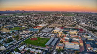
Arizona Town Looks for New Water Sources, Insists Development ‘Full Steam Ahead’
While many Southwest cities are looking for ways to conserve water and limit growth as water supplies become strained, one town is pressing ahead with rapid development.

Planetizen Federal Action Tracker
A weekly monitor of how Trump’s orders and actions are impacting planners and planning in America.

Maui's Vacation Rental Debate Turns Ugly
Verbal attacks, misinformation campaigns and fistfights plague a high-stakes debate to convert thousands of vacation rentals into long-term housing.

Restaurant Patios Were a Pandemic Win — Why Were They so Hard to Keep?
Social distancing requirements and changes in travel patterns prompted cities to pilot new uses for street and sidewalk space. Then it got complicated.

Charlottesville Temporarily Has No Zoning Code
A judge ordered the Virginia city to throw out its newly revised zoning code, leaving permitting for new development in legal limbo.

In California Battle of Housing vs. Environment, Housing Just Won
A new state law significantly limits the power of CEQA, an environmental review law that served as a powerful tool for blocking new development.

Boulder Eliminates Parking Minimums Citywide
Officials estimate the cost of building a single underground parking space at up to $100,000.
Urban Design for Planners 1: Software Tools
This six-course series explores essential urban design concepts using open source software and equips planners with the tools they need to participate fully in the urban design process.
Planning for Universal Design
Learn the tools for implementing Universal Design in planning regulations.
Heyer Gruel & Associates PA
JM Goldson LLC
Custer County Colorado
City of Camden Redevelopment Agency
City of Astoria
Transportation Research & Education Center (TREC) at Portland State University
Jefferson Parish Government
Camden Redevelopment Agency
City of Claremont