


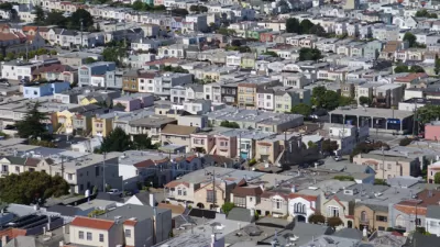
Census data reveals that California is the most urbanized state, with the most dense urban areas. But in California, sprawl, density, crowding, and urbanism are not always what they seem. Fortunately, a new law may help planners make sense of it all.
Josh Stephens delves deeper into the causes and implications of recent census data that ranks the California communities of Los Angeles-Long Beach-Anaheim, San Francisco-Oakland, San Jose, and Delano, as the top four densest urban areas in the entire country.
"Setting aside Delano's unexpected star turn, none of this should come as a surprise to planners in California (which also happens to be the "most urban" state, with 95% urban residency). Density is what happens when you build freeways all over the place and everyone gets to live all over the place. For all the objective connotations of these figures, there's no doubt that there's plenty of room for interpretation, which can have deep implications for public policy."
"If cities implement the tenets of SB 375's Sustainable Communities Strategies--regional plans being drawn up by the metropolitan planning organizations of San Diego, Sacramento, the Bay Area, and Southern California (Los Angeles)--then density may no longer be hidden. It will be plain to see in the streetscapes. And if California residents can accept the fact that we are, indeed, an urban state, maybe, by the time we hit 8,000 per square mile, we'll look like one too."
Thanks to Josh Stephens
FULL STORY: Parsing California's Density Bombshell in 2010 Census Data

SPUR: The Bay Area Has A Sprawl Problem
SPUR states its case clearly by announcing, “We believe cities are the key to our future” at the opening of a new report called “SPUR’s Agenda for Change.”
New Census Numbers Detail Surprising Facts About Urban Density
John King considers a new report released by the Census Bureau on Monday, which finds that of the ten most densely populated urbanized areas in the United States, nine are in the West.
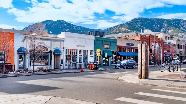
Boulder Eliminates Parking Minimums Citywide
Officials estimate the cost of building a single underground parking space at up to $100,000.

Planetizen Federal Action Tracker
A weekly monitor of how Trump’s orders and actions are impacting planners and planning in America.

Chicago’s Ghost Rails
Just beneath the surface of the modern city lie the remnants of its expansive early 20th-century streetcar system.

San Antonio and Austin are Fusing Into one Massive Megaregion
The region spanning the two central Texas cities is growing fast, posing challenges for local infrastructure and water supplies.

Since Zion's Shuttles Went Electric “The Smog is Gone”
Visitors to Zion National Park can enjoy the canyon via the nation’s first fully electric park shuttle system.

Trump Distributing DOT Safety Funds at 1/10 Rate of Biden
Funds for Safe Streets and other transportation safety and equity programs are being held up by administrative reviews and conflicts with the Trump administration’s priorities.

German Cities Subsidize Taxis for Women Amid Wave of Violence
Free or low-cost taxi rides can help women navigate cities more safely, but critics say the programs don't address the root causes of violence against women.
Urban Design for Planners 1: Software Tools
This six-course series explores essential urban design concepts using open source software and equips planners with the tools they need to participate fully in the urban design process.
Planning for Universal Design
Learn the tools for implementing Universal Design in planning regulations.
planning NEXT
Appalachian Highlands Housing Partners
Mpact (founded as Rail~Volution)
City of Camden Redevelopment Agency
City of Astoria
City of Portland
City of Laramie