


A new program is being implemented in Portland, Oregon, to try to quantify and model the behavior of the city.
The effort is seen as a way to understand how various urban systems and functions interrelate, and how tweaking one might affect others -- or the entire system.
"This problem--if you can't measure it, you can't manage it--combined with the impulse to improve cities by models, is driving both IBM's "smarter city" strategy and the nascent "urban systems" movement, which seek to apply complexity science to cities. IBM sponsored the first Urban Systems Symposium in May (where West co-starred in a show-stopping discussion with Paul Romer and Stewart Brand) and today announced the latest plank in its smarter city platform: an "app" containing 3,000 equations which collectively seek to model cities' emergent behavior. IBM also revealed its first customer, the City of Portland, Oregon.
Systems Dynamics for Smarter Cities, as the app is called, tries to quantify the cause-and-effect relationships between seemingly uncorrelated urban phenomena. What's the connection, for example, between public transit fares and high school graduation rates? Or obesity rates and carbon emissions?"
FULL STORY: IBM Partners With Portland To Play SimCity For Real

Portland Housing Bond Created Nearly 5,000 Units, But Affordability Remains Out of Reach
Despite better-than-expected results from multiple local housing bonds, housing costs and homelessness remain top of mind for many Oregonians.
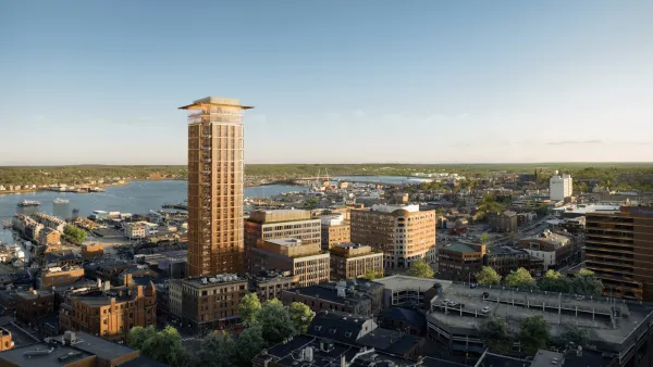
Downtown Portland Ready for Maine's Tallest Building
The city of Portland anticipates a major new urban development addition called the “Old Port Square” project.
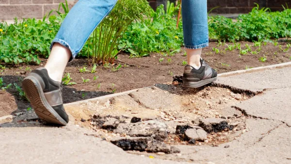
Portland Council Tentatively Approves Sidewalk Repair Plan
The proposal would address sidewalk needs in Portland’s District 1 and District 4.

Planetizen Federal Action Tracker
A weekly monitor of how Trump’s orders and actions are impacting planners and planning in America.

Restaurant Patios Were a Pandemic Win — Why Were They so Hard to Keep?
Social distancing requirements and changes in travel patterns prompted cities to pilot new uses for street and sidewalk space. Then it got complicated.

Map: Where Senate Republicans Want to Sell Your Public Lands
For public land advocates, the Senate Republicans’ proposal to sell millions of acres of public land in the West is “the biggest fight of their careers.”

Maui's Vacation Rental Debate Turns Ugly
Verbal attacks, misinformation campaigns and fistfights plague a high-stakes debate to convert thousands of vacation rentals into long-term housing.

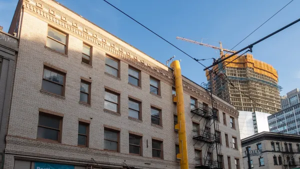
San Francisco Suspends Traffic Calming Amidst Record Deaths
Citing “a challenging fiscal landscape,” the city will cease the program on the heels of 42 traffic deaths, including 24 pedestrians.

California Homeless Arrests, Citations Spike After Ruling
An investigation reveals that anti-homeless actions increased up to 500% after Grants Pass v. Johnson — even in cities claiming no policy change.
Urban Design for Planners 1: Software Tools
This six-course series explores essential urban design concepts using open source software and equips planners with the tools they need to participate fully in the urban design process.
Planning for Universal Design
Learn the tools for implementing Universal Design in planning regulations.
Heyer Gruel & Associates PA
JM Goldson LLC
Custer County Colorado
City of Camden Redevelopment Agency
City of Astoria
Transportation Research & Education Center (TREC) at Portland State University
Camden Redevelopment Agency
City of Claremont
Municipality of Princeton (NJ)