


The WikiLeaks release revealed the locations of a set of infrastructural sites operated by the United States all across the world. This piece from Domus looks at the geographical and geopolitical implications of this network.
Written by Geoff Manaugh of BLDGBLOG, the article explores how the release of this data is both revealing of the vulnerability of this network and also of the hidden extent of the U.S.' global reach.
"That is what made the controversial release by WikiLeaks, in December 2010, of a long list of key infrastructural sites deemed vital to the national security of the United States so interesting. The geographic constellation upon which the United States depends was suddenly laid bare, given names and locations, and exposed for all to see.
The particular diplomatic cable in question, originally sent by Secretary of State Hillary Clinton to all overseas embassies in February 2009 and marked for eventual declassification only in January 2019, describes what it calls "critical foreign dependencies (critical infrastructure and key resources located abroad)". These "critical dependencies" are divided into 18 sectors, including energy, agriculture, banking and finance, drinking water and water treatment systems, public health, nuclear reactors and "critical manufacturing." All of these locations, objects or services, the cable explains, "if destroyed, disrupted or exploited, would likely have an immediate and deleterious effect on the United States". Indeed, there is no back up: several sites are highlighted as "irreplaceable"."
FULL STORY: Open Source Design 02: WikiLeaks Guide/Critical Infrastructure

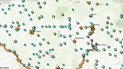
New Book Highlights How GIS Improves Outcomes
Esri Press recently published a digital book called Mapping the Nation which demonstrates how a geographic approach guides important decisions and addresses challenges around the globe.
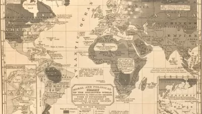
The Pseudoscientific Foundations of Racist Planning Practices
Racist and colonialist narratives in old geography textbooks help explain the prevalence of segregationist and discriminatory policies and other nasty planning practices. It’s time to understand and reconcile.

Europe's New Energy Infrastructure Begins to Emerge
When Russia invaded Ukraine on February 24, Russian President Vladimir Putin hoped to quickly redraw national boundary lines in Eastern Europe. The region's energy infrastructure, particularly pipelines carrying natural gas, may change sooner.

Planetizen Federal Action Tracker
A weekly monitor of how Trump’s orders and actions are impacting planners and planning in America.

Congressman Proposes Bill to Rename DC Metro “Trump Train”
The Make Autorail Great Again Act would withhold federal funding to the system until the Washington Metropolitan Area Transit Authority (WMATA), rebrands as the Washington Metropolitan Authority for Greater Access (WMAGA).

The Simple Legislative Tool Transforming Vacant Downtowns
In California, Michigan and Georgia, an easy win is bringing dollars — and delight — back to city centers.

The States Losing Rural Delivery Rooms at an Alarming Pace
In some states, as few as 9% of rural hospitals still deliver babies. As a result, rising pre-term births, no adequate pre-term care and "harrowing" close calls are a growing reality.

The Small South Asian Republic Going all in on EVs
Thanks to one simple policy change less than five years ago, 65% of new cars in this Himalayan country are now electric.

DC Backpedals on Bike Lane Protection, Swaps Barriers for Paint
Citing aesthetic concerns, the city is removing the concrete barriers and flexposts that once separated Arizona Avenue cyclists from motor vehicles.
Urban Design for Planners 1: Software Tools
This six-course series explores essential urban design concepts using open source software and equips planners with the tools they need to participate fully in the urban design process.
Planning for Universal Design
Learn the tools for implementing Universal Design in planning regulations.
Smith Gee Studio
City of Charlotte
City of Camden Redevelopment Agency
City of Astoria
Transportation Research & Education Center (TREC) at Portland State University
US High Speed Rail Association
City of Camden Redevelopment Agency
Municipality of Princeton (NJ)